Common Era or Current Era (CE) is one of the notation systems for the world's most widely used calendar era. BCE is the era before CE. BCE and CE are alternatives to the Dionysian AD and BC system. The Dionysian era distinguishes eras using AD and BC. Since the two notation systems are numerically equivalent, "2019 CE" corresponds to "AD 2019" and "400 BCE" corresponds to "400 BC". Both notations refer to the Gregorian calendar. The year-numbering system utilized by the Gregorian calendar is used throughout the world today, and is an international standard for civil calendars.

Queensland is the second-largest and third-most populous state in the Commonwealth of Australia. Situated in the north-east of the country, it is bordered by the Northern Territory, South Australia and New South Wales to the west, south-west and south respectively. To the east, Queensland is bordered by the Coral Sea and Pacific Ocean. To its north is the Torres Strait, with Papua New Guinea located less than 200 km across it from the mainland. The state is the world's sixth-largest sub-national entity, with an area of 1,852,642 square kilometres (715,309 sq mi).

Capricornia Cays is both a national park and a scientific national park in Queensland (Australia), located 486 km and 472 km north of the state capital Brisbane respectively. Collectively they comprise 241 ha of coral cays.

Possession Island is a small island in the Torres Strait Islands group off the coast of far northern Queensland, Australia. It is known as Bedanug or Bedhan Lag by the one of the indigenous Australian inhabitants, the Kaurareg though the Ankamuti were also indigenous to the island.

Magnetic Island is an island 8 kilometres (5.0 mi) offshore from the city of Townsville, Queensland, Australia. This 52 km2 (20.1 sq mi) mountainous island in Cleveland Bay has effectively become a suburb of Townsville, with 2,107 permanent residents. The island is accessible from Townsville Breakwater to Nelly Bay Harbour by ferry. There is a large 27 km2 (10.4 sq mi) National Park and bird sanctuary and walking tracks can be taken between the populated bays and to a number of tourist destinations such as the World War II forts.

Charleville is a town and a locality in the Shire of Murweh, Queensland, Australia. In the 2016 census, Charleville had a population of 3,335 people.

Bowen Hills is an inner suburb of Brisbane, Queensland, Australia, located 3 km northeast of the Brisbane CBD. It was named after a Governor of Queensland, Sir George Ferguson Bowen. At the 2016 Australian Census the suburb recorded a population of 3,266.

Seventeen Seventy, also written as 1770, is a town and locality in Gladstone Region, Queensland, Australia, built on the site of the second landing in Australia by James Cook and the crew of HM Bark Endeavour in May 1770. Originally known as Round Hill – after the creek it sits on – the name was changed on 24 June 1936 after the town allotments were surveyed in 1935 to recognise the historical importance of the town. The community of Seventeen Seventy hold the re-enactment of this historic landing each year as part of the 1770 Festival held in May.

South East Queensland (SEQ) is a bio-geographical, political, and administrative region of the state of Queensland in Australia, which contains 3.5 million people out of the state's population of 4.8 million. The area covered by South East Queensland varies, depending on the definition of the region, though it tends to include Queensland's three largest cities: the capital city Brisbane; the Gold Coast; and the Sunshine Coast. Its most common use is for political purposes, and covers 22,420 square kilometres (8,660 sq mi) and incorporates 11 local government areas, extending 240 kilometres (150 mi) from Noosa in the north to the Gold Coast and New South Wales border in the south, and 140 kilometres (87 mi) west to Toowoomba.

The Queensland Museum is the state museum of Queensland, Australia. The museum currently operates from its headquarters and general museum in South Brisbane with specialist museums located in Woolloongabba in Brisbane, North Ipswich in Ipswich, East Toowoomba in Toowoomba, and in Townsville City in Townsville.
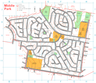
Middle Park is a predominantly residential suburb in the affluent Centenary Suburbs located 14 kilometres (8.7 mi) south-west of the CBD of Brisbane, Queensland, Australia. At the 2011 Australian Census the suburb recorded a population of 4,026. Many properties on Sumners Road have an address in Middle Park but are not in Middle Park and are disregarded in this article.

Point Lookout is a headland, small coastal town and locality on the eastern coast of North Stradbroke Island, Redland City, Queensland, Australia. At the 2011 census, Point Lookout had a population of 678.
North Queensland or the Northern Region is the northern part of the Australian state of Queensland that lies just south of Far North Queensland. Queensland is a massive state, larger than many countries, and the tropical northern part of it has been historically remote and undeveloped, resulting in a distinctive regional character and identity.

Enoggera is a suburb of Brisbane, in Queensland, Australia 6 kilometres (3.7 mi) north-west of the Brisbane CBD. The west of the suburb is dominated by Enoggera Hill.

Wynnum West is an outer suburb of Brisbane, Australia located 13 kilometres (8.1 mi) east of the CBD. Originally part of surrounding suburbs, Wynnum West was gazetted in 1975 as a separate suburb.

Manly West is a suburb of Brisbane, Australia. Manly West originally was an extension of Manly, but was officially gazetted in 1975.

The Endeavour Strait is a strait running between the Australian mainland Cape York Peninsula and Prince of Wales Island in the extreme south of the Torres Strait, in northern Queensland, Australia. It was named in 1770 by explorer James Cook, after his own vessel, HMS Endeavour, and he used the strait as passage out to the Indian Ocean on his voyage.
Turkey Beach is a coastal town and a locality in the Gladstone Region, Queensland, Australia. In the 2016 census, Turkey Beach had a population of 183 people.

Dagworth Station is a cattle station located north-west of Winton in central west Queensland in Australia. It was established in 1876 by Messrs Hunter and Urquhart who were living in a grass hut on the property in 1878 when they were still building up the run. One of the adjoining properties in 1887 was Elderslie Station, which at the time was owned by Sir Samuel Wilson.

Central West Queensland is a remote region in the Australian state of Queensland which covers 396 650.2 km². The region lies to the north of South West Queensland and south of the Gulf Country.
