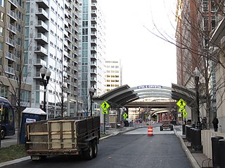
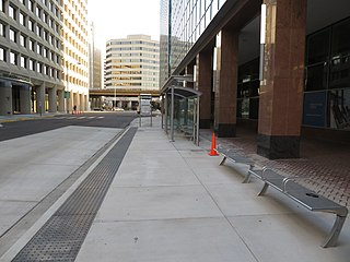
Crystal City station is an underground Washington Metro station in the Crystal City neighborhood of Arlington County, Virginia. The station opened on July 1, 1977, and serves the Blue Line and Yellow Line services, with a Metroway bus rapid transit stop on the surface.

Braddock Road station is an island-platformed Washington Metro station in Alexandria, Virginia, United States. The station was opened on December 17, 1983, and is operated by the Washington Metropolitan Area Transit Authority (WMATA). Providing service for both the Blue and Yellow Lines, the station is located at Braddock Road and West Street.
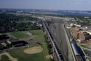
Potomac Yard is a neighborhood in Northern Virginia that straddles southeastern Arlington County and northeastern Alexandria, Virginia, located principally in the area between U.S. Route 1 and the Washington Metro Blue Line /Yellow Line tracks, or the George Washington Memorial Parkway, depending on the definition used. The area was home to what was once one of the busiest rail yards on the Eastern Seaboard of the United States. The "Potomac Yard" name is also used to refer to several developments in the area, especially the Potomac Yard Center power center and a Washington Metro station.

Metrobus is a bus service operated by the Washington Metropolitan Area Transit Authority (WMATA). Its fleet consists of 1,595 buses covering an area of 1,500 square miles (3,900 km2) in Washington, D.C., Maryland, and Virginia. There are 269 bus routes serving 11,129 stops, including 2,554 bus shelters. In 2023, the system had a ridership of 103,438,600, or about 364,300 per weekday as of the first quarter of 2024.

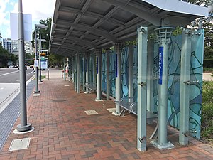
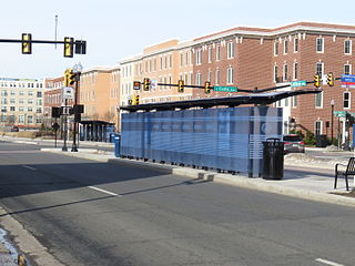
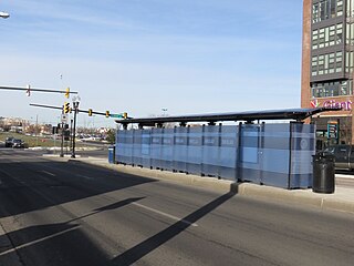
Metroway is a bus rapid transit (BRT) line operated by the Washington Metropolitan Area Transit Authority (WMATA) as part of their Metrobus system. It consists of a single line operating in Arlington and Alexandria, Virginia. It opened on August 24, 2014. It was the first bus rapid transit line to open in Virginia and in the Washington metropolitan area.

Potomac is a bus rapid transit station in Alexandria, Virginia, located at the intersection of Richmond Highway and Potomac Avenue. It is a stop on the portion of the dedicated bus-only highway along the Metroway bus rapid transit line, providing two-way service along the route. The station provides service to the southern Potomac Yard and Del Ray communities in Alexandria.
Custis is a bus rapid transit station in Alexandria, Virginia, located at the intersection of Richmond Highway and East Custis Avenue. It is a stop on the portion of dedicated bus-only highway along the Metroway bus rapid transit line, providing two-way service along the route. The station provides service to the central Potomac Yard and Potomac communities in Alexandria.

Swann is a bus rapid transit station in Alexandria, Virginia, located at the corner of Richmond Highway and East Swann Avenue. It is a stop on the portion of dedicated bus-only highway along the Metroway bus rapid transit line, providing two-way service along the route. The station provides service to the central Potomac Yard and Potomac communities in Alexandria.
East Glebe is a bus rapid transit station in Alexandria, Virginia, located on Richmond Highway between East Glebe Road and Hume Avenue. It is a stop on the portion of dedicated bus-only highway along the Metroway bus rapid transit line, providing two-way service along the route. The station provides service to the central Potomac Yard and Potomac communities in Alexandria.

Reed, also known as Potomac Yard, is a bus rapid transit station in Alexandria, Virginia, located on Potomac Avenue and Reed Avenue. It is a stop on the portion of the mixed-traffic segment of the Metroway bus rapid transit line, providing two-way service along the route. The station provides service to the central Potomac Yard and Potomac communities in Alexandria. This stop also serves the Potomac Yard station on the Yellow and Blue lines of the Washington Metro.

South Glebe is a bus rapid transit station in Arlington County, Virginia, located near the intersection of South Glebe Road and South Clark Place. It is a stop along the dedicated bus-only highway portion of the Metroway bus rapid transit line, providing two-way service along the route to southern Crystal City.

33rd Street is a bus rapid transit station in Arlington, Virginia. It is located near the intersection of 33rd Street South and Potomac Avenue, along the dedicated bus-only highway portion of the Metroway bus rapid transit line, providing two-way service along the route.
27th & Crystal is a bus rapid transit station in Arlington County, Virginia, located near the intersection of 27th Street South and Crystal Drive. The stop is along the Metroway bus rapid transit line, in a portion of the dedicated bus-only highway. It provides two-way service to southern Crystal City.
26th & Clark is a bus rapid transit station in Arlington County, Virginia, located near the intersection of 23rd Street South and South Clark Street. The stop is on a mixed-traffic segment of the Metroway that is restricted to buses during certain hours. It provides southbound service to central Crystal City.

23rd & Crystal is a northbound-only bus rapid transit station in Arlington County, Virginia, located near the intersection of 23rd Street South and Crystal Drive. The stop is on a mixed-traffic segment of the Metroway that is restricted to buses during certain hours. It provides northbound service to central Crystal City.

23rd & Clark is a bus rapid transit station in Arlington County, Virginia, located near the intersection of 23rd Street South and South Clark Street. The stop is on a mixed-traffic segment of the Metroway that is restricted to buses during certain hours. It provides southbound service to central Crystal City.

National Landing is an area in Northern Virginia encompassing parts of the Crystal City and Pentagon City neighborhoods of Arlington County and the Potomac Yard neighborhood in the city of Alexandria. It is the location of the Amazon HQ2 headquarters.
East Glebe & Potomac, is a temporary bus rapid transit station in Alexandria, Virginia, located on Potomac Avenue and East Glebe Road. It was a stop on the portion of the mixed-traffic segment of the Metroway bus rapid transit line, providing two-way service along the route. The station provided service to the central Potomac Yard and Potomac communities in Alexandria.
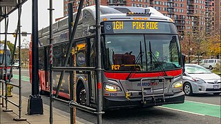
The Columbia Pike–Pentagon City Line, designated as Routes 16G & 16H, were daily bus routes that was operated by the Washington Metropolitan Area Transit Authority between the neighborhoods of Arlington Mill (16G) or Skyline City (16H) and Pentagon City station of the Yellow and Blue lines of the Washington Metro. This line is part of the Pike Ride service, which runs through Columbia Pike. This line provides service through the neighborhoods of Fairfax County and Arlington County to Pentagon City. Unlike the Columbia Pike Line, the Columbia Pike–Pentagon City Line does not serve Columbia Pike past the Arlington County line.

The Columbia Pike–National Landing Line, designated as Route 16M, is a daily bus route operated by the Washington Metropolitan Area Transit Authority between Skyline City and Crystal City station of the Yellow and Blue lines of the Washington Metro. This line is part of the Pike Ride service, which runs through Columbia Pike. This line provides service through the neighborhoods of Fairfax County and Arlington County to Crystal City. Unlike the Columbia Pike Line, the Columbia Pike–National Landing Line does not serve Columbia Pike past the Arlington County line.