An urban growth boundary, or UGB, is a regional boundary, set in an attempt to control urban sprawl by, in its simplest form, mandating that the area inside the boundary be used for urban development and the area outside be preserved in its natural state or used for agriculture. Legislating for an "urban growth boundary" is one way, among many others, of managing the major challenges posed by unplanned urban growth and the encroachment of cities upon agricultural and rural land.

Land use involves the management and modification of natural environment or wilderness into built environment such as settlements and semi-natural habitats such as arable fields, pastures, and managed woods. It also has been defined as "the total of arrangements, activities, and inputs that people undertake in a certain land cover type."

Zoning is the process of dividing land in a municipality into zones in which certain land uses are permitted or prohibited. In addition, the sizes, bulk, and placement of buildings may be regulated. The type of zone determines whether planning permission for a given development is granted. Zoning may specify a variety of outright and conditional uses of land. It may also indicate the size and dimensions of land area as well as the form and scale of buildings. These guidelines are set in order to guide urban growth and development.

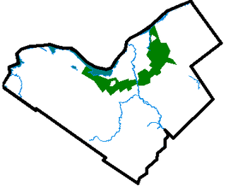
A green belt or greenbelt is a policy and land use zone designation used in land use planning to retain areas of largely undeveloped, wild, or agricultural land surrounding or neighbouring urban areas. Similar concepts are greenways or green wedges which have a linear character and may run through an urban area instead of around it. In essence, a green belt is an invisible line designating a border around a certain area, preventing development of the area and allowing wildlife to return and be established.

The administrative divisions of New York are the various units of government that provide local government services in the state of New York.
Natural Resources Conservation Service (NRCS), formerly known as the Soil Conservation Service (SCS), is an agency of the United States Department of Agriculture (USDA) that provides technical assistance to farmers and other private landowners and managers.

Common land is land owned collectively by a number of persons, or by one person, but over which other people have certain traditional rights, such as to allow their livestock to graze upon it, to collect wood, or to cut turf for fuel.
Western Australia is divided into regions according to a number of systems.

Forestry laws govern activities in designated forest lands, most commonly with respect to forest management and timber harvesting. Ancillary laws may regulate forest land acquisition and prescribed burn practices. Forest management laws generally adopt management policies, such as multiple use and sustained yield, by which public forest resources are to be managed. Governmental agencies are generally responsible for planning and implementing forestry laws on public forest lands, and may be involved in forest inventory, planning, and conservation, and oversight of timber sales. Broader initiatives may seek to slow or reverse deforestation.
The State List or List-II is a list of 61
items in Schedule Seven to the Constitution of India. The legislative section is divided into three lists: Union List, State List and Concurrent List. Unlike the federal governments of the United States, Switzerland or Australia, residual powers remain with the Union Government, as with the Canadian federal government.
The Town and Country Planning Act 1947 was an Act of Parliament in the United Kingdom passed by the Labour government led by Clement Attlee. It came into effect on 1 July 1948, and along with the Town and Country Planning (Scotland) Act 1947 was the foundation of modern town and country planning in the United Kingdom.
Farmland preservation is a joint effort by non-governmental organizations and local governments to set aside and protect examples of a region's farmland for the use, education, and enjoyment of future generations. It is often a part of regional planning and national historic preservation.

Zoning in the United States includes various land use laws falling under the police power rights of state governments and local governments to exercise authority over privately owned real property. The earliest zoning laws originated with the Los Angeles zoning ordinances of 1908 and the New York City Zoning resolution of 1916. Starting in the early 1920s, the United States Commerce Department drafted model zoning and planning ordinances in the 1920s to facilitate states in drafting enabling laws. Also in the early 1920s, a lawsuit challenged a local zoning ordinance in a suburb of Cleveland, which was eventually reviewed by the United States Supreme Court.
The local government in Malaysia is the lowest tier of government in Malaysia administered under the states and federal territories which in turn are beneath the federal tier. Local governments are generally under the exclusive purview of the state governments as provided in the Constitution of Malaysia, except for local governments in the federal territories. The federal Ministry of Housing and Local Government plays a role in co-ordinating and standardising the practices of local governments across the country.
Transferable development rights (TDR) is a method for controlling land use to complement land-use planning and zoning for more effective urban growth management and land conservation. The TDR process can be considered a tool for controlling urban sprawl by concentrating development. TDR is a legal mechanism offered in some local government jurisdictions as a form of development control. TDR are also a way to avoid constitutional takings issues caused by rezoning areas that would otherwise eliminate a significant amount of value from the property. The procedure offers landowners financial incentives or bonuses for the conservation and maintenance of the environmental, heritage or agricultural values of their land. TDR is based on the concept that with land ownership comes the right of use of land, or land development. These land-based development rights can in some jurisdictions be used, unused, sold, or otherwise transferred by the owner of a parcel.

Lana Popham is Canadian politician representing the riding of Saanich South in the 39th and 40th Parliament of British Columbia. She was elected as the British Columbia New Democratic Party candidate in the British Columbia general election, 2009 and has served on the Select Standing Committee on Public Accounts and as the Official Opposition Critic for the Ministry of Agriculture and Lands. She was re-elected in the British Columbia general election, 2013. She has introduced two private members bills: the British Columbia Local Food Act and the Prevention of Cruelty to Animals Amendment Act. Popham owns and operates the organic grape orchard, Barking Dog Vineyard, on Vancouver Island. Her background in community work has included participating in campaigns to reduce excessive automobile driving and to reduce the use of disposable plastic bags within the Capital Regional District.

The community boards of the New York City government are the appointed advisory groups of the community districts of the five boroughs. There are currently 59 community districts: twelve in Manhattan, twelve in the Bronx, eighteen in Brooklyn, fourteen in Queens, and three in Staten Island:
Local government in Ukraine consists of administrative divisions of Ukraine. There are 24 oblasts (regions), with each oblast further divided into raions (districts).

Land grabbing is the contentious issue of large-scale land acquisitions: the buying or leasing of large pieces of land by domestic and transnational companies, governments, and individuals. While used broadly throughout history, land grabbing as used in the 21st century primarily refers to large-scale land acquisitions following the 2007–08 world food price crisis. Obtaining water resources is usually critical to the land acquisitions, so it has also led to an associated trend of water grabbing. By prompting food security fears within the developed world and new found economic opportunities for agricultural investors, the food price crisis caused a dramatic spike in large-scale agricultural investments, primarily foreign, in the Global South for the purpose of industrial food and biofuels production. Although hailed by investors, economists and some developing countries as a new pathway towards agricultural development, investment in land in the 21st century has been criticized by some non-governmental organizations and commentators as having a negative impact on local communities. International law is implicated when attempting to regulate these transactions.

Fawcett Properties Ltd v Buckingham County Council [1960] has become a leading case in planning law and concerned agricultural conditions of use. It is also relevant for its tests on finding certainty versus uncertainty of policy, contract or other concepts rendering them void. It has been applied in English trusts law which has long held a cy-près doctrine, expressed in pre 1649-Law French meaning "there nearly" that is perfecting concepts or a purpose for funds which is tantamount to a legitimate interest or concern and intended to take clear effect.


