
Puerto Vallarta is a Mexican beach resort city situated on the Pacific Ocean's Bahía de Banderas in the Mexican state of Jalisco. PV or simply Vallarta is the second largest urban agglomeration in the state after the Guadalajara Metropolitan Area. The City of Puerto Vallarta is the government seat of the Municipality of Puerto Vallarta which comprises the city as well as population centers outside of the city extending from Boca de Tomatlán to the Nayarit border . The city is located at 20°40′N105°16′W. The municipality has an area of 1,300.7 square kilometres (502.19 sq mi). To the north, it borders the southwest part of the state of Nayarit. To the east, it borders the municipality of Mascota and San Sebastián del Oeste, and to the south, it borders the municipalities of Talpa de Allende and Cabo Corrientes.

Arguineguín is one of the most populated towns along the south coast of Gran Canaria, Spain. A typical Canarian fishing village, it is home to many locals rather than being a tourist resort. It is part of the municipality of Mogán and is located southwest of Las Palmas.

Sonoyta, Sonora is a town in the northern Mexican state of Sonora. It stands on the U.S.-Mexico border, facing Lukeville, Arizona, in the United States. It is the municipal seat of the municipality of Plutarco Elías Calles.

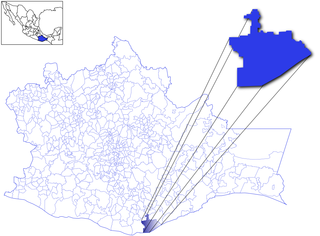
Puerto Escondido is a small port and tourist center in the municipality of San Pedro Mixtepec Distrito 22 in the Mexican state of Oaxaca. Prior to the 1930s, there was no town. The bay had been used as a port intermittently to ship coffee, but there was no permanent settlement due to the lack of potable water. The name "Puerto Escondido" had roots in the legend of a woman who escaped her captors and hid here. The Nahuatl word for this area was Zicatela, meaning “place of large thorns". Today, it refers to the area's most famous beach.

Tourism in Mexico is a very important industry. Since the 1960s, it has been heavily promoted by the Mexican government, as "an industry without smokestacks." Mexico has traditionally been among the most visited countries in the world according to the World Tourism Organization, and it is the second-most visited country in the Americas, after the United States. In 2017, Mexico was ranked as the sixth-most visited country in the world for tourism activities. Mexico has a significant number of UNESCO World Heritage sites with the list including ancient ruins, colonial cities, and natural reserves, as well as a number of works of modern public and private architecture. Mexico has attracted foreign visitors beginning in the early nineteenth century, cultural festivals, colonial cities, nature reserves and the beach resorts. The nation's temperate climate and unique culture – a fusion of the European and the Mesoamerican are attractive to tourists. The peak tourism seasons in the country are during December and the mid-Summer, with brief surges during the week before Easter and Spring break, when many of the beach resort sites become popular destinations for college students from the United States.
Huatulco, formally Bahías de Huatulco, centered on the town of La Crucecita, is a tourist development in Mexico. It is located on the Pacific coast in the state of Oaxaca. Huatulco's tourism industry is centered on its nine bays, thus the name Bahias de Huatulco, but has since been unofficially shortened to simply Huatulco. Huatulco has a wide variety of accommodations from rooms for rent, small economy luxury hotels, luxury villas, vacation condominiums, bed and breakfasts, as well as several luxury resorts standing on or near the shores of Tangolunda Bay. The Camino Real Zaashila, Quinta Real Huatulco, Las Brisas, Dreams Resort & Spa, and the Barceló are examples of the most popular larger resorts in the area.

The Mexican Riviera refers collectively to twenty cities and lagoons lying on the western coast of Mexico. Although there are long distances between these cities, they are often collectively referred to as the Mexican Riviera because of their many oceanfront resorts and their popularity among tourists. Cruise ships often visit three or four of these destinations on their longer cruises. In a 2005 interview Stanley McDonald, the founder of Princess Cruises, mentioned:
The call of the "Mexican Riviera" was coined by Princess Cruise Line. Now everyone refers to it as the Mexican Riviera. I believe that it really spoke to the quality and beauty of what people would see down there. We all know the French Riviera -- the Mexican Riviera was something we had in the western hemisphere.

Puerto López is a small fishing village set in an arched bay on the Pacific coast in the Ecuadorian Manabí Province. Puerto Lopéz is the Machalilla National Park headquarters. The main industries include fishing and ecotourism. The street closest to the beach has many restaurants, cabanas that provide drinks, and some nightclubs.

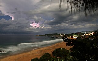
Playa Zipolite is a beach community located in San Pedro Pochutla municipality on the southern coast of Oaxaca state in Mexico between Huatulco and Puerto Escondido.

San Pedro Pochutla is a city and municipality located in the south of Oaxaca state, Mexico next to the Pacific Ocean. It is an important commercial, transportation and administrative hub for the Pochutla District in the east of the Costa Region. Pochutla is located at the junction of coastal Highway 200 and Highway 175 to Oaxaca, with 175 functioning as the town's main thoroughfare. Its name means "place of kapok trees ", and most of the city is built on a lakebed which was drained during the colonial period. The municipality is best known as being the home of the oceanside communities of Puerto Ángel and Zipolite.
San Agustinillo is a small fishing village and beach in the state of Oaxaca, Mexico. It is located in the municipality of Santa María Tonameca just east of the coastal communities of Mazunte and La Ventanilla. This is where the Sierra Madre del Sur mountains meet the Pacific Ocean.

Pitiquito is a small town in Pitiquito Municipality in the northwest of the Mexican state of Sonora.

Puerto Ángel is a small coastal town in the Mexican state of Oaxaca located in the municipality of San Pedro Pochutla. It, along with San Agustinillo and Playa Zipolite are known as the "Riviera Oaxaqueña". It is located 9 km south of city of Pochutla approximately 50 kilometers west of Huatulco and 80 kilometers east of Puerto Escondido. Despite tourism development since the 1960s, the town is still mostly a fishing village, located on a small bay surrounded by rocky hills that lead into the Sierra Madre del Sur. It was founded in the mid 19th century as a port for the region's coffee and lumber industries but since then other means of shipping these products has replaced it.

The Lagunas de Chacahua National Park, created in 1937, is a national park located in the Municipality of Villa de Tututepec de Melchor Ocampo in the Mexican state of Oaxaca, about 54 km west of Puerto Escondido, near a village called Zapotalito. It can be reached via Federal Highway 200 or by boat from Puerto Escondido. It is located between the towns of Santiago Jamiltepec and Puerto Escondido. The park encompasses 132.73 square kilometres, about 30 km² of which is taken by various lagoons such as the ‘’’Laguna de Chacahua,’’’ ‘’’Laguna de La Pastoria,’’’ and Laguna Las Salinas. There are various smaller lagoons that are connected by narrow channels. The rest of the park consists of dry land.

La Ventanilla is a small village on a beach and lagoon in the municipality of Santa María Tonameca, Oaxaca, Mexico. It is best known as an ecotourism center based on its natural resources. It is located on the Costa Chica section of Oaxaca, just west of Mazunte. The La Ventanilla area consists of a long, unbroken stretch of undeveloped beach and a lagoon wedged between the Pacific Ocean and the Sierra Madre del Sur. In the 1990s, the area was nothing more than a coconut plantation with three families living there, and did not have electricity until 1999. Today, the area is home to about twenty five Zapotec families who are dedicated to preserving the ecology of both the beach and the lagoon and live in a small village located on the far east end of the beach.
Luvianos is a small town and municipality located in the southwest of the State of Mexico. It gained municipal status in 2000. People can access Luvianos by driving Federal Road 134 south from Toluca, and then take a detour about 25 minutes north of Tejupilco. The name is derived from a hacienda what was established during colonial times.

Santa María Tonameca is a town and municipality located on the southern coast of Oaxaca, Mexico, about 268 km from the capital city of Oaxaca. It is part of the Pochutla District in the east of the Costa Region. It is a very rural area, which is best known for the beach communities of Mazunte, San Agustinillo and La Ventanilla. The National Turtle Center, a research center and aquarium is located in Mazunte, along with conservation centers for butterflies and iguanas. The town itself is the site of the largest annual festival in the area, celebrating the rescue of a cedar image of the Virgin Mary from the rubble of the town church after an earthquake on 11 May 1870.

The Costa Region or Costa Chica lies on the Pacific coast of the state of Oaxaca, Mexico, south of the more mountainous Sierra Sur inland from the coast. It includes the districts of Jamiltepec, Juquila and Pochutla
According to the Mexican government agency Conapo, Oaxaca is the third most economically marginalized states in Mexico. The state has 3.3% of the population but produces only 1.5% of the GNP. The main reason for this is the lack of infrastructure and education, especially in the interior of the state outside of the capital. Eighty percent of the state's municipalities do not meet federal minimums for housing and education. Most development projects are planned for the capital and the surrounding area. Little has been planned for the very rural areas and the state lacks the resources to implement them. The largest sector of Oaxaca's economy is agriculture, mostly done communally in ejidos or similar arrangements. About 31% of the population is employed in agriculture, about 50% in commerce and services and 22% in industry. The commerce sector dominates the gross domestic product at 65.4%, followed by industry/mining at 18.9% and agriculture at 15.7%.

Playa de Escobilla Sanctuary is a waterfront sanctuary for sea turtles in the Mexican state of Oaxaca, with an area of about 30 hectares. The sanctuary lies in Santa María Tonameca Municipality, between the towns of Puerto Escondido and Huatulco near the town of Mazunte. In order to protect the turtles, the beach is guarded during nesting season and is off-limits to tourists. However, during this season visitors can join overnight trips to observe the Olive Ridley turtles heaving themselves on shore to lay their eggs. These trips help support the local economy, and must be arranged in advance through the Centro Mexicano de la Tortuga.