
Jhansi is a historic city in the Indian state of Uttar Pradesh. Balwant Nagar was the old name of Jhansi. It lies in the region of Bundelkhand, on the banks of the Pahuj River, in the extreme south of Uttar Pradesh. Jhansi is the administrative headquarters of Jhansi district and Jhansi division. Also called the Gateway to Bundelkhand, Jhansi is situated near and around the rivers Pahuj and Betwa at an average elevation of 285 m (935 ft). It is about 420 kilometres (261 mi) from national capital New Delhi, 101 kilometres from Gwalior and 315 kilometres (196 mi) from state capital Lucknow.
Jalaun is a city and a municipal board in Jalaun district in the Indian state of Uttar Pradesh.
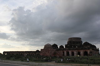
Kalpi is a historical city and municipal board in Jalaun district in Uttar Pradesh, India. It is on the right bank of the Yamuna. Once Kalpi was more important Than Orai It is situated 78 kilometres south-west of Kanpur from which it is connected by both road and rail.

Jalaun district is a district of Uttar Pradesh, India. The district is named after the town of Jalaun, which was the former headquarters of a Maratha governor, but the administrative headquarters of the district is at Orai.

Kulpahar is a city in Mahoba district in the Indian state of Uttar Pradesh. It is a historical town in the Bundelkhand region. Before 11 Feb 1995 Kulpahar was a Tehsil of Hamirpur District. On 11 Feb 1995 Mahoba District was carved out of Hamirpur, and Kulpahar is now a part of the Mahoba District. Kulpahar is the largest Subdivision of Uttar Pradesh. Kulpahar is known for its closeness to Khajuraho and other historic places like Mahoba, Charkhari, Kalinjar Rath, Orchha, and Jhansi. This town holds relics of temples and man-made water bodies of the Chandela Dynasty
Akbarpur is a town in Kanpur Dehat district in the state of Uttar Pradesh, India.
Chirgaon is a town and a municipal board in Jhansi district in the Indian state of Uttar Pradesh, India.

Chitrakoot Dham is a city in the Chitrakoot district, in the Indian state of Uttar Pradesh. It is the headquarters of the Chitrakoot district. Situated in the Bundelkhand region, it holds great cultural, historical, religious and archaeological importance and it is said that Rama, a major deity in Hinduism, spent 11 years of exile in Chitrakoot. It is connected to the town of Chitrakoot, situated in the Satna district of Madhya Pradesh.
Karera is a municipality or Nagar Parishad in the Shivpuri district of the Indian state of Madhya Pradesh.
Konch is a city and a municipal board in Jalaun district in the Indian state of Uttar Pradesh.Konch City is famous for the tapobhoomi of kraunch Rishi.
Maudaha is a city and a Municipal Board in Hamirpur district, Uttar Pradesh, India.
Pukhrayan is a town and a Municipality in Amrodha Block in Kanpur Dehat district in the Indian state of Uttar Pradesh. Found to the south-west of Mati on National Highway 25, Pukhrayan is 2 km (1.2 mi) from Bhognipur.

Rajapur is a town and tehsil of Chitrakoot district in the Indian state of Uttar Pradesh. It is situated along the bank of the river Yamuna. It has the nickname "Tulsi Dhaam" after the Hindi poet Goswami Tulsidas, who is the writer of holy "Ram Charit Manas" along with many other religious books of Hindus. There is a temple devoted to Tulsidas where part of the original "Handwritten Scripture" of Ramcharitmanas is still available, although some pages may be missing. Rajapur is linked with Kaushambi district on the opposite bank of the river Yamuna.

Rasulabad is a town and a nagar panchayat in Kanpur Dehat district in the Indian state of Uttar Pradesh.
Rath is a small town with a municipal board in Hamirpur district in the Indian state of Uttar Pradesh. Rath is a Tehsil of Hamirpur District. It is situated 506 km southeast of New Delhi.
Sumerpur, also known as Bharuwa Sumerpur, is a town and a nagar panchayat in Hamirpur district, Uttar Pradesh, India.
Kanpur Dehat district is a district in Uttar Pradesh state in northern India. The administrative headquarters of the district are at Mati-Akbarpur. This district is part of Kanpur division. Kanpur was formerly spelled Cawnpore.
Itaura is a village in Jalaun district in the Indian state of Uttar Pradesh. This is a twin village and it includes Akbarpur and Itora.
Orai Railway Station is a railway station on Jhansi–Kanpur rail line of North Central Railway in Jalaun district, Uttar Pradesh. Its code is ORAI. It serves Orai city. The station consists of four platforms. The platforms are well sheltered. The station is a lies between Kanpur–Jhansi section and well connected to all over India and station comes under the "model railway station" category.

Ait Junction railway station is a small railway station located in Jalaun, Konch in the Indian state of Uttar Pradesh. Nearby major railway station is Jhansi Jn and the airport is Gwalior Airport. It belongs to North Central, Jhansi Jn.