Alladigam (Also spelt as Aladigam, Alladigaon & Aladigan) is a village in Ganjam District in the Indian State of Odisha.
Alladigam (Also spelt as Aladigam, Alladigaon & Aladigan) is a village in Ganjam District in the Indian State of Odisha.
Alladigam is located at 19°31′N84°53′E / 19.52°N 84.88°E . It has an average elevation of 19 metres (62 ft). Total geographical area of Aladigan village is 5.8 km2 (577 hectares) and it is the 6th biggest village by area in the sub-district Purusottampur.
According to the 2011 India census, Alladigam had a population of 2500. There are 900 houses in this village. The village is situated on the bay of Rushikulya River. There are two schools. One was established in 1921. Other was established in 2008. There is a (Amba Tota) Mango tree here, which is called Chaitanya Matha. Odia (formerly known as oriya) is the local language here.
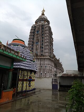
It has some very old temples. Maa Thakurani Temple in middle of the village, Two Radha Krishna Temple, One Panchatatwa Which is situated in Amba tota at Balisahi.
The village has its own post office and the pin code of Aladigam village is 761019. Barapalli & Bhuanbhuin villages also have this Post office and postal head office is Pratapur (Ganjam).
Purusottampur is nearest town to Aladigan which is approximately 10 km away. Purusottampur is the Block, Tahasil, Thana & Court of this village. The village comes under Kamanali - panchayat. Nearest Villages of the village are Barapalli, Bhuanbhuin, Balia, Rampali, K. N. Pur, Badamadhapur, Umburi, Khatia, Goba, Rangamatia, Raipur, Kanthiapalli, Chhotabasa, Pratapur etc.

Simdega is a city in the Indian state of Jharkhand. Simdega is the administrative headquarters of the eponymous district and Subdivision. The city stands at an elevation of approximately 418 metres (1371 feet) above sea level and covers an area of 3,750 km2 (1,450 sq mi). Bounded in the north by Gumla, on the east by Ranchi and West Singhbhum, on the west by Jashpur Nagar, Chhattisgarh and on the south by Rourkela, Odisha. The distance between Rourkela and Simdega is 83 km. It is accessible by road through National Highways from Rourkela and Ranchi. The nearest railway station is Bano railway station.

Asika or Aska (ଆସିକା)/(ଆସ୍କା) is a town and a Notified Area Council in Ganjam district in the state of Odisha, India. Fondly known as the Sugar city of Odisha. Asika is a major commercial and transportation hub of Ganjam .There are 2 National Highway's are pass across the town(157 & 59). It's famous for Maa Khambeswari Temple and Maa Khambeswari's Baishakhi Yatra which is celebrated every year.

Bhanjanagar is a town and an urban region. It is a Notified Area Council in the Ganjam District in the state of Odisha, India. The town, earlier named as Russellkonda after George Russell, President of then board of Revenue, was renamed later after Kavi Samrat Upendra Bhanja. Bhanjanagar is a planned community situated in the confluence of rivers Loharakhandi and Badanadi.

Buguda is a town in the Ghumusara area of Ganjam district in the state of Odisha, India. Buguda is approximately 70 kilometres from Berhampur, a major city in Odisha.
Digapahandi is a town and a Notified Area Council (N.A.C.) in Ganjam district in the state of Odisha, India. There are 171 small villages which comes under Digapahandi tahasil and largely dependent on this town for their business and livelihood. Digapahandi town is divided into 11 wards, comprising Bazar street, Sunari street, New street, Phulasundari Street, Balaji Nagar Bada Brahmin street, Sana Brahmin street, Sasan street, Chikitia street, Rani street, Annapurna street, Anchala street, Uparabasa, Chikiti road.

Mainaguri is a Town and a Municipality in the Jalpaiguri Sadar subdivision of the Jalpaiguri district in the state of West Bengal, India. It is known as the "Gateway of the Dooars" and is a regionally significant tourist destination for "Jalpesh Temple" of Lord Shiva and nearby Gorumara National Park.
North Barrackpur(Bengali pronunciation: [uttoːr bærakpur]) is a city and a municipality of North 24 Parganas district in the Indian state of West Bengal. It is a part of the area covered by Kolkata Metropolitan Development Authority (KMDA). It is situated north of Barrackpore.
Purusottampur is a town and a Notified Area Council in Ganjam district in the Indian state of Odisha.

Surada is a town and a Notified Area Council in Ganjam district in the Indian state of Odisha.
Mausimaa Temple is an ancient shrine located in Kulada, a village also famous for its Bagh Devi temple, in Ganjam District of Odisha, India. The temple can be approached by road from Bhubaneswar (140 km) and Chhatrapur (102 km). The nearest railway station is at Berhampur (88 km). It is about 8 km from Bhanjanagar.

Ganjam is a town and a notified area council in Ganjam district in the state of Odisha, India. Brahmapur, one of the major city of Odisha is situated in this district.
Upper Bagh Devi Temple is an ancient shrine at Kulada, Ganjam District in the state of Odisha in India. The temple is about 8 km from Bhanjanagar, 102 km from Chhatrapur and 140 km from Bhubaneswar. The nearest railway station is at Berhampur, 88 km away.

The Rushikulya River is one of the major rivers in the state of Odisha and covers entire catchment area in the districts of Kandhamal and Ganjam of Odisha. The Rushikulya originates at an elevation of about 1000 metres from Daringbadi hills of the Eastern Ghats range. The place from where the river originates, Daringbadi is called the ' Kashmir of Odisha '. The river lies within the geographical coordinates of 19.07 to 20.19 north latitude and 84.01 to 85.06 east longitude. It meets the Bay of Bengal at Puruna Bandha in Ganjam. Its tributaries are the Baghua, the Dhanei, the Badanadi etc. It has no delta as such at its mouth.

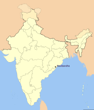
Raulibandha is a village in Malada Gram Panchayat, Ganjam district in the state of Odisha, India.

Siddha Bhairavi temple is a shrine situated at Mantridi in Ganjam district of Odisha India. The presiding deity is the goddess Bhairavi. Carved in crude fashion, the idol features one leg and four hands. It is said that this idol was excavated from a ploughed field. and was enshrined as such in a new temple in 1937. All the Sankranti days in every month of the Hindu calendar and Tuesdays are considered auspicious here.
Patanvav is a large village 23 km from Dhoraji Town, 13 km from Upleta, 21 km from Manavadar, and 115 km from Rajkot by good motorable roads. It is in Dhoraji taluka of Rajkot district in Gujarat. Patanvav is at an elevation of 68 meters above mean sea level. Postal code is 360430. Dhoraji and Upleta towns are connected by railways on Rajkot-Jetalsar-Porbandar line. Village is situated in the foothills of the Osam Hills.
Lower Fagu Tea Garden is a village in the Gorubathan CD block in the Kalimpong Sadar subdivision of Kalimpong district in West Bengal, India.
Purusottampur, is a village in the taluk of Champua, district of Kendujhar, in the Indian state of Odisha. The total geographical area of village is 160 hectares. Mainly Oriya/Bangla/Hindi is the local language on the village.
Prosadpur is a village in Haripal in Chandannagore subdivision of Hooghly district in West Bengal, India.
Nainan is a census town and a gram panchayat within the jurisdiction of the Magrahat police station in the Magrahat II CD block in the Diamond Harbour subdivision of the South 24 Parganas district in the Indian state of West Bengal.