A burgstall is a German term referring to a castle of which so little is left that its appearance cannot effectively be reconstructed. It has no direct equivalent in English, but may be loosely translated as "castle site". Variations in the literature include Burgstelle, Altburgstelle, die Burgställe (plural), Burgstähl (archaic) or abgegangene Burg. In German castle studies, a burgstall is a castle that has effectively been levelled, whereas a "ruin" (Ruine) still has recognisable remnants of the original castle above the level of the ground.

The Schlossberg is a tree-covered hill of 456 metres (1,496 ft) located in the area of the city of Freiburg im Breisgau. It is directly to the east of Freiburg's Old Town and is part of the Black Forest. The main geological fault is at the western edge of the Schlossberg, towards the Upper Rhine Graben.

A circular rampart is an embankment built in the shape of a circle that was used as part of the defences for a military fortification, hill fort or refuge, or was built for religious purposes or as a place of gathering.

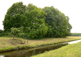
Hodenhagen Castle is the site of a former lowland castle (Niederungsburg) built in the 13th century in the vicinity of Hodenhagen in the German state of Lower Saxony. This medieval manor house only lasted just under 100 years and was destroyed in 1289.

The Ackeburg, also called the Ackenburg, in the Harz Mountains of central Germany, is the site of a high medieval hill castle, 333.2 m above sea level (NN), in the borough of Falkenstein/Harz in Harz district in the state of Saxony-Anhalt. It was first mentioned in 1216 and was abandoned or destroyed in 1400. There was also a village associated with it, known as Akkeburg.

Old Falkenstein Castle in the Harz Mountains of Germany is the castle site or burgstall of a high medieval hill castle. It lies on the territory of Falkenstein/Harz in the state of Saxony-Anhalt in the district of Harz. It was built in the 11th century A.D. and destroyed in 1115.

Altraderach Castle, also called the Old Castle or Little Heathen Palace (Heidenschlösschen), is a levelled castle in the area between Unterraderach and Raderach. The still easily visible burgstall lies in the parish of Kluftern in the borough of Friedrichshafen in the county of Bodenseekreis in the German state of Baden-Württemberg.

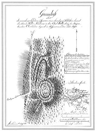
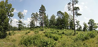
The Burgstall of Schlosshügel near Weidenberg is a lost hill castle or circular rampart site of the type known as a motte from the Early Middle Ages. It lies on the southern perimeter of the Fichtel Mountains at a height of 699 metres above sea level (NN) above the village of Sophienthal, which is part of the market borough of Weidenberg in the Upper Franconia county of Bayreuth in Bavaria. The burgstall or lost castle site was partly investigated by means of an archaeological test excavation and was also mapped several times in the past.

The burgstall of the Altes Schloss is the site of an old castle near the village of Affalterthal in Bavaria, that was probably built in the High Middle Ages for the nobility. It lies within the municipality of Egloffstein in the Upper Franconian county of Forchheim.
The burgstall of Dietrichstein Castle, also called the Diederichstein Ruins, is the site of an old, probably high mediaeval, aristocratic, castle, situated high above the valley of the River Trubach in the municipality of Pretzfeld in the Upper Franconian county of Forchheim in Bavaria, Germany.

The burgstall of Wolkenstein Castle is the site of a late medieval aristocratic castle in the village of Wolkenstein, in the borough of Ebermannstadt in the county of Forchheim in the German state of Bavaria. The burgstall is in private hands and may not be visited.

Schlüsselstein Castle was a castle and the seat of a noble family, probably dating to the High Middle Ages, the remains of which lie above the town of Ebermannstadt in the Upper Franconian county of Forchheim in the south German state of Bavaria. The site is known locally as Burgstall Schlüsselstein.

Ebermannstadt Castle is a levelled medieval motte castle on the heights of the Franconian Jura at Wacht Knock, west of the town of Ebermannstadt in the county of Forchheim in the south German state of Bavaria. It is one of the mightiest motte and bailey castles.

The fortification of Burggraf, also called the Burggrafenstein or Furchste, is a levelled prehistorical or early medieval sector fortification on a hill spur between Untertrubach and Dörnhof near Gräfenberg in the county of Forchheim in the south German state of Bavaria.
The burgstall of Wartleiten Castle is the site of a levelled, medieval hill castle situated at a height of 410 m above sea level (NHN) on the Wartleitenberg, about 600 metres southeast of the church in Streitberg, a village in the market municipality of Wiesenttal in the county of Forchheim in the south German state of Bavaria.
The burgstall of Unterailsfeld Castle is the site of a medieval lowland castle situated at a height of 360 m above sea level (NHN) in the village of Unterailsfeld, in the market municipality of Gößweinstein in the county of Forchheim in the south German state of Bavaria.

The burgstall of the Altes Schloss is the site of a, now levelled, mediaeval castle on the hillside of the Zaunsbacher Berg above the valley of the Trubach. It lies around 1,000 metres south-shouteast of the village of Oberzaunsbach in the Upper Franconian municipality of Pretzfeld in the south German state of Bavaria.

The burgstall of Schlossberg Castle, also called the Burgstall on the Flöss or the Heidenstein, is a now levelled, probably high mediaeval, nobleman's castle. It is situated above Haidhof, a village in the municipality of Gräfenberg in the Upper Franconian county of Forchheim in the south German state of Bavaria.
The small ringwork of the Altes Schloss is all that remains of a, now levelled, early medieval fortification on one of the projecting hill spurs of the Mirsberg Heights on the Lange Meile in the valley of the Eggerbach. The spur is called the Schlossberg. The old castle site lies at a height of 493.4 m above sea level (NN) around 935 metres south-southeast of the Roman Catholic parish church of St. Margareta of Drügendorf in the Upper Franconian municipality of Eggolsheim in Bavaria, Germany. No historical or archaeological information about this hillfort exists, and there have been no finds that might be able to be used to date the site. Based on the design of the fortification it has been tentatively dated to the Carolingian-Ottonian period. All that has survived is a ringwork with an outer ditch in places. The fortification is protected today as heritage site number D-4-6132-0125: "Early Medieval Ringwork".


