
Hunterdon County is a county located in the western section of the U.S. state of New Jersey. As of the 2020 United States Census, the county's population was 128,947, making it the state's 18th-most populous county, representing an increase of 598 (0.5%) from the 128,349 enumerated in the 2010 United States Census, which in turn increased by 6,360 (5.2%) from the 121,989 counted in the 2000 Census. Its county seat is Flemington.
Delaware Township is a township in Hunterdon County, New Jersey, United States. Part of the township is on the Hunterdon Plateau, while the southern portions are in the Amwell Valley. As of the 2010 United States Census, the township's population was 4,563, reflecting an increase of 85 (+1.9%) from the 4,478 counted in the 2000 Census, which had in turn declined by 34 (-0.8%) from the 4,512 counted in the 1990 Census.

East Amwell Township is a township in Hunterdon County, New Jersey, United States. As of the 2010 United States Census, the township's population was 4,013, reflecting a decline of 442 (-9.9%) from the 4,455 counted in the 2000 Census, which had in turn increased by 123 (+2.8%) from the 4,332 counted in the 1990 Census.

Raritan Township is a township in Hunterdon County, New Jersey, United States. As of the 2010 United States Census, the township's population was 22,185, reflecting an increase of 2,376 (+12.0%) from the 19,809 counted in the 2000 Census, which had in turn increased by 4,193 (+26.9%) from the 15,616 counted in the 1990 Census. The township is located within the heart of the Amwell Valley and Raritan Valley regions, as the South Branch of the Raritan River flows through the center of the township. The northwestern portion of the township is located on the Hunterdon Plateau.

West Amwell Township is a township in Hunterdon County, New Jersey, United States. As of the 2010 United States Census, the township's population was 3,840, reflecting an increase of 1,457 (+61.1%) from the 2,383 counted in the 2000 Census, which had in turn increased by 132 (+5.9%) from the 2,251 counted in the 1990 Census.
Pennsylvania Route 179 and Route 179 is an 8.7-mile (14.00 km) state highway in Bucks County, Pennsylvania and Hunterdon County, New Jersey, United States, running along an old alignment of U.S. Route 202 from west of New Hope, Pennsylvania northeast through Lambertville, New Jersey to Ringoes, where it ends at an intersection with US 202 and Route 31. Past this intersection, the road continues east as County Route 514. It is two-lane, undivided highway for most of its length with the exception of a four-lane stretch in Lambertville. The route crosses the Delaware River on the New Hope-Lambertville Bridge, where the designation changes from PA 179 to Route 179.
Amwell Township was a Township that existed in Hunterdon County, New Jersey, United States, from 1708 to 1846.

The Ambush of Geary, also known as the Amwell Skirmish, was a skirmish of the American Revolutionary War fought on 14 December 1776 in Amwell Township of Hunterdon County, New Jersey. Cornet Francis Geary, the leader of a company of dragoons, was shot in an ambush set up by local militiamen led by Captain John Schenck.

Hertford Heath is a village and civil parish near the county town of Hertford in Hertfordshire, England. The population at the 2011 Census was 2,672.
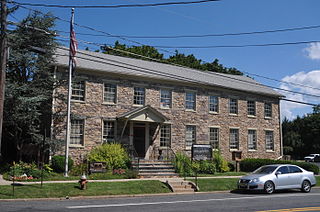
The East Amwell Township School District is a community public school district that serves students in pre-kindergarten through eighth grade from East Amwell Township, in Hunterdon County, New Jersey, United States.

The Amwell Valley is a small valley in Hunterdon County, New Jersey, between the Hunterdon Plateau and the Sourlands. It comprises Stockton, parts of Delaware Township, West Amwell, East Amwell, Flemington and Raritan Township. The region borders the Delaware River to the west and the South Branch Raritan River to the east. The entire area has elevations around 200 feet above sea level. US 202 is the main route running west to east through the valley. Old York Road also passes through the valley, taking a generally more southern route through Raritan and along the Sourlands at Mount Airy. Like the Hunterdon Plateau, Amwell Valley still has a large number of farms due to its sufficient climate, relatively flat land and the presence of silt-loams soils. The valley is home to Unionville Winery and Old York Cellars in Ringoes.

The Sourlands is a region in the US state of New Jersey that includes portions of Hunterdon County, Mercer County and Somerset County. It is centered on Sourland Mountain and comprises parts of Lambertville, East Amwell, West Amwell, Hillsborough, Hopewell Boro, Hopewell Township, and Montgomery Township. The region is flanked by the Hopewell Fault to the south and Amwell Valley to the north that runs from Mount Airy to an area just west of Flagtown and a diabase formation running from Lambertville to Mount Airy. The Sourland also include a hilly area towards the southwest called Pleasant Valley, with a number of farms. Although much of the Sourlands is not conducive to farming, Pleasant Valley and the slopes on the surrounding ridges have a number of farms. The slopes of the ridge to the north are also home to Unionville Vineyard.

The Middlebush Village Historic District is a historic district located in the Village of Middlebush, an unincorporated community within Franklin Township, Somerset County, New Jersey. The district was added to the National Register of Historic Places on April 24, 2007. It includes 37 contributing buildings and three contributing sites.

Amwell Quarry or Amwell Nature Reserve is a 37 hectare biological Site of Special Scientific Interest in Great Amwell in Hertfordshire. The planning authority is East Hertfordshire District Council. It is also part of the Lee Valley Ramsar Site and Special Protection Area, and is owned and managed by the Hertfordshire and Middlesex Wildlife Trust.

Pleasant Valley is an unincorporated community located within Hopewell Township in Mercer County, New Jersey.

Amwell is an unincorporated community located at the tripoint of East Amwell Township in Hunterdon County and Hillsborough and Montgomery townships in Somerset County, in New Jersey, United States. The community is located along Spring Hill Road near its intersection with Zion Road and is located along the top of the Sourland Mountain.
Bowne is an unincorporated community located at the intersection of the boundaries of Delaware, East Amwell and West Amwell townships in Hunterdon County, New Jersey, United States.

Cloverhill is an unincorporated community located at the intersection of the boundaries of East Amwell and Raritan townships in Hunterdon County and Hillsborough Township in Somerset County, in New Jersey, United States. The Clover Hill Historic District was listed on the state and national registers of historic places in 1980.
Reaville is an unincorporated community located along the border of East Amwell and Raritan townships in Hunterdon County, New Jersey. By the 1830s, it was known as Greenville. It was later renamed after Runkle Rea, the first postmaster in 1850.

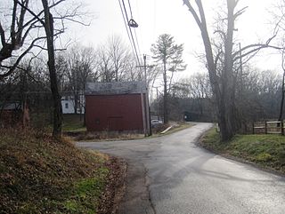
Snydertown is an unincorporated community located within East Amwell Township in Hunterdon County, New Jersey, United States. The settlement is located on the southern face of Sourland Mountain at the intersection of Linvale Road and Snydertown Road. In the past, a mill operated in Snydertown.