Prince George is a city in British Columbia, Canada, situated at the confluence of the Fraser and Nechako rivers. The city itself has a population of 76,708; the metro census agglomeration has a population of 89,490. It is often called the province's "northern capital". because it serves as a centre for higher education, health care, government services, arts and entertainment, sports, and support for major industries such as forest products and mining.

Pacific Rim National Park Reserve is a 511 km2 (197 sq mi) national park located in British Columbia, Canada, which comprises three separate regions: Long Beach, the Broken Group Islands, and the West Coast Trail. It is located in the Pacific Coast Mountains, which are characterized by rugged coasts and temperate rainforests.

Mount Revelstoke National Park is a national park located adjacent to the city of Revelstoke, British Columbia, Canada. The park is relatively small for a national park, covering 260 km2 (100 sq mi). It is located in the Selkirk Mountains and was founded in 1914. Approximately 600,000 visitors enter Mount Revelstoke and nearby Glacier National Park each year.

Chetwynd is a district municipality located in the eastern foothills of the Rocky Mountains, in northeastern British Columbia, Canada. Situated on an ancient floodplain, it is the first town eastbound travellers encounter after emerging from the Rockies along Highway 97, and acts as the gateway to the Peace River Country. The town developed during the construction of infrastructure through the Rocky Mountains in the 1950s; additionally, it was used as a transshipment point during the building of hydroelectric dams, in the 1960s and 1970s, and the new town of Tumbler Ridge, in the early 1980s. Home to approximately 2,600 residents, the town’s population has increased little—if at all—since the 1980s, but is significantly younger than the provincial average.

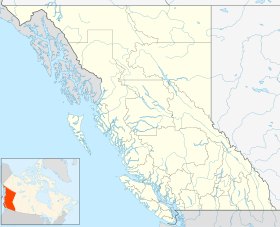
British Columbia is the westernmost province of Canada, bordered by the Pacific Ocean. With an area of 944,735 km2 (364,764 sq mi) it is Canada's third-largest province. The province is almost four times the size of the United Kingdom and larger than every United States state except Alaska. It is bounded on the northwest by the U.S. state of Alaska, directly north by Yukon and the Northwest Territories, on the east by Alberta, and on the south by the U.S. states of Washington, Idaho, and Montana. Formerly part of the British Empire, the southern border of British Columbia was established by the 1846 Oregon Treaty. The province is dominated by mountain ranges, among them the Canadian Rockies but dominantly the Coast Mountains, Cassiar Mountains, and the Columbia Mountains. Most of the population is concentrated on the Pacific coast, notably in the area of Vancouver, located on the southwestern tip of the mainland, which is known as the Lower Mainland. It is the most mountainous province of Canada.

The Great Bear Rainforest is a temperate rain forest on the Pacific coast of British Columbia, comprising 6.4 million hectares. It is part of the larger Pacific temperate rainforest ecoregion, which is the largest coastal temperate rainforest in the world.

Carmanah Walbran Provincial Park, originally Carmanah Pacific Provincial Park, is a remote wilderness park located inside traditional Ditidaht First Nation ancestral territory. The park covers a land area of 16,450 ha (63.5 sq mi) immediately adjacent to Pacific Rim National Park Reserve's West Coast Trail on the south-western, coastal terrain of Vancouver Island. The provincial park comprises the entire drainage of Carmanah Creek, and a good portion of the lower Walbran River drainage, both of which independently empty into the Pacific Ocean. The park is named after the Anglicized diitiid?aatx word kwaabaaduw7aa7tx, or Carmanah, meaning "as far up as a canoe can go" and John Thomas Walbran, a colonial explorer and ship's captain. Access to the park is by gravel logging road from Port Alberni, Lake Cowichan, or Port Renfrew.
The Western Canada Wilderness Committee is a non-profit environmental education organization that aims to protect Canada's wild spaces and species. Paul George, along with Richard Krieger, were the founding directors, and formed the Wilderness Committee in the province of British Columbia in 1980. It now has a membership of over 30,000 people with its head office in Vancouver and field offices in Victoria, British Columbia; Winnipeg, Manitoba; and Toronto, Ontario.
The Lheidli T'enneh Band also known as the Lheidli T'enneh First Nation and historically known as the Fort George Indian Band is the First Nations band government for the Lheidli T'enneh, a subgroup of the Dakelh people whose traditional territory includes the City of Prince George, British Columbia. The name means "The People from the confluence of the two rivers" in the Carrier language referring to how the Nechako River enters the Fraser River at Prince George.

The British Columbia Interior, popularly referred to as the BC Interior or simply the Interior, is a geographic region of the Canadian province of British Columbia. While the exact boundaries are variously defined, the British Columbia Interior is generally defined to include the 14 regional districts that do not have coastline along the Pacific Ocean or Salish Sea, and are not part of the Lower Mainland. Other boundaries may exclude parts of or even entire regional districts, or expand the definition to include the regional districts of Fraser Valley, Squamish–Lillooet, and Kitimat–Stikine.
The Giscome Portage was a portage between the Fraser River and Summit Lake, which connected with the river route to the Peace Country via Finlay Forks. BC Parks administers the Giscome Portage Trail. The Huble Homestead Historic Site, at the south end, is on the Fraser River, 40 kilometres (25 mi) north of Prince George and 6 kilometres (3.7 mi) off Highway 97.

The Kitlope Heritage Conservancy or Huchsduwachsdu Nuyem Jees in the Haisla language, is a conservancy located on the Pacific coast of the province of British Columbia, Canada. It preserves the largest continuous tract of coastal temperate rainforest in the world. Beginning at the head of Gardner Canal, the park stretches inland along the Kitlope River to the border of Tweedsmuir Provincial Park.
The 40th Parliament of British Columbia was in session from June 26, 2013, to April 11, 2017. It consisted of the Legislative Assembly of British Columbia, as elected by the general election of May 14, 2013, and the Queen represented by the Lieutenant-Governor Judith Guichon. That election unexpectedly returned the BC Liberal Party to another absolute majority government, their fourth consecutive government since 2001, this time with Christy Clark who had been premier since 2011. The BC New Democratic Party formed the official opposition under Adrian Dix and John Horgan who replaced Dix in the 2014 leadership election. The first member of the Legislative Assembly (MLA) from the Green Party of BC, Andrew J. Weaver served in this parliament, along with independent Vicki Huntington. Three MLAs resigned: Jenny Kwan and Douglas Horne who resigned to stand in a federal election, as well as Ben Stewart who resigned for the purpose of providing the Premier, who had lost her seat in the general election, with another opportunity to gain a seat. The by-elections to replace the resigned members Clark won Stewart's Kelowna riding, while Melanie Mark and Jodie Wickens replaced Kwan and Horne, respectively. The only members to leave their party, Marc Dalton briefly left the BC Liberals as he unsuccessfully sought the Conservative Party nomination in the federal election, and Pat Pimm left the BC Liberal Party just prior to being arrested.

The forests of Canada are located across much of the country. Approximately half of Canada is covered by forest, totaling around 2.4 million km2. Over 90% of Canada's forests are owned by the public. About half of the forests are allocated for logging.

Southern Carrier, Lower Carrier or locally Dakelh is an endangered dialect group of the Athabaskan Carrier language of British Columbia, Canada.

The North American inland temperate rainforest is a 7 million hectare disjunct temperate rainforest spreading over parts of British Columbia in Canada as well as Washington, Idaho and Montana on the US side. Its patches are located on the windward slopes of the Rocky Mountains and the Columbia Mountains, extending roughly over 1000km from 54° North to 45° North. It is one of the largest inland temperate rainforests in the world.
Boreal woodland caribou(Rangifer tarandus caribou) are a species of caribou and subspecies of North American reindeer. Boreal woodland caribou are also known as southern mountain caribou, woodland caribou, and forest-dwelling caribou. Mountain caribou are uniquely adapted to live in old-growth forests. The mountain caribou diet consists of tree-dwelling lichens predominantly. They are unique in this aspect as in the far northern regions of their habitat zones, the snowpack is shallow enough that the boreal woodland caribou can paw through the snow to eat the ground-dwelling lichens. In the inland Pacific Northwest Rainforests of eastern British Columbia, where the snowpack can reach upwards of five meters, the mountain caribou rely predominantly on the tree-dwelling lichens such as Bryoria spp. and Alectoria spp., hanging above the snowpack. As a result, these mountain caribou are reliant upon the old growth forests, which have been logged for centuries and continue to dwindle.

Mount Arrowsmith Biosphere Region (MABR) is a UNESCO Biosphere Reserve located on the east coast of Vancouver Island in British Columbia, Canada. It was designated in 2000 by UNESCO to protect a large second-growth coast Douglas fir ecosystem in the watersheds of the Little Qualicum and Englishman Rivers from being developed.