
The Arctic Archipelago, also known as the Canadian Arctic Archipelago, is a group of islands north of the Canadian mainland.
Salihorsk is a city in Belarus. In 2010 its population was 102,335.
German submarine U-533 was a Type IXC/40 U-boat of Nazi Germany's Kriegsmarine during World War II. The submarine was laid down on 17 February 1942 at the Deutsche Werft yard at Hamburg as yard number 351, launched on 11 September 1942 and commissioned on 25 November 1942 under the command of Kapitänleutnant Helmut Hennig. After training with the 4th U-boat Flotilla in the Baltic Sea, U-533 was transferred to the 10th flotilla for front-line service on 1 May 1943.

Changzhi Township is a rural township in Pingtung County, Taiwan.
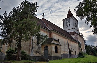
Măieruș is a commune in Brașov County, Romania, on the left of Olt river. It is located 30 km away from the county capital Brașov. It is composed of two villages, Arini (Lüget) and Măieruș. The settlement is mentioned for the first time in 1377 as "villa nucum".

Gomba is a village in Pest county, Hungary.
Cireșu is a commune located in Mehedinți County, Romania. It is composed of four villages: Bunoaica, Cireșu, Jupânești and Negrușa.

Orzeżyn is a village in the administrative district of Gmina Błaszki, within Sieradz County, Łódź Voivodeship, in central Poland. It lies approximately 8 kilometres (5 mi) east of Błaszki, 17 km (11 mi) north-west of Sieradz, and 66 km (41 mi) west of the regional capital Łódź.
Paszowa is a village in the administrative district of Gmina Olszanica, within Lesko County, Subcarpathian Voivodeship, in south-eastern Poland. It lies approximately 10 kilometres (6 mi) north-east of Lesko and 64 km (40 mi) south-east of the regional capital Rzeszów.
Krzyżanowo is a village in the administrative district of Gmina Brudzeń Duży, within Płock County, Masovian Voivodeship, in east-central Poland. It lies approximately 3 kilometres (2 mi) east of Brudzeń Duży, 18 km (11 mi) north-west of Płock, and 112 km (70 mi) north-west of Warsaw.
Długi Kąt is a village in the administrative district of Gmina Biała Piska, within Pisz County, Warmian-Masurian Voivodeship, in northern Poland. It lies approximately 10 kilometres (6 mi) south of Biała Piska, 18 km (11 mi) south-east of Pisz, and 105 km (65 mi) east of the regional capital Olsztyn.
Phúc Hòa is a commune (xã) and village in Tân Yên District, Bắc Giang Province, in northeastern Vietnam.
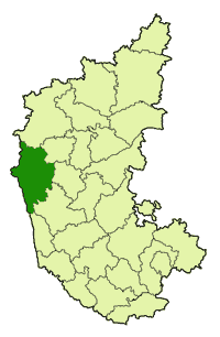
Ajjarni is a village in the southern state of Karnataka, India. It is located in the Sirsi taluk of Uttara Kannada district.
Salasuka is a village in Dryanovo Municipality, in Gabrovo Province, in northern central Bulgaria.

Paralia Panteleimonos is a settlement of the former municipal district of Panteleimonas, the former municipality of East Olympos, which belongs to the municipality of Dio-Olympos, and is one of the 16 total coast of the regional unit.

Skotina is a rural settlement of the former municipality of East Olympos, itself part of the municipality of Dio-Olympos, in the Pieria regional unit, Central Macedonia, Greece.
Ovasaray is a village in the District of Amasya, Amasya Province, Turkey.
Şeyhsadi is a village in the District of Amasya, Amasya Province, Turkey.

Emirzeli (İmirzeli) is a group of ruins in Mersin Province, Turkey

In the plain of Leivithra in 1997 began the excavation work on the ancient winery Kompoloi. They lasted (intermittently) until October 2000.


