Related Research Articles

The Adams–Onís Treaty of 1819, also known as the Transcontinental Treaty, the Spanish Cession, the Florida Purchase Treaty, or the Florida Treaty, was a treaty between the United States and Spain in 1819 that ceded Florida to the U.S. and defined the boundary between the U.S. and Mexico. It settled a standing border dispute between the two countries and was considered a triumph of American diplomacy. It came during the successful Spanish American wars of independence against Spain.
Misantla is a city in the Mexican state of Veracruz, the administrative seat of the municipality (municipio) of the same name. The municipality is bordered by Martínez de la Torre, Colipa and Papantla.

Puente Nacional is a municipality in the Mexican state of Veracruz. Puente Nacional is bordered by Actopan, the port of Veracruz, and La Antigua. It stands on the railway and on Federal Highways 140 and 125.
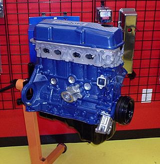
The KA engines were a series of four-stroke inline-four gasoline piston engines manufactured by Nissan, which were offered in 2.0 and 2.4 L. The engines blocks were made of cast-iron, while the cylinder heads were made of aluminum.

Zacapu, is a city and surrounding municipality in the Nahuatzen mountains of Michoacán, Mexico. It is located at 19°49′N101°48′W. The municipality has an area of 455.96 km2 (176.05 sq mi). Geographic features in Zacapu include the Cerro del Tecolote mountain range and Zacapu Lagoon.

The San Antonio River is a major waterway that originates in central Texas in a cluster of springs in midtown San Antonio, about 4 miles north of downtown, and follows a roughly southeastern path through the state. It eventually feeds into the Guadalupe River about 10 miles from San Antonio Bay on the Gulf of Mexico. The river is 240 miles long and crosses five counties: Bexar, Goliad, Karnes, Refugio, and Wilson.

The Río Jamapa is located in the Mexican state of Veracruz, forming in Citlaltépetl and pouring into the Gulf of Mexico in the municipality of Boca del Río.

Actopan Municipality is a municipality located in the montane central zone in the Mexican state of Veracruz, about 50 km from the state capital of Xalapa. It is located at 19°30′N96°37′W. Actopan, the municipal head-board is a small city, located near the capital of the state. The region is one of the most important producers of mangoes in the state.

Apazapan is a municipality in the Mexican state of Veracruz. It is located about 65 km from state capital Xalapa. It has a surface of 65.80 km2. It is located at 19°19′N96°43′W. Apazapan was a population totonac in the days of the Spanish conquest that preserved the indigenous language up to the 19th century and there was one of the points marked in the Codex Dehesa, when the Nonoalcos de Zongolíca, crossed Cocolapa, Coscomatepec, Tepeyehualco, Chiconquiaco and for Apazapan they returned to Zongolíca. During the 16th century, it belonged to the marquisate of Paxaca's Valley started to Hernán Cortés.

Rafael Lucio is a municipality located in the montane central zone of the Mexican state of Veracruz, about 9 km from the state capital Xalapa. It has a surface of 24.68 km2. It is located at 19°35′N96°59′W.
Sochiapa is a municipality located in the central zone of the Mexican State of Veracruz, about 40 km from the state capital Xalapa. It has a surface of 21.39 km2. It is located at 19°12′N96°56′W.For decree of December 10, 1913 suprimió Sochiapa's municipality, passing its territory to form a part of that of Totutla; Later Sochiapa recovered its political category.
Soledad de Doblado is a municipality located in the semiarid zone of the center of the Mexican state of Veracruz, in the plains of the Sotavento of Veracruz, about 75 km from the state capital of Xalapa. It has a surface of 370.96 km2. It is located at 19°03′N96°25′W. On June 16, 1896, by Decree the town was named Soledad de Doblado, in honor of Manuel Doblado, who signed in this place, on February 19, 1862, the preliminary agreements with the representatives of England, Spain and France. By a decree of November 16, 1961 it rose to the category of city.
Tenampa is a municipality located in the montane central zone in the Mexican state of Veracruz, about 30 km from the state capital Xalapa. It has a surface area of 69.92 km2. It is located at 19°15′N96°53′W. In 1455 war came to the municipality by means of the emperor Moctezuma. In 1514, the Spanish conquest resulted in the area being renamed, baptized as Xampala-Tenampa. In 1912 general Jiménez fought the battle of Cotlamanes's hill against the Government of Victoriano Huerta.
Tepatlaxco is a municipality located in the montane central zone in the Mexican state of Veracruz, about 55 km from the state capital Xalapa. It has a surface of 99.53 km2. It is located at 19°04′N96°51′W. During the 18th century he is named the people San Martín Ocotitlán, By decree of June 23, 1890 the limits were fixed between the municipalities of Tepatlaxco and Ixhuatlan.
Tlacotepec de Mejía is a municipality located in the montane central zone in the Mexican state of Veracruz, about 40 km from the state capital Xalapa. It has a surface of 90.48 km2. It is located at 19°12′N96°50′W.
Tlaltetela is a municipality located in the montane central zone in the Mexican state of Veracruz, about 25 km from the state capital Xalapa. It has a surface of 266.50 km2. It is located at 19°19′N96°54′W. The name comes from the Náhuatl language tlal- (land) and tetl (rocks). It was formerly called Axocuapan (from Nahuatl Atl-Xoxoc-Apan, meaning “in the acid water". By the decree 373 of May 8, 1979, Axocuapan was renamed Tlaltetela. In 1998, the first recreational park and the municipal library were opened. On July 12, 2020, a curfew was decreed, due to the increase of COVID-19 cases in the municipality, as the first formal quarantine in Mexico.
The Amapa River is a river in the Mexican states of Oaxaca and Veracruz.

Banderilla is a municipality in the Mexican state of Veracruz. It is located about 9 km from the state capital, Xalapa. It has a surface area of 22.21 km2. It is located at 19°35′N96°56′W.

Black Creek of Arizona is a 55-mi (89 km) long north tributary of the Puerco River, in northeast Arizona and northwest New Mexico.
SS Las Choapas was an oil tanker built in 1898. She was originally commissioned by Standard Oil of New Jersey and built by the Delaware River Iron Ship Building and Engine Works of Chester, Pennsylvania. As the SS Atlas she saw service in World War I before being sold in the 1920s to the Italian company Ditta G.M. Barbagelata, of Genoa.
References
- "Atlas of Mexico – River Basins (Map from book)". lib.utexas.edu. 1975. Archived from the original on 2011-11-07.
- The Prentice Hall American World Atlas, 1984.
- Rand McNally, The New International Atlas, 1993.
19°18′31.54″N96°16′58.48″W / 19.3087611°N 96.2829111°W
| | This article related to a river in Mexico is a stub. You can help Wikipedia by expanding it. |