Related Research Articles

Fort Chiswell is a census-designated place (CDP) in Wythe County, Virginia, United States. The population was 939 at the 2010 census.

The Twin Peaks are two prominent hills with an elevation of about 925 feet (282 m) located near the geographic center of San Francisco, California. The Twin Peaks are the second and third highest natural points in San Francisco; only 928 foot (283 m) Mount Davidson is higher within city limits.

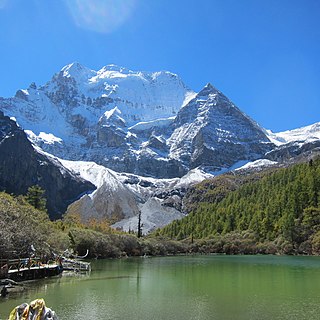
Nyidên, or Yading, is a national level reserve in Daocheng County, in the southwest of Sichuan Province, China. It is a mountain sanctuary and major Tibetan pilgrimage site comprising three peaks sanctified by the 5th Dalai Lama. The peaks are seen as emanations of the three boddhisatvas Chenrezig (Avalokiteśvara), Jampayang (Manjushri) and Chanadorje (Vajrapani), with Chenrezig being the highest peak at 6032 meters above sea level. It is served by Daocheng Yading Airport.

Chalone Vineyard is located in the Chalone AVA south of San Francisco, California, United States, on an unusual geological formation called the Gavilan benchland. The soil is rich in limestone and calcium carbonate and also contains a significant amount of decomposed granite. This soil has a mineral composition similar to the Champagne region of France. Chalone is situated in an arid chaparral environment, in which temperatures can vary as much as 50°F in one day. The climate is very dry, only 12 to 14 inches (360 mm) of rain fall per year. These factors combine to create a unique terroir, the signature profile of a wine growing region.
East Geneva, also called Serven, is a hamlet in the Town of Waterloo, Seneca County, New York, United States, near Seneca Lake. It is located three miles (5 km) east of the City of Geneva and five miles (8 km) west of the Village of Waterloo, at an elevation of 472 feet. The primary cross roads where the hamlet is located are U.S. Route 20/N.Y. Route 5, Border City Road, Serven Road and Seneca Boulevard.
Pine Mountain is an unincorporated community located in eastern Rabun County, Georgia, United States, at an elevation of 1611 feet. It is one of only two Georgia communities located north of South Carolina, due to a quirk of geography: the Chattooga River is the primary tributary of the Savannah River and Tugalo River specified in the 1787 Treaty of Beaufort, but runs perpendicular to them.
Jacks Peak Park is a county park in Monterey County, California. Its central feature is Jacks Peak, the highest point on the Monterey Peninsula, rising 1,068 feet above Monterey and Carmel. The park encompasses 525 acres under control of the Monterey County Parks Department.
James Crossroads is an unincorporated community in Northampton County, Virginia, United States.
Scioto Trail State Forest is a state forest in Pike and Ross counties in the U.S. state of Ohio. Scioto Trail State Park lies within the state forest.
The Icelandic Ministry of Communications was a cabinet-level ministry responsible for transport by land, sea and air, as well as telecommunications and postal services. Since September 2010, the minister had been Ögmundur Jónasson of the Left-Green Movement. Various organisational changes has taken effect in the Ministry of Transport, Communications and Municipal Affairs. A number of projects have been transferred to the Ministry, which has expanded its staff by 8 employees to a total of 36.

Shiquan County is a county in the south Shaanxi province, China. It is under the administration of the prefecture-level city of Ankang. On 14 July 2022, a maximum temperature of 41.9 °C (107.4 °F) was registered.
Short is an unincorporated community in Tishomingo County, Mississippi, United States. It was one of the earliest settlements in the county, and once had its own post office, a high school, a bowling alley, and three bars; but most of its former territory and its establishments were drowned by the damming of the Tennessee River and the subsequent creation of Pickwick Lake.

Miliana District is a district of Aïn Defla Province, Algeria.

Treski is a village in Setomaa Parish, Võru County in southeastern Estonia.
Sublette is a railroad ghost town in northern Rio Arriba County, New Mexico, United States, built as a section station in 1880. It is located north-east of Chama, just south of the Colorado state line and at milepost 306.1 of the former Denver and Rio Grande Western Railroad. When the Denver and Rio Grande abandoned its narrow gauge lines in the late 1960s, two parts of the system were preserved independently: the Cumbres & Toltec Scenic Railroad from Antonito to Chama, including Sublette itself, and the Durango and Silverton Narrow Gauge Railroad. Sublette sits at an elevation of 9,281 feet in the southeastern San Juan Mountains.
Hermosa is an unincorporated community in Pittsylvania County, in the U.S. state of Virginia.
Cary was a community, now extinct, in Harrison Township, Miami County, in the U.S. state of Indiana.
French Ranch is a locale northeast of Hollister in the Diablo Range, in San Benito County, California. It lies on a flat just south of Wildcat Canyon at an elevation of 1,821 feet at the foot of Frenchs Pass. It lies west of an unnamed stream that descends northward to its confluence with Wildcat Canyon Creek from the north slope of Antimony Peak.
Frenchs Pass is a gap on the divide of the Diablo Range and on the boundary of San Benito County and Merced County, California. The pass is at an elevation of 2,428 feet on the north shoulder of 3,257-foot Antimony Peak.
Five Points is an unincorporated community in Milan Township, Allen County, in the U.S. state of Indiana.
References
36°56′25″N121°13′48″W / 36.94028°N 121.23000°W