
Grenada is an island country located between the Caribbean Sea and Atlantic Ocean, north of Trinidad and Tobago. It is located at 12°07′N61°40′W. There are no large inland bodies of water on the island, which consists entirely of the state of Grenada. The coastline is 121 km long. The island has 15 constituencies and speaks English and Grenadian Creole. It is volcanic in origin and its topography is mountainous.

The Orinoco is one of the longest rivers in South America at 2,140 km (1,330 mi).

Aragua State is one of the 23 states of Venezuela. It is located in the north-central region of Venezuela. It has plains and jungles and Caribbean beaches. The most popular are Cata and Choroni. It has Venezuela's first national park which is called Henri Pittier. The capital is Maracay, other important cities include Turmero and El Limón.

The Apure River is a river of southwestern Venezuela, formed by the confluence of the Sarare and Uribante near Guasdualito, in Venezuela, at 7°15′N70°40′W, and flowing across the Llanos into the Orinoco. It provides significant transportation in the area.
The Pacaraima or Pakaraima Mountains are a mountain range primarily in southwestern Guyana, and into northern Brazil and eastern Venezuela.
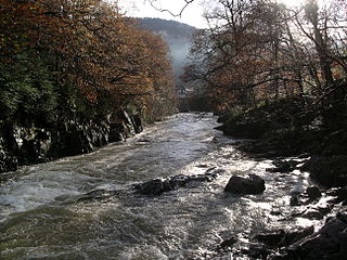
River Llugwy is a tributary of the River Conwy, and has its source at Ffynnon Llugwy, a lake in the Carneddau range of mountains in Snowdonia in north-west Wales.

Grenadines is an administrative parish of Saint Vincent and the Grenadines, comprising the islands of the Grenadines other than those belonging to Grenada. The capital is Port Elizabeth. It's the only parish in the country that's not located on the main island.

The BN-600 reactor is a sodium-cooled fast breeder reactor, built at the Beloyarsk Nuclear Power Station, in Zarechny, Sverdlovsk Oblast, Russia. It has a 600 MWe gross capacity and a 560 MWe net capacity, provided to the Middle Urals power grid. It has been in operation since 1980 and represents an improvement to the preceding BN-350 reactor. In 2014, its larger sister reactor, the BN-800 reactor, began operation.

Ankoko Island is an island located at the confluence of the Cuyuni River and Wenamu River, at 6°43′N61°8′W, on the border between Venezuela and Guyana.
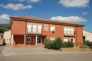
Castrejón de la Peña is a municipality located in the province of Palencia, Castile and León, Spain. According to the 2018 census (INE), the municipality had a population of 360 inhabitants.
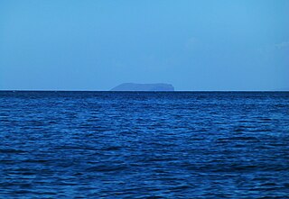
Patos Island is a small uninhabited island in the northwestern Gulf of Paria. The island is a part of the Dependencias Federales of Venezuela.
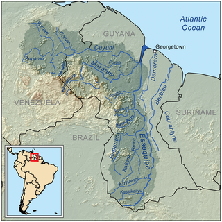
Wenamu River is a river in South America. It forms a portion of the international boundary between Venezuela and Guyana. It is part of the Essequibo River basin.
Heath is an unincorporated community in central Alberta in the Municipal District of Wainwright No. 61, located 5 kilometres (3.1 mi) south of Highway 14, 66 kilometres (41 mi) southwest of Lloydminster.
Atzitzihuacán (municipality) is a town and municipality in the Mexican state of Puebla in south-eastern Mexico.

Stewart Stacks is a group of prominent sea stacks, one of them rising to 25 m, lying between Rugged Island and Astor Island in the northeast of Osogovo Bay, western Livingston Island in the South Shetland Islands, Antarctica. The area was visited by early 19th century sealers.
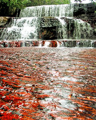
Jasper Creek is the name of a river and a series of cascades and waterfalls in Venezuela. The name jasper is derived from the fact that the water flows over a smooth bedrock of mostly red and black jasper.

Kuskulana River is a waterway in the U.S. state of Alaska. It is located in the Wrangell–St. Elias National Park and Preserve.
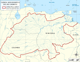
The Orinoco Basin is the part of South America drained by the Orinoco river and its tributaries. The Orinoco watershed covers an area of about 990000 km2, making it the third largest in South America, covering most of Venezuela and eastern part of Colombia.


