
The administrative units of Pakistan comprise four provinces, one federal territory, and two disputed territories: the provinces of Punjab, Sindh, Khyber Pakhtunkhwa, and Balochistan; the Islamabad Capital Territory; and the administrative territories of Azad Jammu and Kashmir and Gilgit–Baltistan. As part of the Kashmir conflict with neighbouring India, Pakistan has also claimed sovereignty over the Indian-controlled territories of Jammu and Kashmir and Ladakh since the First Kashmir War of 1947–1948. It also has a territorial dispute with India over Junagadh, but has never exercised administrative authority over either regions. All of Pakistan's provinces and territories are subdivided into divisions, which are further subdivided into districts, and then tehsils, which are again further subdivided into union councils.

The districts of Pakistan are the third-level administrative divisions of Pakistan, below provinces and divisions, but forming the first-tier of local government. In total, there are 166 districts in Pakistan, including the Capital Territory, and the districts of Azad Kashmir and Gilgit-Baltistan. These districts are further divided into tehsils and union councils.
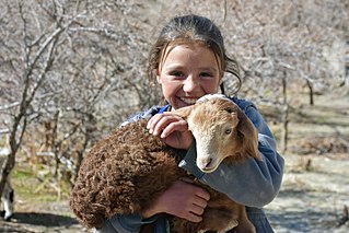
The Wakhi people, also locally referred to as the Wokhik, are an Iranian ethnic group native to Central and South Asia. They are found in Afghanistan, Tajikistan, Pakistan, and China—primarily situated in and around Afghanistan's Wakhan Corridor, the northernmost part of Pakistan's Gilgit−Baltistan and Chitral, Tajikistan's Gorno−Badakhshan Autonomous Region and the southwestern areas of China's Xinjiang Uyghur Autonomous Region. The Wakhi people are native speakers of the Wakhi language, an Eastern Iranian language.

Chitral District was a district in the Malakand Division of the Pakistani province of Khyber Pakhtunkhwa, from 14 August 1947 to 2018. It was the largest district in the Khyber-Pakhtunkhwa, covering an area of 14,850 km2, before splitting into Upper and Lower Chitral Districts in 2018. It was the northernmost district of Khyber Pakhtunkhwa. It shared a border with Gilgit-Baltistan to the east and with Swat and Dir districts of Khyber Pakhtunkhwa to the south. It also shared an international border with Afghanistan to the north and west. Afghanistan's narrow strip of Wakhan Corridor separated Chitral from Tajikistan in the north.

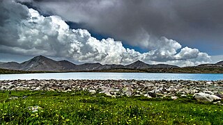
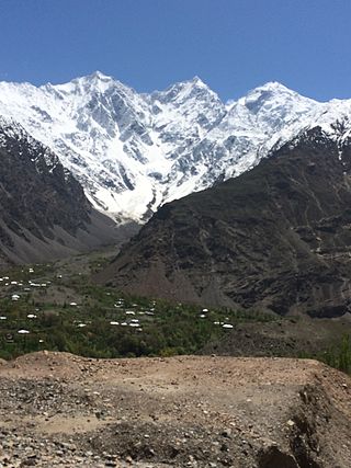
Northern Pakistan is a tourism region in northern and north-western parts of Pakistan, comprising the administrative units of Gilgit-Baltistan, Azad Kashmir, Khyber Pakhtunkhwa, Islamabad Capital Territory and the Rawalpindi Division in Punjab. The first two territories are a part of the wider Kashmir region. It is a mountainous region straddling the Himalayas, Karakoram and the Hindu Kush mountain ranges, containing many of the highest peaks in the world and some of the longest glaciers outside polar regions. Northern Pakistan accounts for a high level of Pakistan's tourism industry.

Shandur Pass(Urdu: شندور) is a pass located on the boundary of district Chitral, Khyber Pakhtunkhwa, Pakistan and Gilgit-Baltistan, a disputed territory within the larger region of Kashmir. Historically part of Gilgit-Baltistan; however, recent Khyber Pakhtunkhwa governments have made claims for the Shandur. It is often referred to as 'The Roof of the World.
Paramilitary forces of Pakistan can refer to any of the following:
Diamer District, also spelled Diamir District,) is a district in the Gilgit-Baltistan region administered by Pakistan. The headquarters of the district is the town of Chilas. The district is bounded on the north by the Tangir and the Gilgit districts, on the east by the Astore District, on the south by the Mansehra district of Pakistan's Khyber Pakhtunkhwa Province and the Neelum District of Pakistan controlled Kashmir, and on the west by the Upper Kohistan District of Khyber Pakhtunkhwa Province. The Karakoram Highway passes through Diamer District.

Gilgit-Baltistan is an administrative territory of Pakistan in the northern part of the country. It was given self-governing status on August 29, 2009. Gilgit-Baltistan comprises 14 districts within three divisions. The four districts of Skardu Kharmang Shigar and Ghanche are in the Baltistan Division, four districts of Gilgit Ghizer Hunza and Nagar districts which were carved out of Gilgit District are in the Gilgit Division and the third division is Diamir, comprising Chilas and Astore. The main political centres are the towns of Gilgit and Skardu.
Pakistan is a federal republic with three tiers of government: national, provincial and local. Local government is protected by the constitution in Articles 32 and 140-A, and each province also has its own local-government-enabling legislation and ministries responsible for implementation. District councils and metropolitan corporations are respectively the highest rural and urban tiers of local government in the provinces. Both urban and rural local government have two or three tiers in all provinces except Khyber Pakhtunkhwa, where councils are not identified as either urban or rural. There are 129 district councils across the four provinces, 619 urban councils made up of one city district, four metropolitan corporations, 13 municipal corporations, 96 municipal committees, 148 town councils, 360 urban union committees, and 1,925 rural councils. Additionally there are 3339 neighbourhood, ‘tehsil’ and village councils in Khyber Pakhtunkhwa.

The following outline is provided as an overview of and topical guide to Pakistan:
Mastuj is a tehsil and a valley in Upper Chitral District in Khyber Pakhtunkhwa province of Pakistan. Mastuj is the principal settlement. It is located at 36°17'0N 72°31'0E with an altitude of 2359 metres. There are ruins of old fort built originally in 18th century and reconstructed several times.
The four provincial governments of Pakistan administer the four provinces of Pakistan. There is also a federal capital territory and two territories which have similar governments but with some differences. The head of each province is a non-executive Governor appointed by the President. The Governors play a similar role, at the provincial level, as the President does at the federal level. Each province has a directly elected unicameral legislature, with members elected for five-year terms. Each provincial assembly elects a Chief Minister, who then selects a cabinet of ministers from amongst the members of the Provincial Assembly. Each province also has a High Court, which forms part of the superior judiciary.

There are many types of gemstones of Pakistan. They can be found among the nation's three mountain ranges - the Hindu Kush, the Himalayas, and the Karakoram - in the provinces of Khyber Pakhtunkhwa, Gilgit-Baltistan, Balochistan, and the Federally Administered Tribal Areas. The gemstone industry in Pakistan has the city of Peshawar as its hub, and there are many companies working in it.

Roads in Pakistan are generally classified as federal, provincial and municipal roads.
Arandu is a town in Skardu District, Gilgit-Baltistan.
The Civil Armed Forces (CAF) are a group of nine paramilitary and gendarmerie organisations, separate and distinct from the regular Pakistan Armed Forces. They are responsible for maintaining internal security, helping law enforcement agencies, border control, counter-insurgency and counter-terrorism, riot control, and anti-smuggling under the Ministry of Interior. They frequently operate alongside the Pakistani military in response to natural disasters. During times of war they can have their command transferred to the Ministry of Defence, and effectively combined to form a reserve force for the Pakistani military.