
Menteith or Monteith, a district of south Perthshire, Scotland, roughly comprises the territory between the Teith and the Forth. Early forms including Meneted, Maneteth and Meneteth. The area between Callander and Dunblane was historically known in English as the Vale of Menteith.

Càrn Mòr Dearg is the ninth-highest mountain in Scotland. It is situated in the west of Scotland, close to the town of Fort William, in Lochaber, Highland. It lies just to the north-west of its much more famous neighbour, Ben Nevis, to which it is linked by the spectacular Càrn Mòr Dearg Arête.

The River Leven is a stretch of water in West Dunbartonshire, Scotland, flowing from Loch Lomond in the North to the River Clyde in the South. The total length of the river is approximately six miles and is very popular with salmon and sea trout anglers, trying to catch one of these migratory fish going up to Loch Lomond.

Beinn Ìme is the highest mountain in the Arrochar Alps, in the Southern Highlands of Scotland. There are three usual routes of ascent. From Succoth, one may follow the same path that is used to reach The Cobbler before taking the right fork near the base of the Cobbler's main crags and continuing up the glen, across the bealach and up Ben Ìme's eastern ridge. Alternatively, the summit can be reached from the pass of Rest and be Thankful and from the Loch Lomond side, using the private road that leads to Loch Sloy. Beinn Ìme separates the Dunbartonshire landscape of Loch Lomond in the East and the Argyll Highlands of Loch Fyne and Loch Goil anywhere north, west, south west. Beinn Ìme is the landmark to the entrance to Argyll.
Beinn an Lochain is a mountain in the Arrochar Alps, southern Scotland, on the western edge of Loch Lomond and the Trossachs National Park. Although included in Sir Hugh Munro's original list of Scottish mountains over 3000 feet, subsequent surveys showed it to be significantly shorter than the 914.4 m cut-off limit required to count as a Munro. Nonetheless, it remains a popular mountain, and is often quoted as an example of an interesting mountain below 3000 feet to show that there is more to mountaineering in Scotland than just Munro-bagging.

The Central Lowlands or Midland Valley is a geologically defined area of relatively low-lying land in southern Scotland. It consists of a rift valley between the Highland Boundary Fault to the north and the Southern Uplands Fault to the south. The Central Lowlands are one of the three main geographical sub-divisions of Scotland, the other two being the Highlands and Islands which lie to the north, northwest and the Southern Uplands, which lie south of the associated second fault line.

Meall a' Bhùiridh is a mountain on the edge of Rannoch Moor in the Highlands of Scotland. It lies near the top of Glen Coe and Glen Etive, overlooking the Kings House Hotel inn and the A82 road. The Glencoe Ski area is located on the northern slopes of the peak.

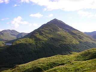
The A81 road is a trunk road in Scotland, United Kingdom. It runs from Glasgow to Callander, a total of 30 miles (48 km).
Glen Dochart in Perthshire, Scottish Highlands is a glen which runs from Crianlarich eastwards to Killin, following the course of the River Dochart as it flows through Loch Dochart and Loch Iubhair. It is met by Glen Ogle at Lix Toll. Lochan Saorach lies within the glen and was once famous for its Floating island.

Beinn a' Chreachain is a Scottish mountain, with a conical top, to the north-west of Loch Lyon.
Logan is a town in East Ayrshire, southwest Scotland. It is 1 mile (1.6 km) east of Cumnock, by the Lugar Water.

SS Rondo was a steam cargo ship. She was built by Tampa Shipbuilding & Drydock Company of Florida for the British government under the name War Wonder and was launched in 1917. The First World War ended before she entered service and she entered service for the US Shipping Board as the Lithopolis. She was sold to various Norwegian companies, becoming the Laurie, and finally the Rondo in 1934.
This is a list of the extreme points and extreme elevations in Scotland.

Glencarse is a village in the Scottish council area of Perth and Kinross.
SS Thesis was a steamship which was wrecked in October 1889 in the Sound of Mull, on Scotland's west coast. She is now a popular dive site with scuba divers.
Murthly is a village in Perth and Kinross, Scotland. It is located on the south bank of the River Tay, 7 kilometres (4.3 mi) south-east of Dunkeld, and 15 kilometres (9.3 mi) north of Perth. Perth District Asylum, later known as Murthly Hospital, was opened in the village on 1 April 1864 for 'pauper lunatics'. It was the second district asylum to be built in Scotland under the terms of the 1857 Lunacy (Scotland) Act. It closed in 1984 and was later demolished. A stone circle is located within the village, in the former grounds of the hospital. The village formerly had a railway station on the Perth and Dunkeld Railway.

The Colmeallie stone circle is a recumbent stone circle in Glen Esk, Angus, Scotland. It is located 8 km north of Edzell at Colmeallie Farm, adjacent to the unclassified road leading from the B966 to Tarfside and Loch Lee.

Tullibardine is a location in Perth and Kinross, Scotland, which gives its name to a village, a castle, and a grant of nobility.

German submarine U-826 was a Type VIIC U-boat of Nazi Germany's Kriegsmarine during World War II.


