
Kappad, or Kappakadavu locally, is a beach near Kozhikode, in the district of the same name, Kerala, India.

C. H. Mohammad Koya, known as C. H., full name Cheriyan Kandi Muhammad Koya, was an Indian politician and journalist who served as the eighth Chief Minister of Kerala from October 12 to December 1, 1979. A long time Secretary of the Indian Union Muslim League, he is the only Muslim to be chosen as the Chief Minister of Kerala. As the Minister of Education (Kerala), from 1967 to 1977, C. H. championed the progress of the education of Muslim community in Kerala.
Balussery, also spelt as Balusseri, Balisseri or Balussheri) is a small but developing town area located in Kozhikode district in Kerala state, south India.

Kerala is a state on the southwestern Malabar Coast of India. It was formed on 1 November 1956, following the passage of the States Reorganisation Act, by combining Malayalam-speaking regions of the erstwhile states of Travancore-Cochin and Madras. Spread over 38,863 km2 (15,005 sq mi), Kerala is the twenty-third largest Indian state by area. It is bordered by Karnataka to the north and northeast, Tamil Nadu to the east and south, and the Lakshadweep Sea to the west. With 33,387,677 inhabitants as per the 2011 Census, Kerala is the thirteenth-largest Indian state by population. It is divided into 14 districts with the capital being Thiruvananthapuram. Malayalam is the most widely spoken language and is also the official language of the state.

Kasaragod district is one of the 14 districts in the southern Indian state of Kerala. It's a northern most district of Kerala. Kasaragod was a part of the South Canara district of the erstwhile Madras Presidency. It then became a part of Kannur district of Kerala. Kasaragod was declared as a district on 24 May 1984.

Atholi is a Grama Panchayath in Kozhikode district of Kerala state, South India. It is a small town on the banks of Korapuzha river. State highway to Kuttiyadi passes through Atholi and it is connected to National Highway 17 through Kuniyil Kadavu bridge which is the longest in Kozhikode district.

Kerala is a state in the southernmost part of India. Kerala, with appreciative development indicators comparable to developed countries, has been experimenting with decentralization and participatory local democracy, ultimately aimed at realization of the constitutional goal of establishing genuine "institutions of local self government" since the enactment of Kerala Panchayat Raj Act & The Kerala Municipality Act in the year 1994.

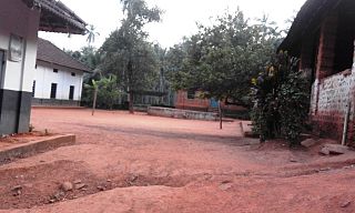
Thiruvangoor is a small village 16 kilometres (9.9 mi) away from Kozhikode, Kerala, India. It lies to the east of the Arabian Sea (Kappad) and west of Kuniyil Kadavu. Portuguese navigator Vasco de Gama is believed to have landed near Thiruvangoor, at Kappad, during one of his voyages, on 20 May 1498. Thiruvangoor sits on a national highway. Nearby major towns are Atholi and Koyilandy. The Kuniyil Kadavu Bridge allows for transportation between Thiruvangoor and Atholi town.

Arikkulam is a village in Kozhikode district in the state of Kerala, India.
Chemancheri is a village in Kozhikode district in the state of Kerala, India.
Chengottukavu is a village in Kozhikode district in the state of Kerala, India.

Moodadi is a village in Koyilandy thaluk of Kozhikode district in the state of Kerala, India.
Naduvannur is a Census town in Kozhikode district in the state of Kerala, India and a part of Kozhikode Urban Agglomeration. The name Naduvannur denotes that it was the centre of the territory of Kurumbranad. 'Nadu' means centre and ur(oor) means place.
Nochad is a village in Kozhikode district in the state of Kerala, India which is part of Perambra Town.
State Highway 68 is a State Highway in Kerala, India that starts in Kappad and ends in Adivaram. The highway is 68.11 km long.
Cheekkilode is a village in Kozhikode district in the state of Kerala, India surrounded by Kolathur on the northern side, Kolakkad on West, Kakkur-Nanmanda on East and Annassery - Chelannur on East. Olayimmal is at the centre place of Cheekkilode which is a market place. Olayimmal is the nerve centre of Cheekkilode from where buses are plying to different places like Kozhikode, Balussery, Ulliyeri, Koyilandi, etc. Kuttiyadi-Calicut irrigation canal passes through Cheekkilode - olayimmal. Some of the places of interest are- Vallikkattukavil, Padinjare veluthedathu Bhuvaneshwari temple, Adumbummal Bhagavathi temple, Pilakkuttiyedath Makham, Kolathur temple, Kandankulangara temple, Ongorappara pukkunnumala and Eliyodu mala are the main attraction of cheekkilode

Paddar, or Padar, is a remote valley in Kishtwar district of Jammu and Kashmir, northern India. It covers the whole northeast portion of Kishtwar district bordering Zanskar (Ladakh) on the north, Pangi, Himachal Pradesh on the East and Marwah-Wadwan on the West. The valley is famous for it sapphire mines. It lies in the Greater Himalayas, along the Chenab River basin. It is among the most remote regions of Jammu and Kashmir. There are various sub valleys in Paddar like Machail, Ghandari, Kabban, Ongai, Bhuzunu, Barnaj, Bhuzas, Kijai Nallah, and Dharlang, among others.

Anthoor is a municipality in the Kannur district of the North Malabar region in the Indian state of Kerala. Anthoor is located roughly 15 km from the Kannur City, and 7 km from Taliparamba town.

Sazar is a village in Paddar tehsil of Kishtwar district in the union territory of Jammu and Kashmir, India.