| Bananal River | |
|---|---|
| Location | |
| Country | Brazil |
| Physical characteristics | |
| Source | |
| • location | Tocantins state |
This article relies largely or entirely on a single source .(July 2022) |
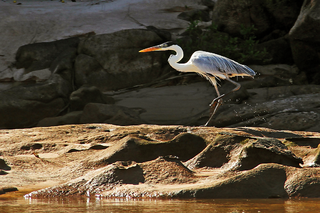
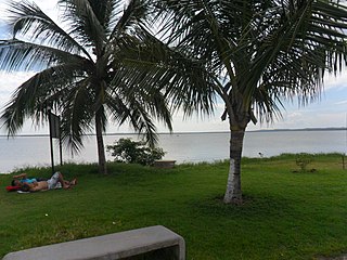
The Bananal River is a river of Tocantins state in central Brazil.
| Bananal River | |
|---|---|
| Location | |
| Country | Brazil |
| Physical characteristics | |
| Source | |
| • location | Tocantins state |
This article relies largely or entirely on a single source .(July 2022) |
The Bananal River is a river of Tocantins state in central Brazil.

The Tocantins River is a river in Brazil, the central fluvial artery of the country. In the Tupi language, its name means "toucan's beak". It runs from south to north for about 2,450 km (1,520 mi). While sometimes included in definitions of the Amazon basin, the Tocantins is not a branch of the Amazon River, since its waters flow into the Atlantic Ocean via an eastern channel of the Amazon Delta, alongside those of the Amazon proper. It flows through four Brazilian states and gives its name to one of Brazil's newest states, formed in 1988 from what was until then the northern portion of Goiás.

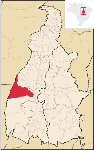
Tocantins is one of the 26 states of Brazil. It is the newest state, formed in 1988 and encompassing what had formerly been the northern two-fifths of the state of Goiás. Tocantins covers 277,620.91 square kilometres (107,190.03 sq mi) and had an estimated population of 1,496,880 in 2014. Construction of its capital, Palmas, began in 1989; most of the other cities in the state date to the Portuguese colonial period. With the exception of Araguaína, there are few other cities with a significant population in the state. The government has invested in a new capital, a major hydropower dam, railroads and related infrastructure to develop this primarily agricultural area. The state has 0.75% of the Brazilian population and is responsible for 0.5% of the Brazilian GDP.

The Pará River, also called Parauaú River, Jacaré Grande River, Marajó River Channel, Macacos River Channel, Santa Maria River Channel and Bocas Bay, is a watercourse and immense estuarine complex that functions as a canal between the rivers Amazon, Tocantins, Campina Grande and Marajó Bay, in addition to numerous other smaller rivers. It can also be considered a distributary channel of the Tocantins River.

Imperatriz is the second most populated city in the Brazilian state of Maranhão. The city extends along the northeastern bank of the Tocantins River and is crossed by the Belém-Brasília Highway, standing on the border with the state of Tocantins.
The Araguaia National Park is a national park located in Tocantins state in the north of Brazil, between 09º51’—11º11’S and 49º57’—50º27’W. Bananal Island, on which the park is located, is believed to be the largest inland river island in the world.

Couto Magalhães is a municipality located in the Brazilian state of Tocantins. Its population was 5,639 (2020) and its area is 1,586 km² (612.4 mi²), a density of 3.07 people/km². It is located 150 m (492.1 ft) above sea level. The demonym is Coutense.

The Manuel Alves Grande River is a river of Tocantins and Maranhão states, dividing the north and northeast regions of Brazil. It is a tributary of the Tocantins River.
The Escuro River is a river of Tocantins state in central Brazil.
The Muricizal River is a river of Tocantins state, in central Brazil. It is part of the Tocantins basin. The Muricizal is a tributary of the Araguaia River.
The Urubu Grande River is a river of Tocantins state in central Brazil.
The Água Fria River is a river of Tocantins state in central Brazil. It is a tributary of the Tocantins River.
Figueirópolis is a municipality in the state of Tocantins in the Northern region of Brazil.
Divinópolis do Tocantins is a municipality in the state of Tocantins in the Northern region of Brazil.
Goianorte is a municipality in the state of Tocantins in the Northern region of Brazil.
Guaraí is a municipality in the state of Tocantins in the Northern region of Brazil.
Juarina is a municipality in the state of Tocantins in the Northern region of Brazil.
Marianópolis do Tocantins is a municipality in the state of Tocantins in the Northern region of Brazil.
Dueré is a municipality in the state of Tocantins in the Northern region of Brazil.
Pium is a municipality in the state of Tocantins in the Northern region of Brazil.
Sandolândia is a municipality in the state of Tocantins in the Northern region of Brazil.
8°39′3.6″S49°12′54.6″W / 8.651000°S 49.215167°W