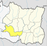
Balaltar is a village development committee in Udayapur District in the Sagarmatha Zone of south-eastern Nepal. At the time of the 1991 Nepal census it had a population of 2551 people living in 460 individual households.

Bărăi is a village development committee in Udayapur District in the Sagarmatha Zone of south-eastern Nepal. At the time of the 1991 Nepal census it had a population of 4613.
Bhumarashuwa is a village development committee in Udayapur District in the Sagarmatha Zone of south-eastern Nepal. At the time of the 1991 Nepal census it had a population of 13,631 people living in 2531 individual households.

Chaudandi is a village development committee in Udayapur District in the Sagarmatha Zone of south-eastern Nepal. At the time of the 1991 Nepal census it had a population of 2715 people living in 469 individual households.

Dumre is a village development committee in Udayapur District in the Sagarmatha Zone of south-eastern Nepal. At the time of the 1991 Nepal census it had a population of 11,749 people living in 2510 individual households.

Hardeni is a village development committee in Udayapur District in the Sagarmatha Zone of south-eastern Nepal. At the time of the 1991 Nepal census it had a population of 2906 people living in 523 individual households.

Jalpachilaune is a populated place located in Triyuga municipality of Udayapur District in Province No. 1 of Nepal. At the time of 2011 Nepal census it had a population of 3,864 people living in 807 individual households.
Janti is a village development committee in Udayapur District in the Sagarmatha Zone of south-eastern Nepal. At the time of the 1991 Nepal census it had a population of 2142 people living in 385 individual households.

Jogidaha is a populated place located in Triyuga municipality of Udayapur District in Province No. 1 of Nepal. At the time of 2011 Nepal census it had a population of 6,665 people living in 1,451 individual households.

Katunjebawala is a village development committee in Udayapur District in the Sagarmatha Zone of south-eastern Nepal. At the time of the 1991 Nepal census it had a population of 3319 people living in 539 individual households.

Lekhani, Sagarmatha is a village development committee in Udayapur District in the Sagarmatha Zone of south-eastern Nepal. At the time of the 1991 Nepal census it had a population of 2141 people living in 373 individual households.

Lekhgau is a village development committee in Udayapur District in the Sagarmatha Zone of south-eastern Nepal. At the time of the 1991 Nepal census it had a population of 2467 people living in 440 individual households.

Yayankhu is a village development committee in Udayapur District in the Sagarmatha Zone of south-eastern Nepal. At the time of the 1991 Nepal census it had a population of 2575.

Risku is a village development committee in Udayapur District in the Sagarmatha Zone of south-eastern Nepal. At the time of the 1991 Nepal census it had a population of 11,546 people living in 2083 individual households.

Rupatar is a village development committee in Udayapur District in the Sagarmatha Zone of south-eastern Nepal. At the time of the 1991 Nepal census it had a population of 556 people living in 3266 individual households.

Sithdipur is a village development committee in Udayapur District in the Sagarmatha Zone of south-eastern Nepal. At the time of the 1991 Nepal census it had a population of 2606 people living in 459 individual households.

Tapeshwari is a village development committee in Udayapur District in the Sagarmatha Zone of south-eastern Nepal. At the time of the 1991 Nepal census it had a population of 97045.

Tawasri is a village development committee in Udayapur District in the Sagarmatha Zone of south-eastern Nepal. At the time of the 1991 Nepal census it had a population of 4612 people living in 843 individual households.

Thoksila is a village development committee in Udayapur District in the Sagarmatha Zone of south-eastern Nepal. At the time of the 1991 Nepal census it had a population of 11,940 people living in 2139 individual households.
Triveni is a town in Katari Municipality, Udayapur District, in the Sagarmatha Zone of south-eastern Nepal. The formerly Triveni village development committee was merged to form a new municipality from 18 May 2014. At the time of the 1991 Nepal census, Triveni had a population of 6015 people, living in 1105 individual households.


