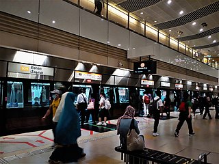
The Circle MRT Line (CCL) is a medium-capacity Mass Rapid Transit line in Singapore operated by SMRT Corporation. It runs a currently incomplete loop from Dhoby Ghaut station in the city area of Singapore to HarbourFront station in the south via Bishan station in Central Singapore. It also has a branch to Marina Bay station from Promenade station, which will be extended to Harbourfront station in the future to form a complete loop. Coloured orange on the rail map, the fully-underground line is 35.5 kilometres (22.1 mi) long with 30 stations. Travelling from one end of the line to the other takes about an hour.

New Frankley in Birmingham is a civil parish in Birmingham, England. As such, it has its own parish council.

Bartley Reservoir is a reservoir for drinking water in Birmingham, England. It covers 460,000 square metres.

Bartley Green is a residential suburban area and electoral ward to the south west of Birmingham city centre, England. The ward is part of the Birmingham Edgbaston constituency and is represented in parliament by Labour Co-operative MP Preet Gill. Located to the east is the Weoley ward, to the south is Frankley and to the west is the county of Worcestershire. To the north is Quinton and Woodgate Valley Country Park.

Dhoby Ghaut MRT station (NS24/NE6/CC1) is an underground Mass Rapid Transit (MRT) interchange station on the North South line (NSL), North East line (NEL) and Circle line (CCL). As the name suggests, it is located in Dhoby Ghaut, Museum Planning Area, Singapore, at the eastern end of Orchard Road shopping belt, underneath Orchard Road and The Atrium@Orchard shopping mall. The station is located near prominent landmarks such as The Istana, Istana Park, the MacDonald House, the House of Tan Yeok Nee, Plaza Singapura and Dhoby Ghaut Green.
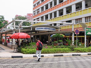
Hougang is a planning area and mature residential town located in the North-East Region of Singapore. The town is the most populous in the region, being home to 247,528 residents as of 2018. Hougang planning area is bordered by Sengkang to the north, Geylang and Serangoon to the south, Bedok to the southeast, Toa Payoh to the southwest, Paya Lebar to the east, Ang Mo Kio to the west and Bishan to the southwest.
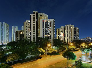
Dover is a relatively small neighbourhood of Singapore, located in Queenstown. It is bordered by Ghim Moh to the north, Kent Ridge to the south and southeast, one-north and Queenstown to the east, Commonwealth and Holland Village to the northeast Clementi to the west and West Coast to the southwest. It is often a noted location due to the sheer number of educational facilities it holds, while lying in a zone between the Central Area and near industrial zone in the vicinity of Jurong.

Promenade MRT station (CC4/DT15) is an underground Mass Rapid Transit (MRT) interchange station on the Downtown line (DTL) and Circle line in Downtown Core, Singapore, located underneath Temasek Avenue and adjacent to Millenia Tower. The Circle line from this station branches out into two routes towards either Dhoby Ghaut station or Marina Bay station via Bayfront.
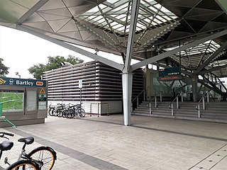
Bartley MRT station (CC12) is an underground Mass Rapid Transit (MRT) station on the Stage 3 of the Circle line, located on the boundary of Serangoon and Toa Payoh planning areas, Singapore.

Lorong Chuan MRT station (CC14) is an underground Mass Rapid Transit (MRT) station on the Circle line in Serangoon, Singapore. It is located underneath Serangoon Avenue 3 near the junction of Lorong Chuan, which the station is named after. The station is in close proximity to schools such as the Nanyang Junior College, Zhonghua Secondary School, Yangzheng Primary School and the Australian International School, and also near to other condominiums such as The Scala, Goldenhill Park, Chuan Park, Chiltern Park and The Springbloom.

Bras Basah MRT station (CC2) is an underground Mass Rapid Transit (MRT) station on the Circle line (CCL) located in Museum planning area, Singapore, underneath Bras Basah Road bordering Waterloo Street and Queen Street. Located next to the Singapore Management University (SMU), this station is in close proximity to Bencoolen MRT station on the Downtown line (DTL), even though they are not directly connected as an interchange. The station is also within walking distance to the National Museum of Singapore, the Singapore Art Museum, Peranakan Museum and the School of the Arts (SOTA).
This is a list of Singapore-related articles by alphabetical order. For a list by topic, see list of Singapore-related topics. Those interested in the subject can monitor changes to the pages by clicking on Related changes in the sidebar. A list of to do topics can be found here.
Mount Vernon is a small hill in central Singapore west of Potong Pasir and north of MacPherson Estate. Officially named in 1956, it is circumscribed by Bartley Road, Upper Aljunied Road, Upper Serangoon Road, and Upper Paya Lebar Road. It is named after British Royal Navy Vice Admiral Edward Vernon (1684–1757).
Bartley Road is a major road in Singapore extending from Upper Serangoon Road to Tampines Avenue 10. The road has a distance of 5.8 km. En route, it passes through the areas of Serangoon, Bartley, Paya Lebar, Defu, Kaki Bukit and Bedok Reservoir.
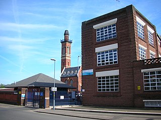
The Birmingham Corporation Water Department was responsible for the supply of water to Birmingham, England, from 1876 to 1974. It was also known as Birmingham Corporation Waterworks Department.

Bedok Reservoir MRT station (DT30) is an underground Mass Rapid Transit station on the Downtown Line in Bedok, Singapore, located at Bedok Reservoir Road, beside Bedok North Avenue 3. It serves residents living near Bedok Reservoir. The station also serves the students of Bedok Green Secondary School, Yu Neng Primary School, Fengshan Primary School and Red Swastika School.

Kaki Bukit is an industrial area located in Bedok in the East Region of Singapore. It is home to many high tech industrial companies and warehouses. There used to be a prison complex called Kaki Bukit Centre, which was converted to a prison school in 2000, however it has since moved to Tanah Merah and the Acacia Welfare Home now stands in its place. On the south of Kaki Bukit is Jalan Tenaga and Jalan Damai neighbourhoods of Bedok Reservoir Road. Redevelopments are in the pipeline for Kaki Bukit beyond 2030 when Paya Lebar Airbase located just north of the estate relocates to Changi. Not only would land be freed up for use but building height restrictions, that are currently in place for safety reasons because the estate is directly aligned with the airbase runway, would also be lifted. Kaki Bukit is classified by Urban Redevelopment Authority (URA) as a subzone under the planning area of Bedok, its boundaries differ from the constituency boundaries used by the Singapore Parliament.
Joo Seng is a subzone located in Toa Payoh in the Central Region of Singapore. It gets its name from Bartley Road, which stretches from the end of Braddel Road to Upper Paya Lebar Road, as part of the Outer Ring Road System. There are some condominiums and houses in the area. It is also where the Gurkha Contingent is based. There are many Gurkhas and their families living there in private flats.


