
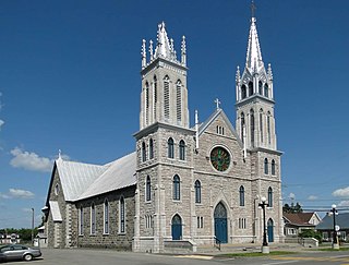
Saint-Tite is a town in the province of Quebec, Canada, north of Trois-Rivières, in the Mékinac Regional County Municipality (RCM) and in the Mauricie administrative region. In the 19th Century, the Batiscanie economy was mainly founded on forestry and agriculture. With many small businesses, Saint-Tite expanded through the production of leather goods and various types of shops. Saint-Tite became a capital of the region, especially concerning education, health and social services. Today, tourism counts as an important economic activity. Its chief industries were forestry, agriculture and leather goods production.

Les Chenaux is a regional county municipality in central Quebec, Canada, in the Mauricie region. The seat is in Saint-Luc-de-Vincennes. It is located adjacent on the east of Trois-Rivières on the Saint Lawrence River. It has a land area of 872.04 square kilometres (336.70 sq mi) and a population of 17,865 inhabitants in the Canada 2011 Census. Its largest community is the parish of Notre-Dame-du-Mont-Carmel.
Saint-Adelphe is a Parish municipality of Quebec, (Canada) located in the Mékinac Regional County Municipality, in the Batiscanie area and in the administrative region of Mauricie. The territory of the municipality was part of the lordship of Sainte-Anne which was owned by Mr. John Hale, and Mr. Price.
Saint-Narcisse is a parish municipality located in the regional county municipality (MRC) Chenaux, in the administrative region of Mauricie, in the province of Quebec, in Canada. Located on the North Shore of the Saint Lawrence River, about 30 km (19 mi) from downtown Trois-Rivières, the parish of Saint-Narcisse is the heart of the Mauricie region.

Sainte-Geneviève-de-Batiscan is a parish municipality in the Mauricie region of the province of Quebec in Canada. This municipality is part of the Les Chenaux Regional County Municipality in Batiscanie and in the administrative region of Mauricie. It is located along the Batiscan River.

Batiscan is a municipality in the Mauricie region of the province of Quebec in Canada. It is located along the Saint Lawrence River at the mouth of the Batiscan River.

Notre-Dame-de-Montauban is a municipality in the Mauricie region in Canada. This municipality is located at the northern edge of regional county municipality of Mékinac Regional County Municipality and the administrative region of Mauricie. It includes the population centres of Notre-Dame-des-Anges and Montauban-les-Mines. Both communities are located along route 367, about 7 kilometres (4.3 mi) apart.

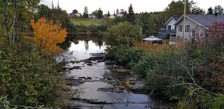
The Batiscan River is located in La Mauricie administrative region, in the Quebec province, Canada. This river flows 196 km from Lake Édouard in Mauricie south and west to empty into the St. Lawrence River at Batiscan, Quebec, northeast of Trois-Rivières, Quebec. It passes through the regional county municipalities (RCM) of La Tuque, Portneuf, Mékinac and Les Chenaux.
Batiscanie is the watershed of the Batiscan River, located in the center of the province of Quebec, Canada, covering 4690 km² on the North Shore of the St. Lawrence River. The area covered by Batiscanie is 53% in the administrative région of Mauricie and 47% in the administrative region of the Capitale-Nationale.

Jeannotte River is a river that rises in Lac Édouard in the municipality of Lac-Édouard in Haute-Mauricie, agglomerated with the city of La Tuque since 2003, in the administrative region of Mauricie, in the province of Quebec, Canada. The head of the Jeannotte River is one of the two emissaries of Lake Edward. The Jeannotte River, whose course is 48 kilometres (30 mi), is in the valley of the Batiscanie, Quebec. The upper segment of the path of the Jeannotte River marks the Zec de la Bessonne and Zec Jeannotte, then the river flows through the Zec Jeannotte, incorporated in 1978.

The Propre River is located in the municipality of Lac-aux-Sables in Regional County Municipality of Mékinac Regional County Municipality, in the administrative region Mauricie, in the province of Quebec, Canada. The Propre River watershed is part of the Batiscanie. It is 6.7 km long.

The Lordship of Batiscan was located on, and included 1/2 lieue of frontage along, the north shore of the St. Lawrence River in the province of Quebec, Canada. It was 20 lieues deep. Granted in 1639 to the Jesuits, colonization of the manor began in 1666, after an initial allotments were added to the census in 1665.) The northern boundary of the Lordship was past the source of the Saint-Maurice River. It was the deepest in the seigneurial system of New France. The Lordship of Batiscan became the most populous governed area of the Three Rivers by the end of the 17th Century.
The Lake Pierre-Paul is located at Saint-Tite in Mékinac Regional County Municipality, in the administrative region of Mauricie, in the province of Quebec, Canada. This lake is part of the Batiscanie watershed. From St. Joseph Boulevard in Saint-Tite, taking the road of Lake Pierre-Paul, just browse 1.4 km to cross the road "Petit Pierre-Paul", 2.2 km to reach the lake Pierre-Paul, 2.4 km to reach the intersection of "chemin de l'île", and 3.6 km to the corner of the road that branches off to the right (Saint-Adelphe) and crosses the railway.
The Lake Edouard, Quebec is a lake in Canada, in province of Quebec, in the municipality of Lac-Edouard in the administrative region of Mauricie. The entire area of this lake is located in the municipality of Lac-Edouard.
The Marmier township is located in the municipalities of Lac-aux-Sables and Notre-Dame-de-Montauban, in the Mekinac Regional County Municipality, in the administrative region of Mauricie, on the north shore of St. Lawrence, in the Quebec, in Canada. In Quebec, a "canton" is a historic cadastral division of the territory to facilitate the grant of public lands to individuals for colonization.

The Roberge Lake is located in the unorganized territory of Lac-Masketsi, Quebec, the Mekinac Regional County Municipality, in Mauricie, in Quebec, in Canada. This lake whose surface is usually frozen from November to April is located entirely in forest land.
The Rivière aux Castors Noirs is a tributary of the Batiscan River, flowing in Haute-Batiscanie, in the province of Québec, Canada. This watercourse crosses:
The Aberdeen River is a tributary of the rivière aux Castors Noirs, flowing in the town of La Tuque and in the municipality of Lac-Édouard, in Haute-Batiscanie, in Mauricie, in the province of Quebec, in Canada.

The "Aberdeen lake" is the main head water of the Aberdeen River, located in Upper Batiscanie in the territory of the city of La Tuque, in the administrative region of Mauricie, in the province of Quebec, Canada.
The lac au Lard is the main body of water on the slope of the ruisseau du Lac au Lard, located in Haute-Batiscanie, in the town of La Tuque, in the administrative region of Mauricie, in Quebec, in Canada.