
Bear Creek Township is a township in Luzerne County, Pennsylvania, United States. The township has a total area of 67.8 square miles (176 km2), making it is the largest municipality in Luzerne County. The population was 2,752 at the 2020 census.

The Lee Metcalf Wilderness is located in the northern Rocky Mountains in the U.S. state of Montana. Created by an act of Congress in 1983, this rugged alpine wilderness is divided into four separated parcels typified by complex mountain topography: Bear Trap Canyon unit, Spanish Peaks unit, Taylor-Hilgard unit, and Monument Mountains unit. The Bear Trap Canyon unit was the first designated wilderness area to be managed by the Bureau of Land Management, and comprises a region of canyonlands adjacent to the Madison River. The other three sections of the wilderness are jointly managed by Beaverhead-Deerlodge and Gallatin National Forests, both of which are a part of the Department of Agriculture. The wilderness was named after the late Montana congressman Lee Metcalf.

Peters Creek is a 7.3-mile-long (11.7 km) stream in San Mateo County, California, and is a tributary of Pescadero Creek. It flows southwestwards through a small canyon to join Pescadero Creek in Portola Redwoods State Park, near La Honda.

Sun City Township is a township in Barber County, Kansas, USA. As of the 2000 census, its population was 100.
Center Township is a township in Clark County, Kansas, United States. As of the 2000 census, its population was 1,097.
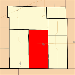
Cedar Township is a township in Cowley County, Kansas, United States. As of the 2000 census, its population was 44.

Adams Township is a township in Dallas County, Iowa, USA. As of the 2000 census, its population was 1,082.

Volga Township is a township in Clayton County, Iowa, United States. As of the 2000 census, its population was 551.

Deep Creek Township is a township in Clinton County, Iowa, United States. As of the 2000 census, its population was 713.

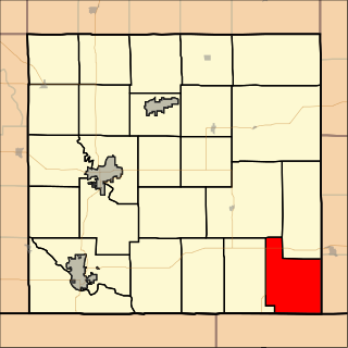
Bear Creek Township is a township in Hamilton County, Kansas, USA. As of the 2000 census, its population was 69.
Bear Creek 3 Airport is a public-use airport located three nautical miles west of the central business district of Bear Creek, in the Yukon-Koyukuk Census Area of the U.S. state of Alaska. Bear Creek 3 is 40 nautical miles north of McGrath Airport.
Buchanan, originally named Mouth of Bear, is an unincorporated community located in Lawrence County, Kentucky, United States at the mouth of Bear Creek where it joins the Big Sandy River, five miles downstream from the mouth of Blaine Creek.

South Branch Roaring Creek is a tributary of Roaring Creek in Columbia County and Northumberland County, Pennsylvania, in the United States. It is approximately 16.8 miles (27.0 km) long. The upper reaches of the creek are located in Weiser State Forest, between Big Mountain and Little Mountain. The creek is home to some trout and is considered a high-quality coldwater fishery. The Chemung Formation occurs in the creek's watershed. The watershed is 25 square miles in area.
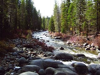
Dinkey Creek is a large stream in the southern Sierra Nevada, in Fresno County, California. The creek is 29.2 miles (47.0 km) long, flowing undammed in a southerly direction through the Sierra National Forest. It is a tributary of the North Fork Kings River, in turn part of the Kings River system which drains into the de-watered Tulare Lake bed.

Bear Creek is a stream in the U.S. states of Mississippi and Alabama. The stream flows approximately 80 miles (130 km) before it empties into the Tennessee River.
