This article is about the demographic features of the population of Slovakia, including population density, ethnicity, education level, health of the populace, economic status, religious affiliations and other aspects of the population. The demographic statistics are from the Statistical Office of the SR, unless otherwise indicated.

A village is a clustered human settlement or community, larger than a hamlet but smaller than a town, with a population ranging from a few hundred to a few thousand. Though villages are often located in rural areas, the term urban village is also applied to certain urban neighborhoods. Villages are normally permanent, with fixed dwellings; however, transient villages can occur. Further, the dwellings of a village are fairly close to one another, not scattered broadly over the landscape, as a dispersed settlement.

Akhiok is a second-class city in Kodiak Island Borough, Alaska, United States. Akhiok is Kodiak's southernmost village. The population was 71 at the 2010 census. Akhiok, which does not have a post office, is a rural location in postal code 99615 that belongs to Kodiak. The village is sometimes called Alitak, after a nearby bay.

Royal Palm Beach is a village in southeast Florida, located within Palm Beach County. The population was measured at 21,523 in the 2000 census. Despite its name, the village is located approximately fifteen miles inland from the Atlantic Ocean.

Aylesford is a village and civil parish on the River Medway in Kent, 4 miles NW of Maidstone in England.

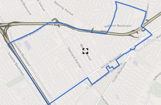
Palms is a highly diverse, densely populated community in the Westside region of Los Angeles, California, founded in 1886 and the oldest neighborhood annexed to the city, in 1915. The 1886 tract was marketed as an agricultural and vacation community. Today it is a primarily residential area, with a large number of apartment buildings, ribbons of commercial zoning and a single-family residential area in its northwest corner.

Tres Cantos is a Spanish municipality in the province and Community of Madrid, situated 22 km to the north of the capital. Tres Cantos' location is highly desirable because of its location, near Monte del Pardo, in the south, and in Viñuelas. As a "satellite city" of Madrid conceived by urban planners in the 1970s, it is the youngest incorporated municipality in the Community of Madrid, with a population of 46,046 inhabitants. Tres Cantos was the Spanish bid host city for the 2018 Ryder Cup. However, residents showed poor popular support.

Bonnyville is a town situated in east-central Alberta between Cold Lake and St. Paul. The surrounding Municipal District (MD) of Bonnyville No. 87's municipal office is located in Bonnyville.

Barrhead is a town in central Alberta, Canada, within the County of Barrhead No. 11. It is located along the Paddle River and at the intersection of Highway 33 and Highway 18, approximately 120 km (75 mi) northwest of the City of Edmonton. It is also located along the route of the Express Trail, used by the North West Company. Originally a First Nations trail that was widened by George Simpson and John Rowand to save the North West Company over $5,000.

The District of Gungahlin is one of the original eighteen districts of the Australian Capital Territory used in land administration. The district is subdivided into divisions (suburbs), sections and blocks. Gungahlin is an Aboriginal word meaning either "white man's house" or "little rocky hill".

The Bamileke is the native group which is now dominant in Cameroon's West and Northwest Regions. It is part of the Semi-Bantu ethnic group. The Bamileke are regrouped under several groups, each under the guidance of a chief or fon. They speak a number of related languages from the Bantoid branch of the Niger–Congo language family. These languages are closely related, however, and some classifications identify a Bamileke dialect continuum with seventeen or more dialects.

Bafut is a town located in a modern commune in Cameroon, it is also a traditional fondom. It is located in the Mezam Department, which in turn is located in the Northwest Province.

Orakzai District is a district in Kohat Division of Khyber Pakhtunkhwa province in Pakistan. Until 2018, it was an agency of Federally Administered Tribal Areas. With the merger of FATA with Khyber Pakhtunkhwa, it became a district. Before to 1973, it was part of FR Kohat.
Crabwood Creek is a small community on the Corentyne River in the East Berbice–Corentyne region of Guyana. The population of about 10,000 people is primarily descendants of indentured laborers who were brought from India in the mid-1830s.
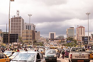
Bambui is an emerging township in northwestern Cameroon. With a population of about 17,000 people, it is located at an elevation of about 1350 metres above sea level. Administratively, Bambui is the headquarters of Tubah Sub-Division in the North West Region of Cameroon. Popularly known to its inhabitants as “abeh-mbeuh,” Bambui is one of the Bamenda grassfield communities of Cameroon, and is known for its mix of modern and indigenous African life. With its lush, rolling, and fertile plains, a mild tropical climate, and an extremely industrious farming community, Bambui is the bread basket of the North West Region in particular and of Cameroon in general. Lying snug in the immense arms of the Sabga hill, Bambui is situated between Sabga and the undulating foothills that separate it with its neighbors, virtually in the shape of a bowl. Bambui is located at the cross-roads that lead to some of the North West Region’s major towns of Bamenda, Ndop, Kumbo, Fundong and Nkambé.

Following is an outline is for the history of Brampton, the fourth largest city in Ontario, Canada.

Lower Hutt is a city in the Wellington Region of the North Island of New Zealand. Administered by the Hutt City Council, it is one of the four cities that constitute the Wellington metropolitan area.

Harbord Village is a neighbourhood in Toronto, Ontario, Canada. It lies just to the west of the University of Toronto, with its most commonly accepted borders being Bloor Street on the north, Spadina Avenue on the east, College Street to the south, and Bathurst Street to the west. Areas west of Bathurst, as far as Ossington are also sometimes included, though they are not covered by the residents' association. The area was previously known as Sussex-Ulster, after two of the major east west streets in the area. In 2000 the residents' association decided to rename itself and the area Harbord Village, after the main street running through the middle of the community. The area is also sometimes referred to as the South Annex after the better known "Annex" community to the north. The city of Toronto for administrative purposes places Harbord Village and most of the St. George campus into a region it calls "University."

Banda Ahenkro is a town located in the west-central region of Brong Ahafo, Ghana. Its geography provided a home for numerous groups seeking shelter from across West Africa during the slave trade era. The original name of the settlement was Serminakuu meaning groups of 'grasses'. This name was changed to Banda, which is a corruption of 'Woanda' meaning 'they did not sleep'. Ancestors of Banda Ahenkro were allies of the Asante kingdom during wars and they provided a military force that virtually refused to sleep during at-war times. Later, 'woanda' was also corrupted by the Brong neighbours to become Banda. The settlement evolved to become the chief town or 'Ahenkro' within a collection of Nafana communities.


![Cocoa bean Fatty seed of [[Theobroma cacao]] which is the basis of chocolate](https://upload.wikimedia.org/wikipedia/commons/thumb/e/e0/Cocoa_Pods.JPG/213px-Cocoa_Pods.JPG)


