
The Shephelah or Shfela, or the Judaean Foothills, is a transitional region of soft-sloping rolling hills in south-central Israel stretching over 10–15 km (6.2–9.3 mi) between the Judaean Mountains and the Coastal Plain. The different use of the term "Judean Plain", as either defining just the Coastal Plain segment stretching along the Judaean Mountains, or also including, or only referring to, the Shfela, often creates grave confusion.

The Battle of Ajnadayn was fought in July or August 634, in a location close to Beit Guvrin in the Roman-era Palestine region ; it was the first major pitched battle between the Byzantine (Roman) Empire and the army of the Arab Rashidun Caliphate. The result of the battle was a decisive Muslim victory. The details of this battle are mostly known through Muslim sources, such as the ninth-century historian al-Waqidi.

The Israel National Trail is a hiking trail that crosses the entire length of Israel, with its northern end at Kibbutz Dan in the far north of the country, extending to Eilat at the southernmost tip of Israel on the Red Sea, with a total length of 1,040 km (650 mi). The trail was inaugurated in 1995.

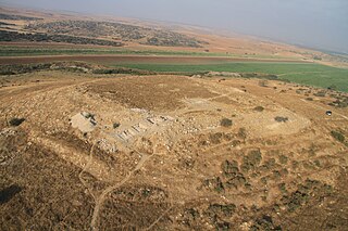
Tel Maresha is the tell of the biblical Iron Age city of Maresha, and of the subsequent, post-586 BCE Idumean city known by its Hellenised name Marisa, Arabised as Marissa (ماريسا). The tell is situated in Israel's Shephelah region, i.e. in the foothills of the Judaean Mountains, about 2 kilometres (1.2 mi) southeast of Beit Gubrin.

Bayt Jibrin or Beit Jibrin, known between 200-400 CE as Eleutheropolis, was a historical town, located in central Israel near the 1949 ceasefire line, 21 kilometres (13 mi) northwest of the city of Hebron.The town had a total land area of 56,185 dunams or 56.1 km2, of which 0.28 km2 were built-up while the rest remained farmland.

Amos Kloner was an Israeli archaeologist and professor emeritus.
Gal On is a kibbutz in southern Israel. Located in the Shephelah, it falls under the jurisdiction of Yoav Regional Council. In 2022 it had a population of 615.

Beit Guvrin is a kibbutz in the Lakhish region, west of the ancient city of Beit Guvrin, for which it is named. Located 14 kilometres east of Kiryat Gat, it falls under the jurisdiction of Yoav Regional Council. In 2022 it had a population of 450.

Beit Kahil is a Palestinian village in the Hebron Governorate in the southern West Bank, located seven kilometers northwest of Hebron. The village had a population of 8,880 in 2017.
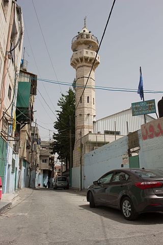
'Azza also known as Beit Jibrin Camp is a Palestinian refugee camp in the Bethlehem Governorate located within the city of Bethlehem. It is the smallest of the 59 refugee camps in the West Bank and the other Arab countries. It was established in 1950 in an area of 20 dunams and receives services from UNRWA workers based in nearby Aida camp, but inside the camp, there are no medical or educational services, so it was merged with the Aida camp to receive services.

Many place names in Palestine were Arabized forms of ancient Hebrew and Canaanite place-names used in biblical times or later Aramaic formations. Most of these names have been handed down for thousands of years though their meaning was understood by only a few. The cultural interchange fostered by the various successive empires to have ruled the region is apparent in its place names. Any particular place can be known by the different names used in the past, with each of these corresponding to a historical period. For example, the city of Beit Shean, today in Israel, was known during the Israelite period as Beth-shean, under Hellenistic rule and Roman rule as Scythopolis, and under Arab and Islamic rule as Beisan.
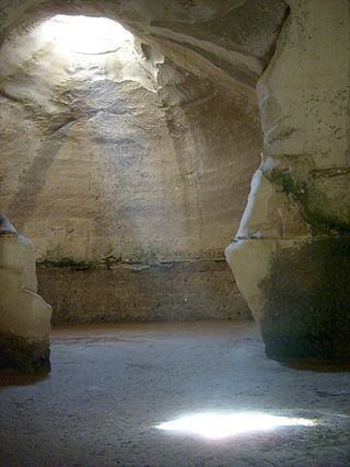
Beit Guvrin-Maresha National Park is a national park in central Israel, containing a large network of caves recognized by UNESCO as a World Heritage Site. The national park includes the remains of the historical towns of Maresha, one of the important towns of Judah during the First Temple Period, and Bayt Jibrin, a depopulated Palestinian town known as Eleutheropolis in the Roman era. However, Maresha and Bayt Jibrin are not part of the UNESCO site, which covers only the cave network.
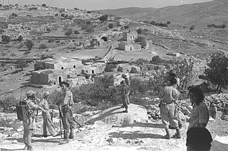
Bayt Nattif or Beit Nattif was a Palestinian Arab village, located some 20 kilometers southwest of Jerusalem, midway on the ancient Roman road between Beit Guvrin and Jerusalem, and 21 km northwest of Hebron. The village lay nestled on a hilltop, surrounded by olive groves and almonds, with woodlands of oak and carobs overlooking Wadi es-Sunt to its south. It contained several shrines, including a notable one dedicated to al-Shaykh Ibrahim. Roughly a dozen khirbas lay in the vicinity.
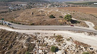
Tel Burna is an archaeological site located in the Shephelah, along the banks of Nahal Guvrin, not far from modern-day Qiryat Gat. Tel Burna is located near Beit Guvrin/Maresha, Tel Goded, Lachish, Tell es-Safi/Gath and Tel Zayit. The site is thought to have been one of a series of sites along the border between Judah and Philistia.

Events in the year 1938 in the British Mandate of Palestine.
Moresheth-Gath, also Moreshet-Gat, was a town of the tribe of Judah in ancient Israel mentioned in the Bible. It was located in the Shephelah region between Lachish and Achzib.

Rebbo or Horvat Rebbo, alternative spellings: Robbo, Ribbo; in Arabic Khurbet Rubba, is an ancient site in Israel, mentioned by Eusebius in his Onomasticon as possibly referring to a site by a similar name in the Book of Joshua. The site, which is now a ruin, sits on a hill 414 metres (1,358 ft) above sea level, in the Shephelah region, and is now part of the Adullam-France Park, maintained by the Jewish National Fund (KKL). It lies about 1.5 km. to the west of Aderet as the crow flies, and about 11 kilometres (7 mi) northeast of Beit Guvrin National Park.
Tel Beit Shemesh is a small archaeological tell northeast of the modern city of Beit Shemesh.

Daroma (Aramaic) or Darom (Hebrew), both meaning 'South', was the name of the southern Hebron Hills in the Late Roman and Byzantine periods. The term is used in Eusebius's Onomasticon and in rabbinic literature. For Eusebius, it is the southern part of the territory of Eleutheropolis, an important city in that period. By the late tenth century, the Arab geographer al-Muqaddasi was still referring to part of the region of Beth Guvrin by this name.