Related Research Articles

Itta Bena is a city in Leflore County, Mississippi, United States. The population was 2,049 at the 2010 census. The town's name is derived from the Choctaw phrase iti bina, meaning "forest camp". Itta Bena is part of the Greenwood, Mississippi micropolitan area. It developed as a trading center of an area of cotton plantations.

Mytholmroyd is a large village and former civil parish, now in the parish of Hebden Royd, in the Calderdale district, in West Yorkshire, England, 2 miles (3 km) east of Hebden Bridge. It lies in the Upper Calder Valley, 10 miles (16 km) east of Burnley and 7 miles (11 km) west of Halifax. The village, which has a population of approximately 4,000, is in the Luddendenfoot Ward of Calderdale Council.

The Upper Palatinate is an administrative district in the east of Bavaria, Germany. It consists of seven districts and 226 municipalities, including three cities.

The Brigach is the shorter of two streams that jointly form the river Danube in Baden-Württemberg, Germany. The Brigach has its source at 925 m (3,035 ft) above sea level within St. Georgen in the Black Forest. The Brigach crosses the city Villingen-Schwenningen. 40.4 km (25.1 mi) from the source, the Brigach joins the Breg in Donaueschingen to form the Danube River.

Gundelfingen im Breisgau is a municipality directly north of the city Freiburg in Baden-Württemberg in southern Germany.

Edale is a village and civil parish in the Peak District, Derbyshire, England, whose population was 353 at the 2011 Census. Edale, with an area of 7,030 acres (2,840 ha), is in the Borough of High Peak.
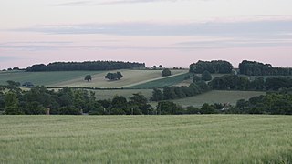
The Vale of White Horse is a local government district of Oxfordshire in England. It was historically part of Berkshire. The area is commonly referred to as the 'Vale of the White Horse'. It is crossed by the Ridgeway National Trail in its far south, across the North Wessex Downs AONB at the junction of four counties. The northern boundary is defined by the River Thames. The name refers to Uffington White Horse, a prehistoric hill figure.

Roxborough is a neighborhood in Northwest Philadelphia, Pennsylvania, United States. It is bordered to the southwest, along the Schuylkill River, by the neighborhood of Manayunk, along the northeast by the Wissahickon Creek section of Fairmount Park, and to the southeast by the neighborhood of East Falls. Beyond Roxborough to the northwest is Montgomery County. Roxborough's ZIP Code is 19128. Most of Roxborough is in Philadelphia's 21st Ward.
Kainantu is a town in the Eastern Highlands of Papua New Guinea. It had some historical significance as an airstrip town during WWII. It functions primarily as a market town for local produce growers and cash croppers. It is located on the "Highlands Highway" approximately 170 kilometres (110 mi) by road west of Lae and 90 kilometres (56 mi) by road east of Goroka. It is 11 kilometres (6.8 mi) approx from a nearby missionary station Ukarumpa and is nearby the Aiyura valley. Kainantu has basic facilities such as a school, hospital, police station, district court, and service stations.

Walderslade is a large suburb in Kent in Chatham split between the unitary authority of Medway and the boroughs of Maidstone and Tonbridge & Malling in South East England. It was, until 1998, fully part of Kent and is still ceremonially associated via the Lieutenancies Act. It encompasses almost all the ME5 postcode district.

Rockridge is a residential neighborhood and commercial district in Oakland, California. Rockridge is generally defined as the area east of Telegraph Avenue, south of the Berkeley city limits, west of the Oakland hills and north of the intersection of Pleasant Valley Avenue/51st Street and Broadway. Rockridge was listed by Money Magazine in 2002 as one of the "best places to live".

Dunston is a western area of the town of Gateshead on the south bank of the River Tyne, in the Metropolitan Borough of Gateshead, North East England. Dunston had a population of 18,326 at the 2011 Census.

The Denaʼina, or formerly Tanaina, are an Alaska Native Athabaskan people. They are the original inhabitants of the south central Alaska region ranging from Seldovia in the south to Chickaloon in the northeast, Talkeetna in the north, Lime Village in the northwest and Pedro Bay in the southwest. The Denaʼina homeland is more than 41,000 sq mi (110,000 km2) in area. They arrived in the south-central Alaska sometime between 1,000 and 1,500 years ago. They were the only Alaskan Athabaskan group to live on the coast. The Denaʼina have a hunter-gatherer culture and a matrilineal system. The Iditarod Trail's antecedents were the native trails of the Denaʼina and Deg Hitʼan Athabaskan Native Alaskans and the Inupiaq Inuit.
The Macdonald River is a perennial river located in the Hunter and Outer Metropolitan Sydney regions of New South Wales, Australia. It is a part of the Hawkesbury-Nepean catchment.

Santry River is a small watercourse on the north side of Dublin city, one of the forty or so watercourses monitored by Dublin City Council. It runs, mostly unculverted, from Harristown and Dubber near Dublin Airport, through Santry and Coolock, reaching the sea at Raheny, in a lagoon area inshore of Bull Island.

Throughout its history, Toronto has been a city divided into many districts and neighbourhoods. As the city has grown, new neighbourhoods have been created by expansion of the city into the countryside. Over time, the neighbourhoods within existing areas have also been altered and rearranged.
Bena is an unincorporated area of Kern County, California. It is located on the Union Pacific Railroad 7 miles (11 km) west-northwest of Caliente, at an elevation of 863 feet (263 m). The Pampa post office operated from 1889 to 1890 and again during 1901.

Paddar, also spelled Padar, is a Sub-District and remote valley in the Kishtwar district of the union territory of Jammu and Kashmir, India. It falls in the Jammu division. It consists of two tehsils namely Machail and Atholi Paddar The valley covers the entire southeastern portion of the Kishtwar district. It borders Zanskar (Ladakh) in the north and east, Pangi in the south and the rest of Jammu and Kashmir in the west. The valley is known for its Sapphire mines. Albeit Sapphires are located in the valley of Paddar in Jammu division, they are known as Kashmiri sapphires which is a misnomer. It lies along the Chandrabhaga river (Chenab) in the Great Himalayas. Paddar is one of the most remote regions of Jammu and Kashmir. There are a number of small valleys within Paddar, such as Machail, Gandhari, Kabban, Ongai, Bhuzunu, Barnaj, Bhuzas, Kijai Nallah, and Dharlang, among others.

Katanda Territory is one of five territories which, along with the city of Mbuji-Mayi, constitute the current Congolese province of Kasai-Oriental. The Democratic Republic of the Congo (DRC) is made up of 192 territories and 20 cities which are grouped in 26 provinces including Kinshasa, the capital city. Katanda Territory is sectioned into four sectors: Baluba-Lubilanji, Mutwayi, Nsangu, and Tshitolo. The territory is also endowed with three towns. Katanda Town is the headquarters of both Katanda Territory and Baluba-Lubilanji Sector as well; this town is located on the top of the hill in the Bena Nshimba Grouping. Tshala town, in the Bakwa Ndaba Grouping, is also famous because of its power station on the Tshala River that supplies power to Mbuji-Mayi city and its neighborhoods. So, Tshitenge Town which is well known for its diamond businesses is in the Bena Nshimba Grouping.
Little Rock, Arkansas is home to numerous neighborhoods. See List of Little Rock Neighborhoods for an exhaustive list.
References
| | This Eastern Highlands Province geography article is a stub. You can help Wikipedia by expanding it. |