Related Research Articles

York County is a county in the eastern part of the Commonwealth of Virginia, located in the Tidewater. As of the 2020 census, the population was 70,045. The county seat is the unincorporated town of Yorktown.
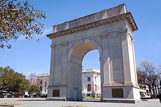
Newport News is an independent city in southeastern Virginia, United States. At the 2020 census, the population was 186,247. Located in the Hampton Roads region, it is the fifth-most populous city in Virginia and 140th-most populous city in the United States. The city is at the southeastern end of the Virginia Peninsula, on the northern shore of the James River to the river's mouth on the harbor of Hampton Roads.

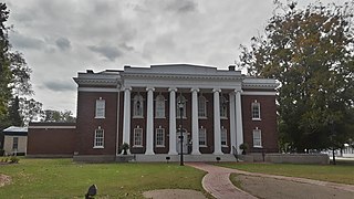
James City County is a county located in the Commonwealth of Virginia. As of the 2020 census, the population was 78,254. Although politically separate from the county, the county seat is the adjacent independent city of Williamsburg.

Saxis is a town in Accomack County, Virginia, United States. The population was 241 at the 2010 census.

Colonial Beach, Virginia (CBVA) is a river and beach town located in the northwestern part of Westmoreland County on Virginia's Northern Neck peninsula. It is bounded by the Potomac River, Monroe Bay and Monroe Creek. It is located 65 mi (105 km) from Washington, D.C.; 70 mi (110 km) from the state capital of Richmond; and 35 nautical miles from the Chesapeake Bay.

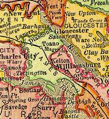
The Virginia Peninsula is located in southeast Virginia, bounded by the York River, James River, Hampton Roads and Chesapeake Bay. It is sometimes known as the Lower Peninsula to distinguish it from two other peninsulas to the north, the Middle Peninsula and the Northern Neck.
Surry County is a county in the southeastern part of the Commonwealth of Virginia. As of the 2020 census, the population was 6,561.

The York River is a navigable estuary, approximately 34 miles (55 km) long, in eastern Virginia in the United States. It ranges in width from 1 mile (1.6 km) at its head to 2.5 miles (4.0 km) near its mouth on the west side of Chesapeake Bay. Its watershed drains an area of the coastal plain of Virginia north and east of Richmond.

Warwick County was a county in Southeast Virginia that was created from Warwick River Shire, one of eight created in the Virginia Colony in 1634. It became the City of Newport News on July 16, 1952. Located on the Virginia Peninsula on the northern bank of the James River between Hampton Roads and Jamestown, the area consisted primarily of farms and small unincorporated villages until the arrival of the Peninsula Extension of the Chesapeake and Ohio Railway in 1881 and development led by industrialist Collis P. Huntington.
Naval Weapons Station Yorktown is a United States Navy base in York County, James City County, and Newport News in the Hampton Roads region of Virginia. It provided a weapons and ammunition storage and loading facility for ships of the United States Atlantic Fleet, and more recently, for those from the Fleet Forces Command.
Magruder was a small unincorporated town in Virginia near Williamsburg in York County. Settled mostly by African-American freedmen after the American Civil War, it once had its own church, post office, cemetery, lodge, and homes. After this land was acquired for the development of the US military reservation known as Camp Peary, all the residents and businesses were displaced. Magruder is considered extinct and one of the lost towns of Virginia.
Camp Peary is an approximately 9,000 acre U.S. military reservation in York County near Williamsburg, Virginia. Officially referred to as an Armed Forces Experimental Training Activity (AFETA) under the authority of the Department of Defense, Camp Peary hosts a covert CIA training facility known as "The Farm", which is used to train officers of the CIA's Directorate of Operations, as well as those of the DIA's Defense Clandestine Service, among other intelligence entities. Its facilities are also available to the members of the intelligence community for "off-site" activities such as conferences and working groups. Camp Peary has a sister facility, "The Point", located in Hertford, North Carolina.
Penniman was an unincorporated town in northwestern York County, Virginia, on the south bank of the York River six miles (9.7 km) northeast of Williamsburg. This was on the Virginia Peninsula and near the Hampton Roads region of southeastern Virginia in the United States.
Grove is an unincorporated community in the southeastern portion of James City County in the Virginia Peninsula subregion of Virginia in the United States. It is located in the center of the Historic Triangle of Colonial Virginia, communities linked by the Colonial Parkway. This area is one of the busiest tourist destinations in the world.
Mouth of Wilson is an unincorporated community, in Grayson County in the U.S. state of Virginia, just north of the North Carolina state line. The community lies in the Blue Ridge Highlands section of the Blue Ridge Mountains which are part of what is considered the 'Middle Appalachian Mountains' on the western banks of the New River, where the Big Wilson Creek empties its waters. The main road through the area is U.S. Route 58; other major roads include Virginia Route 16 and Virginia Route 93.
Camp Wallace was a facility of the United States Army located near the unincorporated town of Grove in southeastern James City County in the Virginia Peninsula portion of the Hampton Roads region of Virginia in the United States.

Morrison was a small unincorporated community in Warwick County, Virginia. After a municipal consolidation in 1958, it became a neighborhood of the independent city of Newport News.
Queen's Creek is located in York County in the Virginia Peninsula area of the Hampton Roads region of southeastern Virginia in the United States. From a point of origin near the Waller Mill Reservoir in western York County, it flows northeasterly across the northern half of the Peninsula as a tributary of the York River.

The Peninsula Extension which created the Peninsula Subdivision of the Chesapeake and Ohio Railway (C&O) was the new railroad line on the Virginia Peninsula from Richmond to southeastern Warwick County. Its principal purpose was to provide an important new pathway for coal mined in West Virginia to reach the harbor of Hampton Roads for coastal and export shipping on collier ships.
References
- ↑ US House of Representatives 1892. Reports of Committees v. 5, Report #1539, Claim of James Bigler.
- ↑ Schulte, D.M., 2017, History of the Virginia oyster fishery, Chesapeake Bay, USA: Frontiers in Marine Science v. 4. https://doi.org/10.3389/fmars.2017.00127
37°20′11″N76°38′44″W / 37.33639°N 76.64556°W
| | This York County, Virginia state location article is a stub. You can help Wikipedia by expanding it. |
| | This United States ghost town-related article is a stub. You can help Wikipedia by expanding it. |