
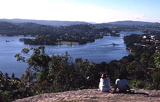
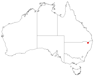
The Border Ranges National Park is a protected national park that is located in the Northern Rivers region of New South Wales, Australia. A small portion of the national park is also located in South East Queensland. The 31,729-hectare (78,400-acre) park is situated approximately 150 kilometres (93 mi) south of Brisbane, north of Kyogle.
A bioregion is an ecologically and geographically defined area that is smaller than an ecozone, but larger than an ecoregion or an ecosystem, in the World Wildlife Fund classification scheme. There is also an attempt to use the term in a rank-less generalist sense, similar to the terms "biogeographic area" or "biogeographic unit".

Gippsland is an economic rural region of Victoria, Australia, located in the south-eastern part of that state. It covers an area of 41,556 square kilometres (16,045 sq mi), and lies to the east of the eastern suburbs of Greater Melbourne, to the north of Bass Strait, to the west of the Tasman Sea, to the south of the Black-Allan Line that marks part of the Victorian/New South Wales border, and to the east and southeast of the Great Dividing Range that lies within the Hume region and the Victorian Alps. Gippsland is generally broken down into the East Gippsland, South Gippsland, West Gippsland, and the Latrobe Valley statistical divisions.

The Deccan Plateau is a large plateau in western and southern India. It rises to 100 metres (330 ft) in the north, and to more than 1,000 metres (3,300 ft) in the south, forming a raised triangle within the South-pointing triangle of the Indian subcontinent's coastline.

The Tibetan Plateau, also known in China as the Qinghai–Tibet Plateau or the Qing–Zang Plateau or Himalayan Plateau, is a vast elevated plateau in Central Asia and East Asia, covering most of the Tibet Autonomous Region and Qinghai in western China, as well as Ladakh and Lahaul & Spiti in India. It stretches approximately 1,000 kilometres (620 mi) north to south and 2,500 kilometres (1,600 mi) east to west. With an average elevation exceeding 4,500 metres (14,800 ft), the Tibetan Plateau is sometimes called "the Roof of the World" because it stands over 3 miles (4.8 km) above sea level and is surrounded by imposing mountain ranges that harbor the world's two highest summits, Mount Everest and K2, and is the world's highest and largest plateau, with an area of 2,500,000 square kilometres (970,000 sq mi). Sometimes termed the Third Pole, the Tibetan Plateau contains the headwaters of the drainage basins of most of the streams in surrounding regions. Its tens of thousands of glaciers and other geographical and ecological features serve as a "water tower" storing water and maintaining flow. The impact of global warming on the Tibetan Plateau is of intense scientific interest.

The Allegheny Plateau, in the United States, is a large dissected plateau area in western and central New York, northern and western Pennsylvania, northern and western West Virginia, and eastern Ohio. It is divided into the unglaciated Allegheny Plateau and the glaciated Allegheny Plateau.
A subregion is a part of a larger region or continent and is usually based on location. Cardinal directions, such as south or southern, are commonly used to define a subregion.

A dissected plateau is a plateau area that has been severely eroded so that the relief is sharp. Such an area may be referred to as mountainous, but dissected plateaus are distinguishable from orogenic mountain belts by the lack of folding, metamorphism, extensive faulting, or magmatic activity that accompanies orogeny.

Monaro, once frequently spelled "Manaro", or in early years of settlement "Maneroo" is a region in the south of New South Wales, Australia. A small area of Victoria near Snowy River National Park is geographically part of the Monaro. While the Australian Capital Territory is not considered part of the region, some towns in the Monaro have close links with Canberra.
Collaroy Plateau is a suburb of northern Sydney, in the state of New South Wales, Australia. Collaroy Plateau is 22 kilometres north-east of the Sydney central business district, in the local government area of Northern Beaches Council and is part of the Northern Beaches region. Collaroy Plateau was designated as a separate suburb in 1977 with a postcode of 2098, but was reassigned as a locality within Collaroy in 1984, with the postcode changing to 2097 as part of Collaroy. In 2001 all localities were renamed Urban Places. In 2011 Collaroy Plateau, along with Wheeler Heights, was re-established as a suburb by the Geographical Names Board of NSW, after lobbying by the community, who had never ceased considering it to be a suburb since its loss of that title in 1984.

Ellenborough Falls, a horsetail waterfall on the headwaters of the Ellenborough River, is located in the Mid North Coast region of New South Wales, Australia.

The geography of Australia encompasses a wide variety of biogeographic regions being the world's smallest continent but the sixth-largest country in the world. The population of Australia is concentrated along the eastern and southeastern coasts. The geography of the country is extremely diverse, ranging from the snow-capped mountains of the Australian Alps and Tasmania to large deserts, tropical and temperate forests.

Fish River, a perennial stream that is part of the Macquarie catchment within the Murray–Darling basin, is located in the central western district of New South Wales, Australia.
Glen Fernaigh River, a perennial river of the Clarence River catchment, is located in the Northern Rivers region of New South Wales, Australia.
Never Never River, a perennial stream of the Bellinger River catchment, is located in the Mid North Coast region of New South Wales, Australia.
Taylors Arm is a perennial river of the Nambucca River catchment, located in the Mid North Coast region of New South Wales, Australia.

Comboyne is a village on the Mid North Coast region of New South Wales. It is situated on the Comboyne Plateau, some 60 km south-west of Port Macquarie, 35 km west of Kew and 54 km north-west of Taree. It is an attractive agricultural area with fertile soils and a high rainfall. The word "Comboyne" is a corruption of the local Biripi people's name for "a place of kangaroos" (Gambuyn). At the 2011 census, Comboyne had a population of 453.
Rosewood River, a perennial river of the Bellinger River catchment, is located in the Mid North Coast region of New South Wales, Australia.

O'Reilly is a locality in the Scenic Rim Region, Queensland, Australia. It is located on border between Queensland and New South Wales on the elevated Lamington Plateau. The plateau remains heavily vegetated by Gondwana Rainforests within the Lamington National Park which covers almost all of O'Reilly. The park contains a network of walking tracks, lookouts and numerous waterfalls. The mountain resort known as O'Reilly's Rainforest Retreat is a popular attraction.
Homoranthus binghiensis is a plant in the myrtle family Myrtaceae and is endemic to a small area in northern New South Wales. It is an upright shrub with pointed leaves and usually paired yellowish to red flowers.


