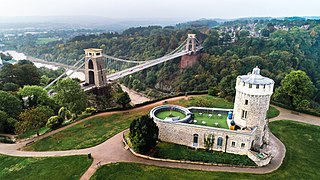
Bristol is a city, unitary authority area and ceremonial county in South West England, the most populous city in the region. Built around the River Avon, it is bordered by the ceremonial counties of Gloucestershire to the north and Somerset to the south. The county is in the West of England combined authority area, which includes the Greater Bristol area and nearby places such as Bath.

Bristol Temple Meads is the oldest and largest railway station in Bristol, England. It is located 118 miles 31 chains away from London Paddington. It is an important transport hub for public transport in the city; there are bus services to many parts of the city and surrounding districts, with a ferry to the city centre. Bristol's other major station, Bristol Parkway, is a more recent station on the northern outskirts of the conurbation. It is the busiest station in South West England.

Yerba Buena Island sits in San Francisco Bay within the borders of the City and County of San Francisco. The Yerba Buena Tunnel runs through its center and connects the western and eastern spans of the San Francisco–Oakland Bay Bridge, linking the city with Oakland, California. Treasure Island is connected by a causeway to Yerba Buena Island. According to the United States Census Bureau, Yerba Buena Island and Treasure Island together have a land area of 0.901 square miles (2.33 km2) with a total population of 2,500 as of the 2010 census.

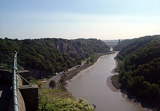
The River Avon is a river in the southwest of England. To distinguish it from a number of other rivers of the same name, it is often called the Bristol Avon. The name 'Avon' is loaned from an ancestor of the Welsh word afon, meaning 'river'.

Bristol Zoo was a zoo in the city of Bristol in South West England. The zoo's stated mission was to "maintain and defend" biodiversity through breeding endangered species, conserving threatened species and habitats and promoting a wider understanding of the natural world".

Newport is a city and county borough in Wales, situated on the River Usk close to its confluence with the Severn Estuary, 12 mi (19 km) northeast of Cardiff. The population grew considerably between the 2011 and the 2021 census, rising from 145,700 to 159,587, the largest growth of any unitary authority in Wales. Newport is the third-largest principal authority with city status in Wales, and sixth most populous overall. Newport became a unitary authority in 1996 and forms part of the Cardiff-Newport metropolitan area, also known as the Cardiff Capital Region.

Avonmouth is a port and outer suburb of Bristol, England, facing two rivers: the reinforced north bank of the final stage of the Avon which rises at sources in Wiltshire, Gloucestershire and Somerset; and the eastern shore of the Severn Estuary. Strategically the area has been and remains an important part of the region's maritime economy particularly for larger vessels for the unloading and exporting of heavier goods as well as in industry including warehousing, light industry, electrical power and sanitation. The area contains a junction of and is connected to the south by the M5 motorway and other roads, railway tracks and paths to the north, south-east and east.
Lodge is originally a term for a relatively small building, often associated with a larger one.

The Downs are an area of public open limestone downland in Bristol, England. They consist of Durdham Down to the north and east and Clifton Down to the south, separated by Stoke Road.

The Avon Gorge is a 1.5-mile (2.5-kilometre) long gorge on the River Avon in Bristol, England. The gorge runs south to north through a limestone ridge 1.5 miles (2.4 km) west of Bristol city centre, and about 3 miles (5 km) from the mouth of the river at Avonmouth. The gorge forms the boundary between the unitary authorities of North Somerset and Bristol, with the boundary running along the south bank. As Bristol was an important port, the gorge formed a defensive gateway to the city.
Cribbs Causeway is both a road in South Gloucestershire, England, running north of the city of Bristol, and the adjacent area which is notable for its out-of-town shopping and leisure facilities. The retail and leisure complex takes its name from the road, and includes retail parks, supermarkets, an enclosed shopping centre known as The Mall, an ice-rink, Vue, a cinema, Hollywood Bowl, a ten-pin bowling venue, and a gym.

Blackboy Hill was named after the Australian native "black boy" plants, Xanthorrhoea preissii, which dominated the site which is now absorbed into Greenmount, Western Australia.

Severn View services, formerly Aust Services is a motorway service station on the M48 motorway near the village of Aust, northwest of Bristol, in South West England. It is owned by Moto.

Whiteladies Road is a main road in Bristol, England. It runs north from the Victoria Rooms to Durdham Down, and separates Clifton on the west side from Redland and Cotham on the east. It forms part of the A4018.

Bedminster railway station is on the Bristol to Exeter line and serves the districts of Bedminster and Windmill Hill in Bristol, south-west England. It is 0.9 miles (1.4 km) to the west of Bristol Temple Meads, and 119 miles (192 km) from London Paddington. Its three letter station code is BMT. It was opened in 1871 by the Bristol and Exeter Railway, was resited slightly further to the west in 1884 and was rebuilt in 1932. The station, which has three through-lines and two island platforms, but minimal facilities, is managed by Great Western Railway who operates all train services that serve the station, mainly an hourly service between Bristol Parkway and Weston-super-Mare.
Blackboy Hill may refer to:

Old Cleeve is a village 5 miles (8 km) south east of Minehead in the Somerset West and Taunton district of Somerset, England, and also a civil parish. The civil parish of Old Cleeve covers an area of 2,092 hectares and includes the villages of Old Cleeve, Roadwater and Washford as well as hamlets such as Bilbrook, Chapel Cleeve, Golsoncott and Leighland Chapel. Approximately half the parish lies within the Exmoor National Park. The remaining half is on the southern edge of Exmoor. The village has been in existence since the early 13th century. The village held its first council meeting in 1711. By the 1720s the village had several churches, in which to meet. The town hall was built in 1727. The first church here was built in 1694, built by the Eastern Christian Society. This church was destroyed in a fire in 1847, and has been rebuilt and restored. In 2011, the population of the parish was 1,672.

The Bristol underground scene is a cultural movement in Bristol beginning in the early 1980s. The scene was born out of a lack of mainstream clubs catering for the emergence of hip hop music, with street and underground parties a mainstay. Crews formed playing hip hop in disused venues with sound systems borrowed from the reggae scene: City Rockers, 2 Bad, 2 Tuff, KC Rock, UD4, FBI, Dirty Den, Juice Crew, Rene & Bacus, Soul Twins, KC Rock, Fresh 4, and the Wild Bunch were among them. These names were the precursors to the more well known names that came from this scene. It is characterized by musicians and graffiti artists. The scene was influenced by the city's multiculturalism, political activism, and the arts movements of punk, reggae, hip hop, hippies and new age.

The Centre is a public open space in the central area of Bristol, England, created by covering over the River Frome. The northern end of The Centre, known as Magpie Park, is skirted on its western edge by Colston Avenue; the southern end is a larger paved area bounded by St Augustine's Parade to the west, Broad Quay the east, and St Augustine's Reach to the south, and bisected by the 2016 extension of Baldwin Street. The Centre is managed by Bristol City Council.

The Narragansett Trail is a 16-mile hiking trail located in Connecticut. It is one of the Blue-Blazed Trails maintained by the Connecticut Forest and Park Association, the Narragansett Council, and The Rhode Island chapter of Scouts BSA.


