Bologoye (Бологое) is the name of several inhabited localities in Russia.
The classification system of the types of inhabited localities in Russia, the former Soviet Union, and some other post-Soviet states has certain peculiarities compared with the classification systems in other countries.

Russia, officially the Russian Federation, is a transcontinental country in Eastern Europe and North Asia. At 17,125,200 square kilometres (6,612,100 sq mi), Russia is the largest country in the world by area, covering more than one-eighth of the Earth's inhabited land area, and the ninth most populous, with about 146.77 million people as of 2019, excluding Crimea. About 77% of the population live in the western, European part of the country. Russia's capital, Moscow, is the largest metropolitan area in Europe proper and one of the largest cities in the world; other major cities include Saint Petersburg, Novosibirsk, Yekaterinburg and Nizhny Novgorod. Extending across the entirety of Northern Asia and much of Eastern Europe, Russia spans eleven time zones and incorporates a wide range of environments and landforms. From northwest to southeast, Russia shares land borders with Norway, Finland, Estonia, Latvia, Lithuania and Poland, Belarus, Ukraine, Georgia, Azerbaijan, Kazakhstan, China, Mongolia and North Korea. It shares maritime borders with Japan by the Sea of Okhotsk and the U.S. state of Alaska across the Bering Strait. However, Russia recognises two more countries that border it, Abkhazia and South Ossetia, both of which are internationally recognized as parts of Georgia.
- Urban localities
- Bologoye, Tver Oblast, a town in Bologovsky District of Tver Oblast

Bologoye is a town and the administrative center of Bologovsky District in Tver Oblast, Russia, as well as a major railway hub. It is located approximately halfway between Moscow and St. Petersburg on the railway route connecting the two cities. Population: 23,494 (2010 Census); 26,612 (2002 Census); 35,926 (1989 Census).

Bologovsky District is an administrative and municipal district (raion), one of the thirty-six in Tver Oblast, Russia. It is located in the north of the oblast and borders with Borovichsky District of Novgorod Oblast in the north, Udomelsky District in the east, Vyshnevolotsky District in the southeast, Firovsky District and the urban-type settlement of Ozyorny in the south, Valdaysky District of Novgorod Oblast in the west, and with Okulovsky District, also of Novgorod Oblast, to the northwest. The area of the district is 2,463.7 square kilometers (951.2 sq mi). Its administrative center is the town of Bologoye. Population: 38,557 ; 18,757 (2002 Census); 32,790 (1989 Census). The population of Bologoye accounts for 60.9% of the district's total population.

Tver Oblast is a federal subject of Russia. Its administrative center is the city of Tver. From 1935 to 1990, it was known as Kalinin Oblast, named after Mikhail Kalinin. Population: 1,353,392.
- Rural localities
- Bologoye, Omsk Oblast, a selo in Rozovsky Rural Okrug of Russko-Polyansky District in Omsk Oblast
- Bologoye, Pskov Oblast, a village in Novosokolnichesky District of Pskov Oblast
Russko-Polyansky District is an administrative and municipal district (raion), one of the thirty-two in Omsk Oblast, Russia. It is located in the south of the oblast. The area of the district is 3,300 square kilometers (1,300 sq mi). Its administrative center is the urban locality of Russkaya Polyana. Population: 19,333 ; 24,481 (2002 Census); 26,959 (1989 Census). The population of the administrative center accounts for 30.6% of the district's total population.

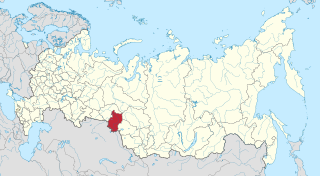
Omsk Oblast is a federal subject of Russia, located in southwestern Siberia. The oblast has an area of 139,700 square kilometers (53,900 sq mi). Its population is 1,977,665 with the majority, 1.15 million, living in Omsk, the administrative center.

Novosokolnichesky District is an administrative and municipal district (raion), one of the twenty-four in Pskov Oblast, Russia. It is located in the south of the oblast and borders with Loknyansky District in the north, Velikoluksky District in the east, Nevelsky District in the south, Pustoshkinsky District in the west, and with Bezhanitsky District in the northwest. The area of the district is 1,616.0 square kilometers (623.9 sq mi). Its administrative center is the town of Novosokolniki. Population: 14,776 (2010 Census); 19,389 ; 21,319 (1989 Census). The population of Novosokolniki accounts for 54.9% of the district's total population.
| This article includes a list of related items that share the same name (or similar names). If an internal link incorrectly led you here, you may wish to change the link to point directly to the intended article. |
