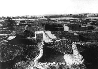
Boumdeid بومديد | |
|---|---|
 | |
| Country | |
| Area | |
| • Total | 1,670 sq mi (4,320 km2) |
| Population (2013 census) | |
| • Total | 7,917 |
| • Density | 4.7/sq mi (1.8/km2) |
Boumdeid is a department of Assaba Region in Mauritania. [1] [2]
Boumdeid بومديد | |
|---|---|
 | |
| Country | |
| Area | |
| • Total | 1,670 sq mi (4,320 km2) |
| Population (2013 census) | |
| • Total | 7,917 |
| • Density | 4.7/sq mi (1.8/km2) |
Boumdeid is a department of Assaba Region in Mauritania. [1] [2]
The Boumdeid department is made up of following municipalities:
In 2013, the entire population of the Boumdeid Department has a total of 7,917 inhabitants (3,860 men and 4,057 women). [3]

Demographic features of the population of Mauritania include population density, ethnicity, education level, health of the populace, economic status, religious affiliations and other aspects.

Tagant is a region in south-central Mauritania named for the Tagant Plateau. Its capital is Tidjikdja. Other major cities/towns include Tichit and Rachid, Nbeika. The region borders the Mauritanian regions of Adrar to the north, Hodh Ech Chargui to the east, Hodh El Gharbi and Assaba to the south and Brakna to the west. The Aoukar basin, which formerly gave name to the greater region, is located in the southern part of Tagant.

Hodh El Gharbi is a region in southern Mauritania, with an area of 53,400 square km. The population at the 2013 census was 294,109. Its capital is Aïoun. The region borders the Mauritanian regions of Tagant to the north, Hodh Ech Chargui to the east and Assaba to the west. To the south in borders Mali, and a part of Malian territory protrudes into the region. The Aoukar basin, which formerly gave name to a greater region, is located in the northern and central part of Hodh El Gharbi, extending eastwards.

Guidimaka is the southernmost region of Mauritania. Its capital is Sélibaby. The region borders the Mauritanian region of Assaba to the north-east, Mali to the south-east, Senegal to the south-west and the Mauritanian Gorgol Region to the west.

Gorgol is a region in southern Mauritania. Its capital is Kaédi and the Gorgol River forms parts of the landscape. Other major cities/towns include Mbout and Maghama. The region borders the Mauritanian regions of Brakna and Assaba to the north, the Mauritanian region of Guidimaka to the south-east and Senegal to the south-west. The Senegal River runs along the region's border with Senegal.

Brakna is a region in south-west Mauritania. Its capital is Aleg and its other major cities/towns include Boghé. The region borders the Mauritanian regions of Tagant to the north-east, Assaba and Gorgol to the south-east, and Trarza to the north-west. The Sénégal River in the south-west runs along the region's border with Senegal.

Assaba is a region in southern Mauritania, covering an area of 36,600 square km. It had a population of 325,897 at the 2013 Census. Its capital is Kiffa. Other major cities/towns include Guerou. The region borders the Mauritanian regions of Brakna and Tagant to the north, the Mauritanian region of Hodh El Gharbi to the east, Mali to the south and the Mauritanian regions of Gorgol and Guidimaka to the west. The Aoukar basin, which formerly gave name to the greater region, is located in the north and the east of the central part of Assaba.

Tidjikja is the capital of the Tagant region of central Mauritania, lying on the Tagant plateau. Founded in 1680, it has a population of around 11,000 people.

The Tagant Plateau is located in eastern Mauritania, forming a stony part of the Sahara Desert. The Tagant Region, a national administrative division, is named after the plateau.

Ksar el Barka is a ruined town in Mauritania. In 2013 it had a population of 7,037.
Articles related to Mauritania include:

Mauritania, officially the Islamic Republic of Mauritania, is a sovereign country in Northwest Africa. It is bordered by the Atlantic Ocean to the west, Western Sahara to the north and northwest, Algeria to the northeast, Mali to the east and southeast, and Senegal to the southwest. By land area, Mauritania is the 11th-largest country in Africa and the 28th-largest in the world, and 90% of its territory is situated in the Sahara. Most of its population of approximately 4.3 million lives in the temperate south of the country, with roughly one-third concentrated in the capital and largest city, Nouakchott, located on the Atlantic coast.
Aioun or El Aioun is a town and commune in the Assaba Region of southern Mauritania near the border with Mali. It has a population of 22,796.
Ajar is a town and commune in the south-central Assaba region of Mauritania.
Guerou is a city and department in south-central Mauritania. Guerou is the region's largest city after Kiffa, capital of Assaba Region. It is located at around 16°49′N11°50′W.

Aftout or Barkewol is a department of Assaba Region in Mauritania.

Guerou is a department of Assaba Region in Mauritania.

Kankossa is a department of Assaba Region in Mauritania.

Kiffa is a department of Assaba Region in Mauritania.

Mohamed Ould Cheikh Mohamed Ahmed Ould Ghazouani, also known as Ghazouani and Ould Ghazouani, is the 9th President of Mauritania, having assumed office on 1 August 2019. He is also a retired Mauritanian Army general.
Boumdeid Constituency occupies less area than the department. In 2018 there were a total of 31,419 registered voters and they have 1 seat in congress.