
Cumbria is a ceremonial and non-metropolitan county in North West England. The county and Cumbria County Council, its local government, came into existence in 1974 after the passage of the Local Government Act 1972. Cumbria's county town is Carlisle, in the north of the county. The only other major urban area is Barrow-in-Furness on the south-western tip of the county.

Ulverston is a market town and a civil parish in the South Lakeland district of Cumbria, England. In the 2001 census the parish had a population of 11,524, increasing at the 2011 census to 11,678. Historically in Lancashire, it lies a few miles south of the Lake District National Park and just north-west of Morecambe Bay, within the Furness Peninsula. Lancaster is 51 miles (82 km) to the east, Barrow-in-Furness 8 miles (13 km) to the south-west and Kendal 33 miles (53 km) to the north-east.

Scafell Pike is the highest and the most prominent mountain in England, at an elevation of 978 metres (3,209 ft) above sea level. It is located in the Lake District National Park, in Cumbria, and is part of the Southern Fells and the Scafell massif.

Alston is a town in Cumbria, England, within the civil parish of Alston Moor on the River South Tyne. It shares the title of the 'highest market town in England', at about 1,000 feet (300 m) above sea level, with Buxton, Derbyshire. Despite its altitude, the town is easily accessible via the many roads which link the town to Weardale, Teesdale, and towns in Cumbria such as Penrith via Hartside Pass, as well as Tynedale. Historically part of Cumberland, Alston lies within the North Pennines, a designated Area of Outstanding Natural Beauty. Much of the town centre is a designated Conservation Area which includes several listed buildings.
Newbiggin may refer to several places in England:

The River Lune is a river 53 miles (85 km) in length in Cumbria and Lancashire, England.
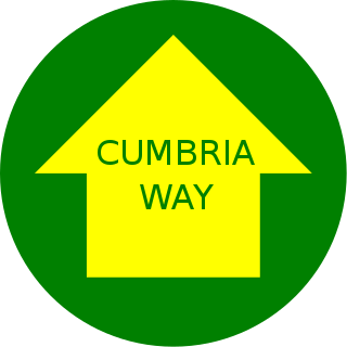
The Cumbria Way is a linear 112-kilometre (70-mile) long-distance footpath in Cumbria, England. The majority of the route is inside the boundaries of the Lake District National Park. Linking the two historic Cumbrian towns of Ulverston and Carlisle, it passes through the towns of Coniston and Keswick. The route cuts through Lakeland country via Coniston Water, Langdale, Borrowdale, Derwent Water, Skiddaw Forest and Caldbeck. It is a primarily low-level route with some high-level exposed sections.

Allonby is a village on the coast of the Allerdale district in Cumbria, England. The village is on the B5300 road 5 miles (8.0 km) north of Maryport and 8 miles (13 km) south of Silloth. The village of Mawbray is 3 miles (4.8 km) to the north, and 3.5 miles (5.6 km) to the east is the village of Westnewton. The county town of Carlisle is located 26 miles (42 km) to the north east. Other nearby settlements include Crosscanonby, Edderside, Hayton, and Salta.

Dent is a village and civil parish in Cumbria, England, within the historic boundaries of the West Riding of Yorkshire. It lies in Dentdale, a narrow valley on the western slopes of the Pennines within the Yorkshire Dales National Park, 4 miles (6 km) south east of Sedbergh and 8 miles (13 km) north east of Kirkby Lonsdale. At the 2011 census, Dent and Middleton had a total population of 785.

Holme is a village and civil parish in the South Lakeland district of Cumbria, England, about 2 miles (3.2 km) north of Burton-in-Kendal and 3 miles (4.8 km) south east of Milnthorpe. The parish had a population of 1,167 at the 2001 census, increasing to 1,486 at the 2011 Census.
Garsdale is a dale or valley in the south east of Cumbria, England, historically a part of the West Riding of Yorkshire. It is now within the South Lakeland local government district, but is still a "Yorkshire Dale" for planning purposes. In the 2001 census the parish had a population of 202, decreasing at the 2011 census to 191.
Brackenthwaite is a settlement and former civil parish in Lake District of England. It is situated some 6 miles (9.7 km) south of Cockermouth in the county of Cumbria. It should not be confused with the identically named settlement of Brackenthwaite that is situated some 3 miles (4.8 km) south-east of the town of Wigton in the same county. In 1931 the parish had a population of 89.
The English county of Cumbria is located in North West England and has a population of 496,200. Cumbria has an area of 6,768 km², making the county England's 3rd largest county. With only 73 inhabitants per km², it is the country's second least densely populated county. People from Cumbria are known as Cumbrians and they speak a variety of the Cumbrian dialect to the north, whilst a Lancashire accent is more prominent in the South. Along with Lancashire to the south, Cumbria is bordered with Scotland to the north, the Irish Sea to the west, Northumberland to the north-east, County Durham to the east and North Yorkshire to the south-east.

Gilcrux is a small village and civil parish in the ceremonial county of Cumbria, England, and historically part of Cumberland. It is situated just outside the Lake District National Park.
Distington is a large village and civil parish in Cumbria, England, 3 miles (4.8 km) south of Workington and 4 miles (6.4 km) north of Whitehaven. Historically a part of Cumberland, the civil parish includes the nearby settlements of Common End, Gilgarran and Pica. The parish had a population of 2,247 in the 2001 census, increasing slightly to 2,256 at the 2011 census.
Brackenthwaite is a settlement situated some 3 miles (4.8 km) south-east of the town of Wigton in the English county of Cumbria. It should not be confused with the identically named settlement of Brackenthwaite that is situated some 6 miles (9.7 km) south of Cockermouth in the same county.
Rosthwaite, Cumbria may refer to two different settlements in the English county of Cumbria:
Little Strickland is a small village and civil parish in the Eden district of Cumbria, England. It is about 7 miles (11 km) from Penrith and 8 miles (13 km) from the small town of Appleby-in-Westmorland. The village has one place of worship and a telephone box. The population of the civil parish as taken at the 2011 Census was less than 100. Details are included in the parish of Great Strickland. On 1 April 2019 Thrimby parish was merged with Little Strickland.

Nether Denton is a scattered settlement and civil parish in rural Cumbria, England, situated about 12 miles (19 km) north-east of Carlisle, by the A69 road. The population of the parish taken at the 2011 census was 415. Nether Denton is a couple of miles south-west of the village of Upper Denton. The parish contains the village of Low Row.