Related Research Articles
Hesleden is a village in County Durham, England. It is situated to the south of Peterlee. It has a large pond situated at the bottom next to the Hart to Haswell Walkway. Hesleden also has a park and Dene to walk through and explore.

Rutherglen and Hamilton West is a burgh constituency of the House of Commons of the Parliament of the United Kingdom, which was created for the 2005 general election. It covers almost all of the former constituency of Glasgow Rutherglen and most of the former constituency of Hamilton South, and it elects one Member of Parliament (MP) by the first-past-the-post system of election. The current MP is Gerard Killen of the Labour Co-op party, who was first elected at the 2017 snap general election.

East Kilbride, Strathaven and Lesmahagow is a county constituency of the House of Commons of the Parliament of the United Kingdom, which was first used in the general election of 2005. It replaced East Kilbride and some of Clydesdale, and it elects one Member of Parliament (MP) by the first past the post system of election.
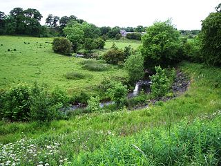
The North Calder Water is a river in North Lanarkshire, Scotland. It flows for 12 miles (19 km) from the Black Loch via the Hillend Reservoir, Caldercruix, Airdrie and Calderbank to the River Clyde at Daldowie, south-east of Glasgow. For the last 2 miles (3.2 km) of its course, it forms part of the boundary between North Lanarkshire and Glasgow.
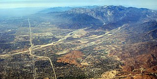
Lytle Creek, California, is an approximately 18-mile-long (29 km) stream in southwestern San Bernardino County near the city of San Bernardino. It is a tributary of Warm Creek, a tributary of the Santa Ana River. The Mormon settlers of San Bernardino named the stream "Lytle Creek" after their leader, Captain Andrew Lytle.
Loop 332 was a state highway in Liberty Hill, Texas, in the United States, following an old route for State Highway 29. Loop 332 ran from SH 29 southeastward along Main street to an intersection with RM 1869, also known as Liveoak street. Loop 332 then continued on Main Street to SH 29. Its length was certified in 2005 as being 1.99 miles.
Westfield is a suburb of Edinburgh, the capital of Scotland. It is north of A71.

Upperton is a village in North Lanarkshire, Scotland, near Airdrie and Cumbernauld, about 20 miles (32 km) north-east of Glasgow. It lies close to the B803 between Greengairs and Slamannan. Other nearby roads include Hulks Road towards the A73, Fannyside Road to Abronhill and the road to Caldercruix via Longriggend. The Avon Water flows through the village and meets the Shielhill Burn, a tributary of the River Avon, just outside the village. William Forrest's 1816 map of Lanarkshire shows the site as Upper Town. The Ordnance Survey map sites "Uppertown" on Shiel Hill.

ALSIB was the Soviet Union portion of the Alaska-Siberian air road receiving Lend-Lease aircraft from the Northwest Staging Route. Aircraft manufactured in the United States were flown over this route for World War II combat service on the Eastern Front.

Tannochside is an area of Uddingston approximately 8 miles (13 km) south-east of Glasgow, Scotland, UK. Although considered part of Uddingston, it lies within a separate local authority area. Tannochside is contained within the boundaries of North Lanarkshire council whereas the original village of Uddingston is in South Lanarkshire. Tannochside is between the Birkenshaw and Viewpark areas of Uddingston. Tannochside is part of the Greater Glasgow conurbation. It is often debated as to where the borders lie between Tannochside and other nearby areas of Uddingston such as Viewpark and Birkenshaw. One suggested border is Aitkenhead Road, a main road which splits housing areas adjacent to Scotmid and a local water tower.

Wattston is a village on the B803, west of Greengairs in North Lanarkshire, Scotland. Between them Wattston and Greengairs have about 1,190 residents. It is around 4 km south of Cumbernauld, and 4 km north of Airdrie. Other places nearby include Caldercruix, Longriggend, Riggend and Slamannan.
Symington is a small village in South Lanarkshire, Scotland, 3 miles (5 km) southwest of Biggar, 10 miles (16 km) east of Douglas and 13 miles (21 km) southeast of Carluke. Geographical features near Symington include Tinto Hill, the Coulter Hills and the River Clyde. A map by Pont in 1596 showed two St John's Kirks in a small settlement, and another map by Roy in 1754 showed a mill to the east.

Hughenden is a multi-sports venue in the Hyndland area of Glasgow, Scotland. It has been the home since 1924 of Hillhead Sports Club, a private members' club catering for cricket, rugby union and tennis. Hughenden is best known as a rugby venue and is the home ground of Hillhead Jordanhill RFC. It was also used as the home ground of the professional Glasgow Rugby team from 1996 to 2005 and again from 2006 to 2007. The main rugby ground has a capacity of 6,000.
The Rural Municipality of South Cypress is a former rural municipality (RM) in the Canadian province of Manitoba. It was originally incorporated as a rural municipality on December 22, 1883. It ceased on January 1, 2015 as a result of its provincially mandated amalgamation with the Village of Glenboro to form the Municipality of Glenboro – South Cypress.

Aïn Larbaâ District is a district of Aïn Témouchent Province, Algeria.

The Blauberge or Blauberg are a mountain range in the Bavarian Prealps on the border between the states of Bavaria in Germany and Tyrol in Austria. Its highest summit is the Halserspitze, or Halserspitz at 1,862 m.

Clyde Bridge, not to be confused with the similarly named Clyde's Bridge further upstream, is a road bridge built in 1831 spanning the River Clyde in Motherwell, Scotland. The bridge carries the A723 from Motherwell to Hamilton and the Hamilton Interchange junction of the M74 motorway. In 2011, South Lanarkshire Council undertook a £38,000 renovation of the steel girder bridge to strengthen the underwater supports, following Government advice after several bridges were washed away in flooding.

Daer Water is one of the streams located in the watershed region which surrounds the River Clyde in Scotland. It begins in the Lowther Hills about 600 metres (2,000 ft) above sea level and joins with Portrail Water near the Lanarkshire town of Elvanfoot at which point they become the River Clyde. The Daer Water flows through the Daer Reservoir which supplies water to the nearby towns of Lanarkshire.
Irvine is an unincorporated community in Converse County, in the U.S. state of Wyoming.
Spring Creek is a stream in Maries and Phelps counties of Missouri. It is a tributary of Gasconade River.
References
- The geographic coordinates are from the Ordnance Survey.
| Wikimedia Commons has media related to Braehead, Carnwath . |
| This South Lanarkshire location article is a stub. You can help Wikipedia by expanding it. |