Related Research Articles

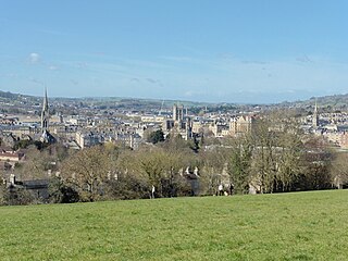
Bath is a city in Somerset, England, known for and named after its Roman-built baths. At the 2021 Census, the population was 94,092. Bath is in the valley of the River Avon, 97 miles (156 km) west of London and 11 miles (18 km) southeast of Bristol. The city became a UNESCO World Heritage Site in 1987, and was later added to the transnational World Heritage Site known as the "Great Spa Towns of Europe" in 2021. Bath is also the largest city and settlement in Somerset.

Avon was a non-metropolitan and ceremonial county in the west of England that existed between 1974 and 1996. The county was named after the River Avon, which flows through the area. It was formed from the county boroughs of Bristol and Bath, together with parts of the administrative counties of Gloucestershire and Somerset.
Bath and North East Somerset (B&NES) is a unitary authority district in Somerset, South West England. Bath and North East Somerset Council was created on 1 April 1996 following the abolition of the county of Avon. It is part of the ceremonial county of Somerset.

The A303 is a trunk road in southern England, running between Basingstoke in Hampshire and Honiton in Devon via Stonehenge. Connecting the M3 and the A30, it is part of one of the main routes from London to Devon and Cornwall. It is a primary A road throughout its length, passing through five counties.

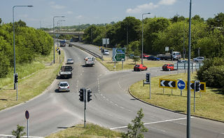
The A46 is a major A road in England. It starts east of Bath, Somerset and ends in Cleethorpes, Lincolnshire, but it does not form a continuous route. Large portions of the old road have been lost, bypassed, or replaced by motorway development. Between Leicester and Lincoln the road follows the course of the Roman Fosse Way, but between Bath and Leicester, two cities also linked by the Fosse Way, it follows a more westerly course.
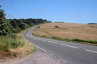
The A36 is a trunk road and primary route in southwest England that links the port city of Southampton to the city of Bath. At Bath, the A36 connects with the A4 to Bristol, thus providing a road link between the major ports of Southampton and Bristol. It also provides a link between Bristol and London via the A303.

The A27 is a major road in England. It runs from its junction with the A36 at Whiteparish in the county of Wiltshire, follows the south coast of Hampshire and West Sussex, and terminates at Pevensey in East Sussex.

The M32 is a 4.4-mile-long (7.1 km) motorway in South Gloucestershire and Bristol, England. It provides a link from the M4, a major motorway linking London and South Wales, to Bristol city centre and is maintained by National Highways, the national roads body.
The A259 is a road on the south coast of England passing through Hampshire, West Sussex, East Sussex, and Kent, and is the longest Zone 2 A road in Great Britain. The main part of the road connects Brighton, Peacehaven, Eastbourne, Hastings, Rye, and Folkestone.

The A403 is a main road linking Bristol with the Severn Estuary. It runs from junction 1 of the M48 at Aust to the docks at Avonmouth. After the Severn Bridge was opened in 1966, the A403 was constructed in 1969 and 1970 to provide a direct route between the M4 motorway and Avonmouth. It is an important route for the local industries, allowing easy access between Wales and this part of England. It was financed by Gloucestershire County Council with a £387,000 grant from the Ministry of Transport and was initially known as the Avonmouth Aust Coast Road.

The Somerset and Dorset Joint Railway, was an English railway line jointly owned by the Midland Railway (MR) and the London and South Western Railway (LSWR) that grew to connect Bath and Bournemouth, with a branch in Somerset from Evercreech Junction to Burnham-on-Sea and Bridgwater. Strictly speaking, its main line only ran from Bath Junction to Broadstone, as the Bath to Bath Junction section was wholly owned by the MR and the Broadstone to Bournemouth section was owned by the LSWR.

The A350 is a north–south primary route in southern England, that runs from the M4 motorway in Wiltshire to Poole in Dorset.
Batheaston is a village and civil parish 2 miles (3.2 km) east of the English city of Bath, on the north bank of the River Avon. The parish had a population of 2,735 in 2011. The northern area of the parish, on the road to St Catherine, is an area known as Northend.

The A5036 is a road in Merseyside, England, which comprises two sections separated by a gap of around 1.6 miles (2.6 km).
The A4174 is a major ring road in England which runs around the northern and eastern edge of Bristol, mainly in South Gloucestershire, and through the southern suburbs of the city. When it was first conceived it was planned to circle the whole of Bristol, and is commonly referred to as the "Avon Ring Road", or less accurately the "Bristol Ring Road", on road signs. The road does not circle the whole city, instead covering roughly half of the route. It is broken in part where it is concurrent with the A4.
Bristol is a city in south west England, near the Bristol Channel coast, approximately 106 miles (170 km) west of London. Several factors have influenced the development of its transport network. It is a major centre of employment, retail, culture and higher education, has many historic areas, and has a history of maritime industry. The city has a population of 450,000, with a metropolitan area of 650,000, and lies at the centre of the former County of Avon, which includes many dormitory towns, and has a population of one million.

The earliest known infrastructure for transport in Somerset is a series of wooden trackways laid across the Somerset Levels, an area of low-lying marshy ground. To the west of this district lies the Bristol Channel, while the other boundaries of the county of Somerset are along chains of hills that were once exploited for their mineral deposits. These natural features have all influenced the evolution of the transport network. Roads and railways either followed the hills, or needed causeways to cross the Levels. Harbours were developed, rivers improved, and linked to sources of traffic by canals. Railways were constructed throughout the area, influenced by the needs of the city of Bristol, which lies just to the north of Somerset, and to link the ports of the far south-west with the rest of England.

MetroWest, formerly known as the Greater Bristol Metro, is a project to improve the rail services in Bristol, England, and the surrounding region. It was first proposed at First Great Western's Stakeholder Event in March 2008. The aim of the project is to develop half-hourly services through central Bristol which will also serve the surrounding West of England region. Transport campaigning groups Friends of Suburban Bristol Railways (FoSBR) and Transport for Greater Bristol are actively supporting the proposal, as are the three unitary authorities under the West of England Combined Authority and North Somerset Council.

Bristol Supertram was a proposed light rail system for the Bristol and South Gloucestershire regions of England. In 2001, the project was given backing from the government to build a line that would link the city centre with the North Bristol region, but the project was cancelled in 2004.

Road building was central to planning policy for much of the 20th century in Bristol, England. The planned road network evolved over time but at its core was a network of concentric ring roads and high-capacity radial roads.
References
- ↑ Christian Wolmar (2005). On the wrong line: how ideology and incompetence wrecked Britain's railways. Aurum. p. 280. ISBN 978-1-85410-998-9.
- 1 2 3 "Bristol/Bath to South Coast Study — final reports published". Government News. 13 February 2004. Archived from the original on 14 April 2013. Retrieved 28 September 2012.
{{cite news}}: CS1 maint: unfit URL (link) - ↑ "Hansard 6 Jan 2004 : Column 218W". Hansard . Parliament of the United Kingdom. 6 January 2004. Retrieved 28 September 2012.
- ↑ Federation of Bath Residents' Associations (21 June 2012). "Councils must work together on HGV problem". Bath Chronicle . Archived from the original on 14 September 2013. Retrieved 7 June 2013.
- ↑ "Cost cutting claims hit Bath link-road". Commercial Motor . 22 April 2004. Archived from the original on 26 February 2015. Retrieved 7 June 2013.
- ↑ Nash, Sally (22 April 2004). "Cost cutting claims hit Bath link-road". Commercial Motor . Vol. 199, no. 5076. p. 14. Archived from the original on 26 February 2015. Retrieved 7 June 2013. – via EBSCOhost (subscription required)