This is a list of the extreme points of the United Kingdom: the points that are farther north, south, east or west than any other location. Traditionally the extent of the island of Great Britain has stretched "from Land's End to John o' Groats".

Loch a' Chàirn Bhàin, or Loch Cairnbawn, is a sea inlet off Eddrachillis Bay on the west coast of the Scottish Highlands north of Ullapool. It was the site of the World War Two midget submarine training base, Port HHZ.
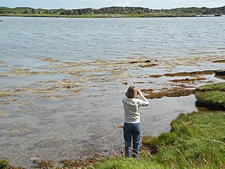
North Lochs,, an area in eastern Lewis, Outer Hebrides, Scotland, is named for the many lochans which dot the landscape. Because of its largely undulating and rocky terrain, it is sparsely populated apart from flat ground near the coast. Its communities support traditional crofting and fishing.

The River Thurso has Loch Rumsdale in Caithness as its source, about 26 kilometres (16 mi) south and 14 kilometres (8.7 mi) west of the burgh of Thurso, Caithness, and about 2 kilometres (1.2 mi) south of the railway line linking the burghs of Thurso and Wick with Inverness. At its source and until it reaches Loch More the river is known also as Strathmore Water. Caithness is in the Highland area of Scotland.

Seaforth Island is an uninhabited island in the Outer Hebrides of Scotland. Unlike many other islands of the Outer Hebrides which are mainly surrounded by open sea, Seaforth Island lies in a narrow fjord-like sea loch named Loch Seaforth, 8 kilometres (5.0 mi) from the open waters of The Minch.

Eddrachillis Bay is a bay on the north-west coast of Sutherland, Scotland. It lies north of Assynt and is at the mouth of the Loch a' Chàirn Bhàin, also known as the Loch Cairnbawn. It is neighboured by Eddrachillis, of which namesakes are shared.

HMS Sturgeon was an S-class submarine that entered service with the Royal Navy in 1932. Ordered in 1930, she was laid down at Chatham Dockyard in January 1931 and launched on 8 January 1932. Commissioned on 27 February 1933, Sturgeon was assigned to the 2nd Submarine Flotilla.
Eilean Mhealasta is an uninhabited island off the west coast of Lewis in the Outer Hebrides of Scotland. It takes its name from Mealista, a nearby township on Lewis.

Isle Ristol, the innermost of the Summer Isles in Scotland, is a Scottish Wildlife Trust Reserve.

Calbha Beag is an uninhabited island in Eddrachillis Bay, off Sutherland, Highland, Scotland. It is immediately to the west of Calbha Mor.
Oldany Island is an uninhabited island in Assynt, Sutherland, north-west Scotland.
Kilchoman is a small settlement and large parish on the Scottish island of Islay, within the unitary council of Argyll and Bute.

Loch Vennachar was an iron-hulled, three-masted clipper ship that was built in Scotland in 1875 and lost with all hands off the coast of South Australia in 1905. She spent her entire career with the Glasgow Shipping Company, trading between Britain and Australia. The company was familiarly called the "Loch Line", as all of its ships were named after Scottish lochs. The ship was named after Loch Venachar, in what was then Perthshire.
This is a list of the extreme points and extreme elevations in Scotland.

Lewis and Harris, or Lewis with Harris, is a Scottish island in the Outer Hebrides, around 24 miles (39 km) from the Scottish mainland.
Ceabhaigh is a small island in an arm of Loch Ròg on the west coast of Lewis in the Outer Hebrides of Scotland. It is about 25 hectares in extent. It is not known if the island was ever permanently inhabited.
Loch an t-Sailein is a sea loch at the southeast coast of Islay, Scotland. European seals frequently visit the shallow waters of this loch. A number of bird species are found along the shores of Loch an t-Sailein. The southeast coast of Islay has a highly irregular shoreline with many lochs and bays including Aros Bay somewhat to the east.

Hoy Sound is a body of salt water subject to tidal currents situated south of the town of Stromness in the Orkney archipelago of Scotland.
Laxford is a remote area in the far Northwest Highlands of Scotland around the River Laxford which runs northwest from Loch Stack to Laxford Bay. This bay is an inlet of Loch Laxford, a sea loch and Special Area of Conservation. The river is well known for its salmon fly fishing, indeed the name "Laxford" derives from the Norse for "salmon fjord". The area is important geologically, being a region of shear in the Moine Thrust. A road bridge, Laxford Bridge, crosses the river adjacent to the A838 and A894 roads, the road junction making the spot well known to tourists. Laxford is in Sutherland, in the Highland council area of Scotland; Scourie, 12 kilometres away, is the nearest village. The area forms part of the North West Sutherland National Scenic Area, one of 40 such areas in Scotland, which are defined so as to identify areas of exceptional scenery and to ensure its protection by restricting certain forms of development.

Loch Na Berie is a broch in the Outer Hebrides of Scotland, located approximately 400 yards from the shore, and is thought to have been located on an island as the land to the east is a marsh. The site is designated a Scheduled Monument.