
The Severn River is a tidal estuary 14 miles (23 km) long, located in Anne Arundel County in the U.S. state of Maryland, south of the Magothy River and north of the South River.

Fortune Bay—Cape La Hune is a provincial electoral district for the House of Assembly of Newfoundland and Labrador, Canada. When created in 1975 it was called Fortune-Hermitage. As of 2011, there are 6,053 eligible voters living within the district.
Baie Verte-Green Bay is a provincial electoral district for the House of Assembly of Newfoundland and Labrador, Canada. As of 2011 it has 8,067 eligible voters. The district was redistributed in 2015.
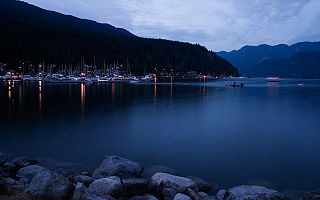
Deep Cove refers to the community in the easternmost part of the District of North Vancouver, in British Columbia, Canada, and is also the geographic name of the small bay beside the town. It is affectionately referred to as "The Cove" by local residents. Located at the foot of Mount Seymour, Deep Cove faces due east, fronting onto Indian Arm, a branch of the Burrard Inlet. The area is the traditional territory of the Tsleil-Waututh and Squamish Nations. Deep Cove is 13 kilometres (8.1 mi) from downtown Vancouver.

Smuggler Cove Marine Provincial Park is a provincial park in British Columbia, Canada.

Baie Verte is a town located on the north coast of the island portion of the Canadian province of Newfoundland and Labrador on the Baie Verte Peninsula.
Springdale is a town in Newfoundland and Labrador, Canada, which had a population of 2,971 people in 2016, up from 2,764 in the Canada 2006 Census. The community is located on the Northwestern shores of Hall's Bay, in Central Newfoundland, near the mouth of Indian River.
Renews–Cappahayden is a small fishing town on the southern shore of Newfoundland, 83 kilometres south of St. John's.
Indian Cove is a small two-street community just off Route 340 on New World Island in Newfoundland and Labrador, Canada. It is the last community before crossing the causeway to Twillingate. Before the construction of the causeway, there was a ferry that ran from Indian Cove to Twillingate. There is a hair salon and dog grooming services. Education is provided by New World Island Academy in Summerford and grocery shopping can be done in nearby Twillingate.

Humber Arm South is a town in the Canadian province of Newfoundland and Labrador. The town had a population of 1,854 in the Canada 2006 Census. The Town's Post Office is located in the section of the town referred to as Benoit's Cove. Humber Arm South is located in the Bay of Islands, and is in the Bay of Islands electoral district.
Confusion Bay is a natural bay located on the north-east tip of the Baie Verte Peninsula of the island of Newfoundland, in the Canadian province of Newfoundland and Labrador.
Musket Island Marine Provincial Park is a provincial park in British Columbia, Canada, located on the west side of Nelson Island, at the mouth of Jervis Inlet and near Earl's Cove in the Sunshine Coast region.

Purbeck's Cove is a settlement in Newfoundland and Labrador.
Pumbley Cove is a settlement in Newfoundland and Labrador.
Potupo District is one of 10 districts of River Gee County, Liberia. As of 2008, the population was 7,337.

The Lizard Lifeboat Station can refer to several Royal National Lifeboat Institution lifeboat stations located on The Lizard in Cornwall, United Kingdom. The first was established at the southernmost point of the peninsula in 1859. Since then successive stations have all been in operation at different locations on The Lizard. The current station is located at Kilcobben Cove 0.5 mi (0.80 km) east of the village of Lizard.
Paxtang Manor is an unincorporated community in Dauphin County, Pennsylvania in the Harrisburg-Carlisle Metropolitan Statistical Area, the latitude is 40.270, and the longitude -76.831, its elevation is 486 feet (148 m).
Flower's Cove is a town in the Canadian province of Newfoundland and Labrador. The town had a population of 270 in the Canada 2006 Census. It is known for its thrombolite fossils.
Division No. 1, Subdivision U is an unorganized subdivision on the Avalon Peninsula in Newfoundland and Labrador, Canada, in Division 1. It contains the unincorporated communities of Admiral's Cove, Bauline East, Bauline South, Burnt Cove, Devils Kitchen, Flat Rock, St. Michaels and Seal Cove.
Wahlsburg is an unincorporated community in Brown County, in the U.S. state of Ohio.


