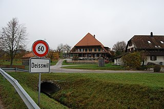
Buch bei Märwil is a village and former municipality in the district of Frauenfeld in the canton of Thurgau, Switzerland.
The canton of Thurgau is a northeast canton of Switzerland.
Switzerland, officially the Swiss Confederation, is a country situated in western, central and southern Europe. It consists of 26 cantons, and the city of Bern is the seat of the federal authorities. The sovereign state is a federal republic bordered by Italy to the south, France to the west, Germany to the north, and Austria and Liechtenstein to the east. Switzerland is a landlocked country geographically divided between the Alps, the Swiss Plateau and the Jura, spanning a total area of 41,285 km2 (15,940 sq mi). While the Alps occupy the greater part of the territory, the Swiss population of approximately 8.5 million people is concentrated mostly on the plateau, where the largest cities are to be found: among them are the two global cities and economic centres Zürich and Geneva.
It was first recorded in 1228 as Buch. From 1819 to 1953 it was named Buch bei Affeltrangen.
The municipality also contained the villages Azenwilen and Bohl. It had 245 inhabitants in 1850, which decreased to 160 in 1900 and 152 in 1910. It then increased to 221 in 1950, but declined again to 140 in 1990.
Bohl is a surname. Notable people with the surname include:
In 1995 the municipality was incorporated into the larger, neighboring municipality Affeltrangen.
Affeltrangen is a municipality in the district of Münchwilen in the canton of Thurgau in Switzerland.
There are several municipalities and communities have the name Langnau in Switzerland:
Wangen District was one of the 26 administrative districts in the canton of Bern, Switzerland. Its capital was the municipality of Wangen an der Aare. The district had an area of 129 km² and consisted of 23 municipalities. It was dissolved on 31 December 2009 when it and the Aarwangen District became part of the Oberaargau district.
Bezirk Graz-Umgebung is a district of the state of Styria in Austria. Since the 2015 Styria municipal structural reform, it consists of the following municipalities:
Rüti, which comes from the Old High German word riod, meaning clearing is a popular name for towns in the German speaking part of Switzerland. It can refer to the following:
Oberwil bei Büren is a municipality in the Seeland administrative district in the canton of Bern in Switzerland.
Deisswil bei Münchenbuchsee is a municipality in the Bern-Mittelland administrative district in the canton of Bern in Switzerland.
Braunau is a municipality in the district of Münchwilen in the canton of Thurgau in Switzerland.
Uesslingen-Buch is a municipality in the district of Frauenfeld in the canton of Thurgau in Switzerland.
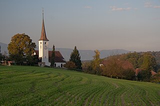
Buch may refer to:
Buch bei Frauenfeld is a village and former municipality in the canton of Thurgau, Switzerland.
Uesslingen is a village and former municipality in the canton of Thurgau, Switzerland.
Trüttlikon is a village in the canton of Thurgau, Switzerland.
Illighausen is a village and former municipality in the canton of Thurgau, Switzerland.
Oberhofen bei Kreuzlingen is a village and former municipality in the canton of Thurgau, Switzerland.
Tägerschen is a village and former municipality in the canton of Thurgau, Switzerland.
Guntershausen bei Aadorf is a village and former municipality in the district of Frauenfeld in the canton of Thurgau, Switzerland.
Märwil is a village and former municipality in the district of Frauenfeld in the canton of Thurgau, Switzerland.
Zezikon is a village and former municipality in the district of Frauenfeld in the canton of Thurgau, Switzerland. It was first recorded in 827 as Zezinchova.
Hartberg-Fürstenfeld is a district in Styria, Austria. It came into effect on January 1, 2013, by merging of the districts of Hartberg and Fürstenfeld. Since the 2015 Styria municipal structural reform, it consists of the following municipalities:
The Historical Dictionary of Switzerland is an encyclopedia on the history of Switzerland that aims to take into account the results of modern historical research in a manner accessible to a broader audience.
Coordinates: 47°32′10.89″N9°03′22.09″E / 47.5363583°N 9.0561361°E
A geographic coordinate system is a coordinate system that enables every location on Earth to be specified by a set of numbers, letters or symbols. The coordinates are often chosen such that one of the numbers represents a vertical position and two or three of the numbers represent a horizontal position; alternatively, a geographic position may be expressed in a combined three-dimensional Cartesian vector. A common choice of coordinates is latitude, longitude and elevation. To specify a location on a plane requires a map projection.
This Thurgau location article is a stub. You can help Wikipedia by expanding it. |