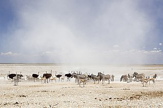
Etosha National Park is a national park in northwestern Namibia. It was proclaimed a game reserve in March 1907 in Ordinance 88 by the Governor of German South West Africa, Dr. Friedrich von Lindequist. It was designated as Wildschutzgebiet in 1958, and was elevated to the status of a national park in 1967 by an act of parliament of the Republic of South Africa. It spans an area of 22,270 km2 (8,600 sq mi) and gets its name from the large Etosha pan which is almost entirely within the park. The Etosha pan covers 23% of the area of the total area of the Etosha National Park. The park is home to hundreds of species of mammals, birds and reptiles, including several threatened and endangered species such as the black rhinoceros.

Kariba is a town in Mashonaland West province, Zimbabwe, located close to the Kariba Dam at the north-western end of Lake Kariba, near the Zambian border. According to the 2012 Population Census, the town had a population of 26,451.
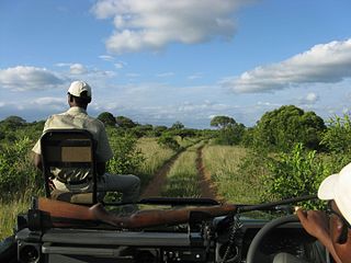
Phinda Private Game Reserve, formerly known as Phinda Resource Reserve, is a 170 km² private game reserve situated in KwaZulu-Natal, South Africa between the Mkuze Game Reserve and the Greater St. Lucia Wetland Park. Formed in 1991, this ethnically named reserve means "return to the wild". Phinda has seven distinct ecosystems with palm savannah and mountain bush to rare sand forest and dense thornveld.

Maun is the fifth-largest town in Botswana. As of 2011, it had a population of 55,784. Maun is the "tourism capital" of Botswana and the administrative centre of Ngamiland district. Francistown and Maun there are linked by the A3 highway. It is also the headquarters of numerous safari and air-charter operations who run trips into the Okavango Delta.
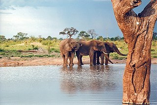
Hwange National Park is the largest natural reserve in Zimbabwe. The park lies in the west, on the main road between Bulawayo and the Victoria Falls and near to Dete.
Matusadonha National Park is a national park in northern Zimbabwe situated on the southern shore of Lake Kariba. The park takes its name from the local Matuzviadonha Hills.

Zimbabwe Parks and Wildlife Management Authority (Zimparks) is an agency of the Zimbabwe government managing national parks.

The Matobo National Park forms the core of the Matobo or Matopos Hills, an area of granite kopjes and wooded valleys commencing some 35 kilometres (22 mi) south of Bulawayo, southern Zimbabwe. The hills were formed over 2 billion years ago with granite being forced to the surface, this has eroded to produce smooth "whaleback dwalas" and broken kopjes, strewn with boulders and interspersed with thickets of vegetation. Mzilikazi, founder of the Ndebele nation, gave the area its name, meaning 'Bald Heads'.

The Queen Elizabeth National Park (QENP) is Uganda's most visited national park.

Mana Pools National Park is a 219,600 ha wildlife conservation area and national park in northern Zimbabwe. It is a region of the lower Zambezi River in Zimbabwe where the flood plain turns into a broad expanse of lakes after each rainy season. As the lakes gradually dry up and recede, the region attracts many large animals in search of water, making it one of Africa's most renowned game-viewing regions.
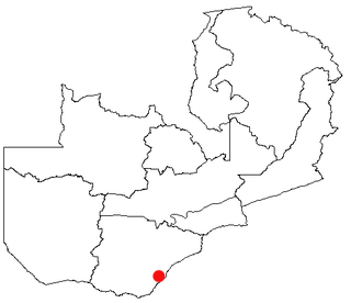
Sinazongwe is a town in the Southern Province of Zambia, lying on the north shore of Lake Kariba. It was constructed in the 1950s as a local administrative centre, while its main industry now is kapenta fishing. It is also home to a lighthouse and an airstrip, while ferries sail to Chete Island. Sinazongwe also boasts The Houseboat Company. Sinazongwe is a fast developing area in Zambia. Commercial plots have just been sold to potential investors who are all looking at bringing more tourism into the area, with a proposed campsite, lodge and many more future tourist attractions to come, such as Zamarula Fishing Camp.

Skukuza, located 50 km east of Hazyview at the confluence of the N'waswitshaka and Sabie Rivers in Mpumalanga, is the administrative headquarters and the "Capital city" of the Kruger National Park, South Africa. It is also the largest rest camp of the park and the country. It is South Africa's number one game viewing destination and is the most popular game reserve in the country. It is popular with domestic and foreign tourists alike, as the big five game are in relative abundance when compared it to other game reserves in the country. A tourist in Skukuza may not have to go out looking for Africa's big five, as these animals could potentially be observed from the deck of the Cattle Baron restaurant. Lions, leopards and cheetahs regularly kill their prey on the green lawns of Skukuza's golf course or cricket club. The game reserve is situated in a medium rainfall area, on the well-wooded banks of the Sabie and N'waswitshaka rivers of Mpumalanga Province.
Makuti is a small village in Mashonaland West province, Zimbabwe. It lies on the main road between Harare and Chirundu borderpost. All traffic for Kariba turns off the Harare-Chirundu road at Makuti. The village is surrounded by wildlife/safari areas, and very few people live there. Makuti has a petrol station, a hotel, and a shop. The hotel's name is Clouds End, and it provides a scenic view of the Zimbabwean bush towards Lake Kariba. The name Makuti means "wet mist" or "persistent drizzle".

Katavi National Park is a Tanzanian national park created in 1974 and is located in Katavi Region, Tanzania. It is a very remote park that is less frequently visited than other Tanzanian national parks. The park is approximately 4,471 square kilometers (1,726 sq mi) in area, which makes it the third largest national park in Tanzania. The park encompasses the Katuma River and the seasonal Lake Katavi and Lake Chada floodplains.

The Timbavati Game Reserve is located at the border line between Hoedspruit in (Limpopo) and Acornhoek in (Mpumalanga), north of the Sabi Sands Private Game Reserve on the western edge of Kruger National Park. Geographically and politically, Timbavati is located in Mpumalanga Province. In Xitsonga, the name 'Timbavati' means "the place where something sacred came down to Earth from the Heavens", and refers to the rare white lions of Timbavati.
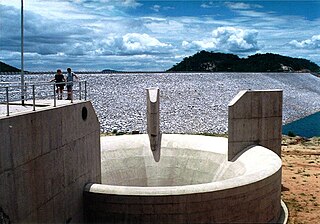
The Osborne Dam site on the Odzi River, Zimbabwe, was identified in the 1950s by the planning engineers of the Ministry of Water. Cored drilling investigations on the two possible alignments were completed in the 1960s. After the completion of Mazvikadei dam [1985–'88] under Italian aid finance, further funding became available for the project and when the 10 000 hectares of potential irrigable land was identified downstream the project was approved in 1989 by the multi-ministry irrigation committee of the Zimbabwe Government.

The Tuli Block is a narrow fringe of land at Botswana's eastern border wedged between Zimbabwe in the north and east and South Africa in the south. It consists mainly of privately owned game farms offering safari tourism. The eastern section up to and including Redshield has been declared a game reserve, known as the Northern Tuli Game Reserve.
Sibilobilo Safari Area comprises the Sibilobilo Islands in Lake Kariba and is part of the Zimbabwe Parks and Wildlife Estate.
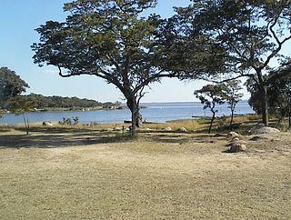
Lake Chivero Recreational Park is a protected area around Lake Chivero within the Zimbabwe Parks and Wildlife Estate.

A safari lodge is a type of tourist accommodation in southern and eastern Africa. Lodges are mainly used by tourists on wildlife safaris, and are typically located in or near national parks or game reserves.


