Bungabah, New South Wales

Last updated

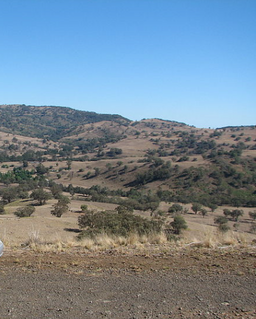
Bungabah is a civil parish of Napier County in New South Wales. [1] [2]

Civil parish Territorial designation and lowest tier of local government in England

In England, a civil parish is a type of administrative parish used for local government, they are a territorial designation which is the lowest tier of local government below districts and counties, or their combined form, the unitary authority. Civil parishes can trace their origin to the ancient system of ecclesiastical parishes which historically played a role in both civil and ecclesiastical administration; civil and religious parishes were formally split into two types in the 19th century and are now entirely separate. The unit was devised and rolled out across England in the 1860s.

Napier County Cadastral in New South Wales, Australia

Napier County is one of the 141 Cadastral divisions of New South Wales.

New South Wales State of Australia

New South Wales is a state on the east coast of Australia. It borders Queensland to the north, Victoria to the south, and South Australia to the west. Its coast borders the Tasman Sea to the east. The Australian Capital Territory is an enclave within the state. New South Wales' state capital is Sydney, which is also Australia's most populous city. In September 2018, the population of New South Wales was over 8 million, making it Australia's most populous state. Just under two-thirds of the state's population, 5.1 million, live in the Greater Sydney area. Inhabitants of New South Wales are referred to as New South Welshmen.

The parish is on the Gwabegar railway line, and the now closed Murrawal railway siding is in the parish. [3]

Gwabegar railway line

The Gwabegar Railway Line is a railway line in the Central West and North West Slopes of New South Wales, Australia, which passes through the towns of Mudgee, Gulgong, Dunedoo, Coonabarabran and terminates at Gwabegar.

Murrawal is a location on the now closed Gwabegar railway line in north-western New South Wales, Australia. A loop and loading bank station was located there between 1917 and 1972.

Bungabah is on the Castlereagh River [4] and the nearest town is Coonabarabran to the north.

Castlereagh River river in New South Wales

The Castlereagh River is located in the central–western district of New South Wales, Australia. It is part of the Macquarie-Castlereagh catchment within the Murray–Darling basin and is an unregulated river, meaning no dams or storage have been built on it to control flows. On a map of NSW, the Castlereagh has a distinctive appearance among the north-western rivers for its fish-hook-like shape: from upstream in the north at its confluence with the Macquarie River it extends southwards to a hook-shape, flattened-out at the base, which curves to the right through to the tip of the hook in the Warrumbungle Mountains at the river's source.

Coonabarabran Town in New South Wales, Australia

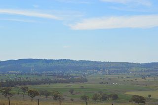
Coonabarabran is a town in Warrumbungle Shire that sits on the divide between the Central West and North West Slopes regions of New South Wales, Australia. At the 2016 census, the town had a population of 2,537. The town's nickname is "Coona".

Related Research Articles

Piambra is rural locality of Warrumbungle Shire Council and a civil parish of Napier County.

Napier Parish, New South Wales

Napier is a rural locality of Warrumbungle Shire Council and a civil parish of Napier County New South Wales. and is at 31°35′54″S149°46′04″E.

Binnia is a civil parish of Napier County in New South Wales.

Lowe, New South Wales

Lowe Parish is a civil Parish of Napier County, New South Wales.

Mumbedah, New South Wales

Mumbedah is a civil parish, a creek and a hill in central New South Wales.

Morven Parish is a civil parish of County of Napier, a county in the central western part of New South Wales, Australia.

Coolah Parish, New South Wales New South Wales, Australia

Coolah Parish is a civil parish of the County of Napier, a county in the central western part of New South Wales, Australia in Warrumbungle Shire. The only town of the parish is Coolah, New South Wales and at the 2006 census, Coolah township had a population of 910.

Moorangoorang is a rural locality and a civil parish of County of Napier in the central western part of New South Wales, Australia. The parish has three railway stations, Mooren, Borah and Pimbra.

Butheroo is a civil parish of Napier County, a county of central New South Wales.

Toorawandi Parish (Napier County), New South Wales New South Wales, Australia

Toorawandi is a civil parish of Napier County in New South wales.

Neible Parish, New South Wales is a civil parish of Napier County, a county located in central western New South Wales.

Binnaway Parish, New South Wales New South Wales, Australia

Binnaway Parish is a civil Parish of Napier County, New South Wales, located on the Castlereagh River in central western New South Wales.

Mendooran Parish, New South Wales

Mendooran Parish, New South Wales is a civil parish of Napier County, New South Wales.

Caigan, New South Wales

Caigan, New South Wales is a bounded rural locality and civil parish of Gowen County, New South Wales.

Eurimbula, New South Wales is a civil parish of Gordon County, New South Wales, a Cadastral divisions of New South Wales.

Burrawong Parish is a civil parish of Gordon County, New South Wales, a Cadastral divisions of New South Wales.

Burgoon Parish is a civil parish of Gordon County, New South Wales, a Cadastral divisions of New South Wales.

The Gap Parish is a civil parish of Gordon County, New South Wales, a Cadastral divisions of New South Wales.

Parish of Buckinbah

Buckinbah Parish is a civil parish of Gordon County, New South Wales, a Cadastral divisions of New South Wales.

References

  1. Robert McLean, The New atlas of Australia : the complete work containing over one hundred maps and full descriptive geography of New South Wales, Victoria, Queensland, South Australia and Western Australia, together with numerous illustrations and copious indices (Sydney :J. Sands, [1886) Map 14.
  2. "Napier County". Geographical Names Register (GNR) of NSW. Geographical Names Board of New South Wales. OOjs UI icon edit-ltr-progressive.svg
  3. Murrawal NSWrail.net, accessed 9 April 2010.
  4. Department of Lands, Sydney N.S.W , Map of the County of Napier, Central Division, N.S.W. (Published Sydney : Dept. of Lands, 1964).