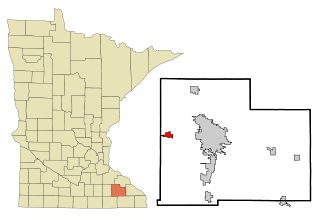
Byron is a city in Olmsted County, Minnesota, United States, approximately five miles (8 km) west of Rochester on U.S. Route 14. It is surrounded by Kalmar Township. The population was 6,312 at the 2020 census.
Port Byron is a village in Cayuga County, New York, United States. The population was 1,290 at the 2010 census. It is in the town of Mentz and is north of Auburn.

The Bighorn Basin is a plateau region and intermontane basin, approximately 100 miles (160 km) wide, in north-central Wyoming in the United States. It is bounded by the Absaroka Range on the west, the Pryor Mountains on the north, the Bighorn Mountains on the east, and the Owl Creek Mountains and Bridger Mountains on the south. It is drained to the north by tributaries of the Bighorn River, which enters the basin from the south, through a gap between the Owl Creek and Bridger Mountains, as the Wind River, and becomes the Bighorn as it enters the basin. The region is semi-arid, receiving only 6–10 in (15–25 cm) of rain annually.
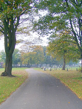
West Derby Cemetery, Lower House Lane, Croxteth. Opened in January 1884 it has been used for Church of England, Roman Catholic and Jewish burials. Various buildings at the cemetery are Grade II listed buildings.
Bonanza is a ghost town in Custer County, Idaho, United States. It was originally established as a mining town. As of 2005, the land is privately owned but open to the public. Custer has a museum for the gold-rush era where visitors can experience the lives of the citizens of Custer and can search for gold.
Hibberts Corner is a village within the town of Washington in Knox County, Maine, United States. It is located at 44°18′15″N69°24′26″W, at an altitude of 354 feet (108 m).

Rocky Mountain High School (RMHS) is a public high school in Cowley, Wyoming, United States. It covers grades 9 through 12, and is part of Big Horn County School District 1. RMHS serves the cities of Byron, Cowley, Deaver, and Frannie. The school mascot is the Grizzly Bear. In 2010 the Middle School and High School were combined into a 6-12 school in a new building in Cowley.
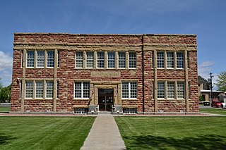
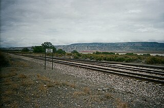
The Big Horn Academy Building was built in 1916. It is located in Cowley, Wyoming, United States. It served as a high school and junior college for the students who lived in the Bighorn Basin.
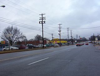
Nutbush is a long-standing neighborhood in northeastern Memphis, Tennessee, United States.
Kane is a ghost town that existed 2 miles (3.2 km) south of the confluence of the Shoshone River and the Bighorn River in Big Horn County, northern Wyoming, United States.

North Township is one of ten townships in Marshall County, Indiana, United States. As of the 2020 census, its population was 4,054 and it contained 1,640 housing units.
Scott is a town in the Rural Municipality of Tramping Lake No. 380, Saskatchewan, Canada. The population was 74 at the 2021 Canada Census. The town is south of the junction of Highway 14 and Highway 374, approximately 10 km west of the town of Wilkie. Scott was known as Saskatchewan's smallest town, but is now second smallest to Fleming.
Carleton Corner is a community in the Canadian province of Nova Scotia, located in Annapolis County adjacent to Bridgetown. It is a designated place with a population of 99 in 2021. It is on Nova Scotia Route 201.
Point of Timber is a former settlement in Contra Costa County, California. It was located on Indian Slough 2 miles (3.2 km) north of Byron, and about 2.5 miles east of Union Cemetery in Brentwood. It was originally named Point of Timber Landing. The landing was built by Josiah Wills, who organized the deepening of Indian Slough, connecting the landing to the Old River. Point of Timber got its name from the mile wide strip of open Oak woodland that ran from just east of the house of John Marsh along the course of Arroyo del Sur to the edge of the marshes bordering Indian Slough and Old River.

The Certosa di Bologna is a former Carthusian monastery in Bologna, northern Italy, which was founded in 1334 and suppressed in 1797. In 1801 it became the city's Monumental Cemetery which would be much praised by Byron and others. In 1869 an Etruscan necropolis, which had been in use from the sixth to the third centuries BC, was discovered here.
The Swift River is a 26.7-mile-long (43.0 km) river in western Maine. It is a tributary of the Androscoggin River, which flows to the Kennebec River near its mouth at the Atlantic Ocean.
The West Branch Swift River is a 6.4-mile-long (10.3 km) tributary of the Swift River in western Maine. Via the Swift River, it is part of the Androscoggin River watershed, flowing to the Kennebec River and ultimately the Atlantic Ocean.
Orleans was a city in Linn County, Oregon, United States. It was established around 1850 and destroyed in the Great Flood of 1862. It was not rebuilt. The city was located across the Willamette River from Corvallis. The Orleans cemetery survived because it was built on high ground at 44.5697°N 123.1913°W.
Byron is an extinct town in Clark County, in the U.S. state of Nevada. The community was about 44 miles (71 km) north of Las Vegas.
