
The River Roding rises at Molehill Green, Essex, England, then flows south through Essex and London and forms Barking Creek as it reaches the River Thames.
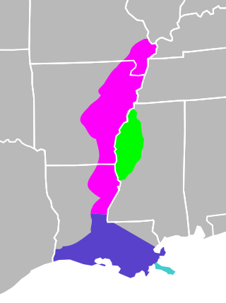
The Mississippi River Alluvial Plain is an alluvial plain created by the Mississippi River on which lie parts of seven U.S. states, from southern Louisiana to southern Illinois.

The Cold River is a 16.7-mile-long (26.9 km) river in western Maine in the United States. It very briefly enters New Hampshire as well. It is part of the Saco River drainage basin.
Beaver Brook is a 30.7-mile-long (49.4 km) river located in New Hampshire and Massachusetts in the United States. It is a tributary of the Merrimack River, part of the Gulf of Maine watershed.

The Spicket River is a 17.7-mile-long (28.5 km) river located in New Hampshire and Massachusetts in the United States. It is a left tributary of the Merrimack River, part of the Gulf of Maine watershed. It is sometimes spelled "Spickett".
The Little River is a 12.9-mile-long (20.8 km) river in New Hampshire and Massachusetts in the United States. It is a tributary of the Merrimack River, part of the Gulf of Maine watershed.

The Haraz River is a notable river flowing through the Mazandaran Province of northern Iran. It flows northwards, from the Alborz mountain range into the Caspian Sea. After flowing along the Haraz Road and Valley for about 100 km, the Haraz river meanders in the midst of Amol, from where it reaches the Caspian Sea. The Haraz begins in Mount Damavand and flows northward and pours into Caspian Sea in the area between the two northern cities of Mahmoudabad and Fereydunkenar. The Haraz is currently contaminated due to discharge of effluent from various industrial plants.
The South Branch of the Souhegan River is a 5.8-mile-long (9.3 km) river located in northern Massachusetts and southern New Hampshire in the United States. It is a tributary of the Souhegan River, which flows to the Merrimack River and ultimately to the Gulf of Maine.

The Blackwater River is a 3.1-mile-long (5.0 km) tidal inlet in northeastern Massachusetts and southeastern New Hampshire in the United States.

The Little Cold River is a 3.9-mile-long (6.3 km) stream in western Maine in the United States, flowing through the foothills of the White Mountains. It is a tributary of the Cold River, part of the Saco River watershed.

The Manu is an Indo-Bangladesh transboundary river that originates below the Kahosib Chura of the Shakhantang Mountains in the Indian state of Tripura, flowing north-east through Kumarghat and Kailasahar, and passes through the Moulvibazar district of Bangladesh to the Sylhet Plain, later the Dholai River joins the Manu and then it flows northwest and meets the Kushiara Manumukh. It is 167 km long, making it the longest river in Tripura. It is located near the town of Manu. The river has a width of 200 meters in the railway bridge area. The area of the basin is 500 square kilometres. The river flows throughout the year.

The North Branch of the Westfield River starts at the town of Savoy, Massachusetts, in the Berkshires. It flows southeasterly to the town of Cummington where it follows Route 9 to the junction with the Swift River. Here it turns sharply south and flows through the picturesque Pork Barrel region to West Chesterfield. It continues through a wilderness region to the Knightville Reservoir. From here it continues south for about 5 miles to Huntington, Massachusetts, where it becomes the main branch of the Westfield River. The Middle Branch and the West Branch join it in this section.

Edward River, or Kolety is an anabranch of the Murray River and part of the Murray–Darling basin, is located in the western Riverina region of south-western New South Wales, Australia.

The River Cegidog is a river in north-east Wales. It flows mainly through Flintshire but towards the end of its course it forms the border between Flintshire and Wrexham County Borough.

The Par River, also known as the Luxulyan River is a river draining the area north of St Blazey in Cornwall, in the United Kingdom.

The Shōnai River is a Class 1 river flowing through Gifu and Aichi prefectures in Japan. In Gifu Prefecture, it is also referred to as the Toki River ; around the city of Kasugai in Aichi Prefecture, it is referred to as the Tamano River. Fujimae-higata exists in the River mouth.
The Neyyar River is 56 km long river which flows through the Thiruvananthapuram district of Kerala in India. It flows from the Agastya Mala (Agastyarkoodam) in the Western Ghats. The town Neyyattinkara in Thiruvananthapuram district, is situated on the banks of the river, is named after this river. The river flows through the Neyyar wildlife sanctuary and into the Neyyar resorvoir. It then flows towards the west through the towns of Kallikkad, Kattakkada, Ottashekharamangalam, Keezharoor, Anavoor, Aruvipuram, Neyyantinkara and Thirupuram. The river then empties into the Arabian Sea at the Poovar estuary. Tributaries include the Kallar, Mullayar, and the Karavaliyar. It has several small canals along the river and the Neyyar Irrigation Project, "Neyyar Dam", is situated in this river. A safari park is located near the river. Neyyar river has been severely affected by sand mining.

The River Allen in north Cornwall is one of two rivers in Cornwall which share this name. In this case the name is the result of a mistake made in 1888 by Ordnance Survey, replacing the name Layne with Allen which is the old name for the lower reaches of the Camel. The other River Allen runs through Truro.

The Dwarka River is a tributary of Bhagirathi.

The Brahmani River is a tributary of the Dwarka River.

