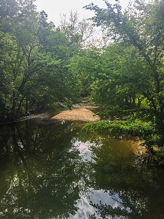
Clinton County is a county located in the U.S. state of Ohio. As of the 2020 census, the population was 42,018. Its county seat and largest city is Wilmington. The county is named for former U.S. Vice President George Clinton. Clinton County comprises the Wilmington, Ohio Micropolitan Statistical Area, which is also included in the Cincinnati-Wilmington-Maysville, OH-KY-IN Combined Statistical Area.

Warren County is a county located in the southwestern part of the U.S. state of Ohio. As of the 2020 census, the population was 242,337. Its county seat is Lebanon and largest city is Mason. The county is one of Ohio's most affluent, with the highest median income of the state's 88 counties. The county was established on May 1, 1803, from Hamilton County; it is named for Dr. Joseph Warren, a hero of the Revolution who sent Paul Revere and the overlooked William Dawes on their famous rides and who died at the Battle of Bunker Hill. Warren County is part of the Cincinnati, OH-KY-IN Metropolitan Statistical Area.
Eaton Township was a township of Warren County, Ohio, United States. It was created on June 26, 1806, from the eastern part of Wayne Township beyond Caesars Creek. When Clinton County was created in 1815, most of the land became part of Clinton County.
New Burlington is a former town located in Chester Township in the northwestern corner of Clinton County, Ohio, off Ohio State Route 380. The GNIS classifies it as a populated place. It was acquired by the United States federal government when Caesar Creek was dammed and a reservoir created in the 1970s.

Caesar Creek State Park is a public recreation area located in southwestern Ohio, five miles (8 km) east of Waynesville, in Warren, Clinton, and Greene counties. The park is leased by the State from the U.S. Army Corps of Engineers, who in the 1970s erected a dam on Caesar Creek to impound a 2,830-acre (1,150 ha) lake. The total park area, including the lake, is 7,530-acre (3,050 ha).
Rattlesnake Creek is a tributary of Paint Creek, 42.3 miles (68.1 km) long, in south-central Ohio in the United States. Via Paint Creek and the Scioto and Ohio Rivers, it is part of the watershed of the Mississippi River, draining an area of 277 square miles (720 km2). According to the Geographic Names Information System, it has also been known historically as "Rattlesnake Fork."

Lees Creek, also known as Centerville, is an unincorporated community in central Wayne Township, Clinton County, Ohio, United States. It lies at the intersection of State Route 729 with Cox Road, 6 miles south of Sabina and 12 miles (19 km) southeast of Wilmington, the county seat of Clinton County. It lies between the headwaters of the Middle Fork of Lees Creek, to the southeast, and the Anderson Fork of Caesar Creek. it had a post office, with the ZIP code 45138. The Post Office closed in 2012 and the town, including East Clinton High School, now carries a Sabina mailing address.
Todd Fork is a stream in Clinton and Warren counties, Ohio, in the United States. It is a tributary of the Little Miami River.
Lytle Creek is a stream in Clinton County, Ohio, in the United States.

Anderson Fork is a stream in Clinton and Greene counties, Ohio, in the United States.
Wilson Creek is a stream in Clinton County, Ohio, in the United States.
Lees Creek is a stream in Highland, Fayette and Clinton counties, Ohio, in the United States.

Clear Creek is a tributary of the Great Miami River in southwestern Ohio. The creek forms in the southeastern portion of Clearcreek Township, with major tributaries including Mad Run, Beech Run, Bull Run, Richards Run, Twin Creek, Gander Run, Goose Run, and Dearth Run. The watershed includes the highest point in Warren County east of Five Points. It drains most of Clearcreek Township, Springboro, Ohio, much of Franklin Township, and then discharges into the Great Miami River in Franklin, Ohio.

Massies Creek is a stream located entirely within Greene County, Ohio. It is a tributary of the Little Miami River.
Jonahs Run is a stream in the U.S. state of Ohio. It is a tributary to Caesar Creek.
Halls Creek is a stream in the U.S. state of Ohio. It is a tributary to the Little Miami River.
Baker Creek is a stream in the U.S. state of Ohio. It is a tributary to the Little Miami River.
Muddy Creek is a stream in the U.S. state of Ohio. It is a tributary to the Little Miami River.
Grog Run is a stream in the U.S. state of Ohio.
Butterworth is an extinct town in Warren County, Ohio.


