This article needs additional citations for verification .(May 2013) |
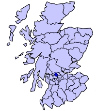
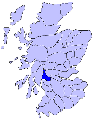
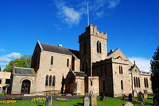
Campsie is a civil parish in East Dunbartonshire, Scotland. The parish was formerly part of Stirlingshire. [1]
This article needs additional citations for verification .(May 2013) |
Campsie is a civil parish in East Dunbartonshire, Scotland. The parish was formerly part of Stirlingshire. [1]

East Dunbartonshire is one of the 32 council areas of Scotland. It borders Glasgow City Council Area to the south, North Lanarkshire to the east, Stirling to the north, and West Dunbartonshire to the west. East Dunbartonshire contains many of the suburbs in the north of Greater Glasgow, including Bearsden, Milngavie, Bishopbriggs, Kirkintilloch, Lenzie, Twechar, Milton of Campsie, Balmore, and Torrance, as well as some other of Glasgow's commuter towns and villages. The council area covers parts of the historic counties of Dunbartonshire, Lanarkshire, and Stirlingshire.

Stirlingshire or the County of Stirling is a historic county and registration county of Scotland. Its county town is Stirling.

Strathkelvin is the strath (valley) of the River Kelvin in west central Scotland, lying north-east of Glasgow. The name Strathkelvin was used between 1975 and 1996 for one of nineteen local government districts in the Strathclyde region.

The Campsie Fells are a range of hills in central Scotland, stretching east to west from Denny Muir to Dumgoyne in Stirlingshire and overlooking Strathkelvin to the south. The southern extent of the range falls within East Dunbartonshire. The range overlooks the villages of Strathblane, Blanefield, Milton of Campsie, Lennoxtown and Torrance to the south; Killearn to the west, and Fintry and Strathendrick to the north. The Fintry Hills lie further to the north; Kilpatrick Hills lie to the west and the Kilsyth Hills to the east.

Douglas Academy is a non-denominational, co-educational, comprehensive secondary school in the town of Milngavie, East Dunbartonshire, serving the Milngavie, Craigton and Baldernock areas. In 2007, Douglas Academy was ranked as Scotland's top performing state school, and with every year the school continues to place among the highest in Scotland.

The Archdiocese of Glasgow was one of the thirteen dioceses of the Scottish church. It was the second largest diocese in the Kingdom of Scotland, including Clydesdale, Teviotdale, parts of Tweeddale, Liddesdale, Annandale, Nithsdale, Cunninghame, Kyle, and Strathgryfe, as well as Lennox, Carrick and the part of Galloway known as Desnes.

The Lennox is a region of Scotland centred on The Vale of Leven, including its great loch: Loch Lomond.

Baldernock meaning 'settlement of St Earnaig' is a small parish in East Dunbartonshire, Scotland, ten miles (16 km) to the north of Glasgow's city centre.

The Central Lowlands, sometimes called the Midland Valley or Central Valley, is a geologically defined area of relatively low-lying land in southern Scotland. It consists of a rift valley between the Highland Boundary Fault to the north and the Southern Uplands Fault to the south. The Central Lowlands are one of the three main geographical sub-divisions of Scotland, the other two being the Highlands and Islands which lie to the north, northwest and the Southern Uplands, which lie south of the associated second fault line. It is the most populated of Scotland’s three geographical regions.

New Kilpatrick, is an ecclesiastical Parish and former Civil Parish in Dunbartonshire. It was formed in 1649 from the eastern half of the parish of Kilpatrick, the western half forming Old Kilpatrick. New Kilpatrick is also a disused name for the town of Bearsden.

Lennoxtown is a town in the East Dunbartonshire council area and the historic county of Stirlingshire, Scotland. The Campsie Fells are located to Lennoxtown's north. The town had a population of 4,094 at the 2011 UK census.

Strathblane is a village and parish in the registration county of Stirling, situated in the southwestern part of the Stirling council area, in central Scotland. It lies at the foothills of the Campsie Fells and the Kilpatrick Hills on the Blane Water, 12 miles (19 km) north of Glasgow, 14 miles (23 km) east-southeast of Dumbarton, and 20 miles (32 km) southwest of Stirling. Strathblane is a dormitory village for Greater Glasgow, and has a total resident population of 1,811.

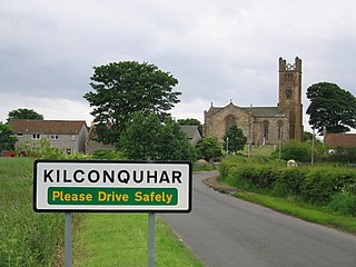
Kilconquhar is a village and parish in Fife in Scotland. It includes the small hamlet of Barnyards. It is bounded by the parishes of Elie, Ceres, Cameron, St Monans, Carnbee, Newburn and Largo. It is approximately 9 miles from north to south. Much of the land is agricultural or wooded. The village itself is situated inland, north of Kilconquhar Loch. Also in the civil parish are Colinsburgh and Largoward, the latter since 1860 being a separate ecclesiastical parish.

The Kirktown of Fetteresso is a well-preserved village near Stonehaven, Scotland. In the planning area of Kincardine and Mearns, Aberdeenshire, this village contains many very old stone residential structures as well as the Church of St. Ciarans and its associated graveyard. The Carron Water winds through the Kirktown of Fetteresso, and Fetteresso Castle, a listed building, lies at the northwestern verge. Some of the earliest area prehistory has been found nearby on the Fetteresso Estate grounds, where there have been archaeological finds from the Bronze Age.

Balfron High School is a secondary school situated in the village of Balfron, approximately 18 miles (29 km) west of Stirling and 16 miles (26 km) north of Glasgow. The catchment area extends over most of West Stirlingshire including the villages of Arnprior, Balfron, Balmaha, Blanefield, Buchlyvie, Croftamie, Drymen, Fintry, Killearn, Kippen, Milton of Buchanan and Strathblane, along with the hamlets of Balfron Station, Boquhan, Buchanan Smithy, Dumgoyne, Gartness and Mugdock. The school also has pupils attending from other nearby areas of Dunbartonshire and Stirlingshire.
Milton of Campsie is a village formerly in the county of Stirlingshire, but now in East Dunbartonshire, Scotland roughly 10 miles (16 km) north of Glasgow. Nestling at the foot of the Campsie Fells, it is neighboured by Kirkintilloch and Lennoxtown.

Ballikinrain is an independent residential school in Stirling, central Scotland. It is run by CrossReach, a social care outreach arm of the Church of Scotland. The school is housed in the 19th-century Ballikinrain Castle, situated in the Parish of Killearn, 2 kilometres (1.2 mi) south-east of Balfron and 5 kilometres (3.1 mi) west of Fintry.

Torrance railway station was opened in 1879 on the Kelvin Valley Railway and served the area of the village of Torrance in East Dunbartonshire until 1951 for passengers and 1959 for freight.
The Finglen Burn is a burn in Scotland that runs from north east of the Earl's Seat to just north of Campsie Village where it merges with the Kirk Burn to form the Glazert Water. Named tributaries of the burn from the earliest to the latest are as follows: Cooper's Gote, Flaughter Burn, Earl's Burn, Altmarrage Burn, Almarnock Burn, Horse Burn, Almeel Burn and finally the Pow Burn.
56°01′04″N4°14′27″W / 56.01778°N 4.24083°W