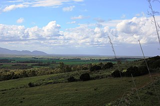
The cape is situated in the territory of the Comune of San Vero Milis, in the Province of Oristano, approximately 22km north of Oristano. It is also the northern tip of the Sinis peninsula, and it is part of the Marine Protected Area Sinis Peninsula and the island of Mal di Ventre.
The comune is a basic administrative division in Italy, roughly equivalent to a township or municipality.
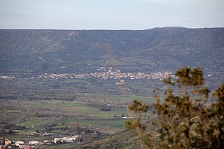
San Vero Milis is a comune (municipality) in the Province of Oristano in the Italian region Sardinia, located about 100 kilometres (62 mi) northwest of Cagliari and about 13 kilometres (8 mi) north of Oristano. As of 31 December 2004, it had a population of 2,506 and an area of 72.2 square kilometres (27.9 sq mi).
The province of Oristano is a province in the autonomous island region of Sardinia in Italy. Its capital is the city of Oristano. It has an area of 3,040 square kilometres (1,170 sq mi), a total population of 160,746 (2016), and a population density of 53.7 people per square kilometer. There are 87 municipalities (comuni) in the province).
Sport
Capo Mannu is renowned attraction for surfers, windsurfers and kiters, both nationally and internationally. The mistral, the dominant wind of the area, gives rise to waves up to 4–5 metres high. Every year, several surfing, windsurfing and kiteboarding competitions take place in the area, the most well known probably being the Capo del Capo (Chief of the Cape) windsurfing and kitesurfing competition.
A geographic coordinate system is a coordinate system that enables every location on Earth to be specified by a set of numbers, letters or symbols. The coordinates are often chosen such that one of the numbers represents a vertical position and two or three of the numbers represent a horizontal position; alternatively, a geographic position may be expressed in a combined three-dimensional Cartesian vector. A common choice of coordinates is latitude, longitude and elevation. To specify a location on a plane requires a map projection.
This Sardinia location article is a stub. You can help Wikipedia by expanding it.
This page is based on this Wikipedia article Text is available under the CC BY-SA 4.0 license; additional terms may apply. Images, videos and audio are available under their respective licenses.
Related Research Articles
The Aegean Sea is an elongated embayment of the Mediterranean Sea located between the Greek and Anatolian peninsulas i.e. between the mainlands of Greece and Turkey. In the north, the Aegean is connected to the Marmara Sea and Black Sea by the Dardanelles and Bosphorus. The Aegean Islands are within the sea and some bound it on its southern periphery, including Crete and Rhodes.
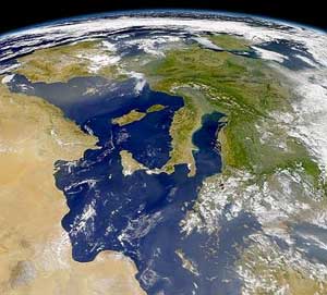
Italy is located in southern Europe and comprises the long, boot-shaped Italian Peninsula, the southern side of Alps, the large plain of the Po Valley and some islands including Sicily and Sardinia. Corsica, although belonging to the Italian geographical region, has been a part of France since 1769. Italy is part of the Northern Hemisphere.
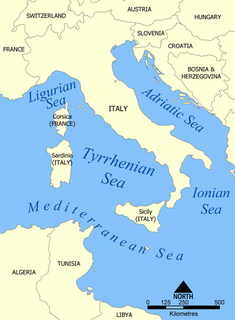
The Tyrrhenian Sea is part of the Mediterranean Sea off the western coast of Italy. It is named for the Tyrrhenian people, identified since the 6th century BCE with the Etruscans of Italy.
Sinis may refer to :
Dahab is a small town on the southeast coast of the Sinai Peninsula in Egypt, approximately 80 km (50 mi) northeast of Sharm el-Sheikh. Formerly a Bedouin fishing village, Dahab is now considered to be one of Sinai's most treasured diving destinations. Following the Six-Day War, Sinai was occupied by Israel and Dahab became known as Di-Zahav, after a place mentioned in the Bible as one of the stations for the Israelites during the Exodus from Egypt. The Sinai Peninsula was restored to Egyptian rule under the Egypt–Israel Peace Treaty in 1982. The arrival of international hotel chains and the establishment of other ancillary facilities has since made the town a popular destination with tourists. Dahab is served by Sharm el-Sheikh International Airport. Masbat is a popular diving destination, and there are many (50+) dive centers located within Dahab. Most of Dahab's diving spots are shore dives.
Tharros was an ancient city and former bishopric on the west coast of Sardinia, Italy.
Saros Bay or Gulf of Saros is an inlet of the northern Aegean Sea located north of the Gallipoli Peninsula in northwestern Turkey. The Archipelago of Saros is in the gulf. It consists the three small islands - The Big island, The Small island and The Little island.
Prasonisi cape is a part of the island of Rhodes. It is located 92 km from Rhodes town; 40 km from Lindos, at the southern-west part of Rhodes.
Stintino is a coastal comune (municipality) in the Province of Sassari in the Italian region Sardinia, located about 200 kilometres (120 mi) north of Cagliari and about 35 kilometres (22 mi) northwest of Sassari.
Baradili is a comune (municipality) in the Province of Oristano in the Italian region Sardinia, located about 60 kilometres (37 mi) northwest of Cagliari and about 35 kilometres (22 mi) southeast of Oristano.
Cabras is a comune (municipality) in the Province of Oristano in the Italian region Sardinia, located about 90 kilometres (56 mi) northwest of Cagliari and about 6 kilometres (4 mi) northwest of Oristano.
Sini is a comune (municipality) in the Province of Oristano in the Italian region Sardinia, located about 60 kilometres (37 mi) northwest of Cagliari and about 30 kilometres (19 mi) southeast of Oristano. As of 31 December 2004, it had a population of 574 and an area of 8.7 square kilometres (3.4 sq mi).
Sini is a census town in Seraikella- Kharshwan district in the Indian state of Jharkhand.
Polygala sinisica is a species of plant in the Polygalaceae family. It is endemic to Italy.
The Gulf of Asinara is a sea sector included between the Asinara Island, Cape Falcone and the town of Castelsardo, in northern Sardinia, Italy. The communes facing its coast include also Stintino, Porto Torres, Sassari, Sorso, Valledoria and Badesi.
The Gulf of Oristano is a gulf in the Sardinian Sea, near Oristano, in the western Sardinian coast.
Viganj is a village located in the west of the Pelješac peninsula in southern Dalmatia, Croatia, by the Adriatic Sea. It has a population of 283.
Mal di Ventre is a private island located off the coast of Sardinia. Mal di Ventre is notable for its Roman ruins and a Sardinian nationalist attempt at creating a micronation in 2008.
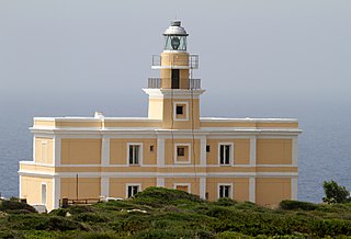
Capo San Marco Lighthouse is an active lighthouse located on Capo San Marco promontory, on the tip of Sinis peninsula overlooking the ruins below of Tharros. The structure is in the municipality of Cabras, in the west of the island on the Sea of Sardinia.