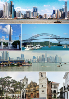
Panama City is the capital and largest city of Panama. It has an urban population of 880,691, with over 1.5 million in its metropolitan area. The city is located at the Pacific entrance of the Panama Canal, in the province of Panama. The city is the political and administrative center of the country, as well as a hub for banking and commerce.

The Bridge of the Americas is a road bridge in Panama, which spans the Pacific entrance to the Panama Canal. Designed by Sverdrup & Parcel, it was completed in 1962 at a cost of US$20 million, connecting the north and south American land masses. Two other bridges cross the canal: the Atlantic Bridge at the Gatun locks (expected to open early 2019) and the Centennial Bridge.

Ancón is a corregimiento in Panamá District, Panamá Province, Panama with a population of 29,761 as of 2010. Its population as of 1990 was 11,518; its population as of 2000 was 11,169. It is sometimes considered a suburb or small town within Panama City, northeast of the limits of the town of Balboa. Ancon Hill is also the name of a large hill that overlooks Panama City and once served as a form of protection from pirates and sea invasion. The township was originally located around this hill, and was created to house employees of the Panama Canal during its construction. As part of the construction effort, the historic Gorgas Army Hospital was founded and built on the hillside. The first ship to officially transit the canal, SS Ancon, was named after the district. The community continued to serve as housing for employees of the Panama Canal Company until 1980, when parts of it began to be turned over to the Panamanian government under the 1977 Torrijos-Carter Treaties. Modern-day Ancón is a corregimiento of Panama City, serving mainly as a residential area. The Gorgas Army Hospital building is now the Panamanian Oncology Hospital, primarily used for cancer research. The area also houses Panama's Supreme Court, just a few feet away from the Gorgas Army Hospital building, and several Smithsonian Tropical Research Institute buildings for research into tropical biology. Ancón is also a parish (parroquia) of the District of Panama, located in the Panama Canal adjacent area.

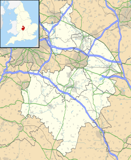
Budbrooke is a small village and civil parish in the Warwick district of Warwickshire, England, about 2½ miles west of Warwick town centre. According to the 2001 census the parish had a population of 2,319, reducing to 1,863 at the 2011 Census. The majority of the population of Budbrooke live in Hampton Magna, a housing estate built in the late 1960s, with other smaller settlements in Budbrooke Village and Hampton on the Hill.

Gorgas Hospital was a U.S. Army hospital in Panama City, Panama, named for Army Surgeon General William C. Gorgas (1854–1920).
Diablo was one of many residential townships in the Panama Canal Zone. It was established in 1905 by William Luke Jenkins.
Rainbow City, now known as the sector Arco Iris, in the corregimiento Cristóbal, is a section of the city of Colón in the Republic of Panama. It was originally built as segregated housing for Panama Canal employees and was developed into a proper town by the Canal Zone Government. During over a century of history, Rainbow City was home to some of Panama Canal's teachers, workers, and athletes.

Gamboa is a small town in the Republic of Panama. It was one of a handful of permanent Canal Zone townships, built to house employees of the Panama Canal and their dependents. The name Gamboa is the name of a tree of the quince family.

Paraíso is a town in the Republic of Panama, located just north of the Panama Canal's Pedro Miguel Locks. It was a vibrant township of the old Canal Zone, though it was segregated for most of its history.
The Scout and Guide movement in Panama is served by

The United States Air Forces Southern Command is an inactive Major Command of the United States Air Force. It was headquartered at Albrook Air Force Base, Canal Zone, being inactivated on 1 January 1976.

Cristóbal is a port town and county in Colón District, Colón Province, Panama with a population of 49,422 as of 2010. It is located on the western edge of Manzanillo Island, on the Atlantic side of the Panama Canal. Cristóbal Colón is the Spanish translation for Christopher Columbus, the Genovese explorer for whom these places were named.
Corozal American Cemetery and Memorial is located approximately 3 miles north from Panama City, Panama. It is in the city of Corozal and is the location of 5,336 American veterans and others. A paved walkway leads from the Visitor Center to a small memorial that sits atop a knoll overlooking the graves area. The memorial was established in 1923 by Congress to remember people that served overseas since 1917. It consists of a paved plaza with a 12-foot rectangular granite obelisk flanked by two flagpoles on which fly the United States and Panamanian flags.
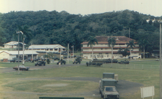
Fort Kobbe was an Army fort renamed from Fort Bruja on 15 April 1932 to honor Major General William A. Kobbe. At the time it was located adjacent to Howard Air Force Base in the Panama Canal Zone. In the 1930s it was primarily a United States Army Coast Artillery Corps post. It was located on the west side of the Panama Canal. Most of the area around it was uninhabited, though Panama City could be reached by crossing the nearby Bridge of the Americas. An rock quarry was operated intermittently in the southwest corner of the Fort near the southern end of the Howard Air Force Base main runway. In the Fort, there was a series of barracks starting on the southern end of Howard Air Force Base in the level land adjacent to the southern end of Howard Air Force Base. In the hills on the east side of the fort were Officer's Married and Bachelor Quarters, and an Officer's Club. There was a small parade field and married NCO housing in the southern end of the Fort. There was a beach in the southeast corner of the fort going into the Pacific Ocean. The beach was protected by a large shark net, as it was understood that the waters in that part of the Pacific were shark-infested. The tides were almost 12', so the beach was not a pristine site. Given that Panamanian locals did not have access to the area, the beach was not used very heavily. The eastern half of Fort Kobbe was jungle stretching over to the western side of the mouth of the Panama Canal.

Student housing at University of Florida is governed by the Division of Student Affairs, and provides housing for undergraduate, graduate, and professional students on and off-campus.

The 7th Reconnaissance Squadron is a squadron of the United States Air Force. It is assigned to the 69th Reconnaissance Group and is stationed at Naval Air Station Sigonella, Sicily, Italy.
The 52nd Fighter Squadron is an inactive United States Air Force unit. Its last assignment was with the Western Air Defense Force, based at Hamilton Air Force Base, California. It was inactivated on 8 June 1951.This is after WW2.
PSA Panama International Terminal is a port built by PSA International on the site of the former United States Navy Rodman Naval Base located southwest of Panama City at the entrance to the canal from the Pacific Ocean.

Red Bluff Air Force Station is a closed United States Air Force General Surveillance Radar station. It is located 4.3 miles (6.9 km) west-southwest of Red Bluff, California. It was closed in 1970.


