Lillooet is a town in the Fraser Canyon in British Columbia.
Okanogan (US) or Okanagan (Canada) may refer to:

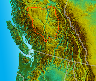
The Cariboo is an intermontane region of British Columbia, Canada, centered on a plateau stretching from Fraser Canyon to the Cariboo Mountains. The name is a reference to the caribou that were once abundant in the region.

The Columbia Mountains are a group of mountain ranges along the Upper Columbia River in British Columbia, Montana, Idaho and Washington. The mountain range covers 135,952 km². The range is bounded by the Rocky Mountain Trench on the east, and the Kootenai River on the south; their western boundary is the edge of the Interior Plateau. Seventy-five percent of the range is located in Canada and the remaining twenty-five percent in the United States; American geographic classifications place the Columbia Mountains as part of the Rocky Mountains complex, but this designation does not apply in Canada. Mount Sir Sandford is the highest mountain in the range, reaching 3,519 metres (11,545 ft).

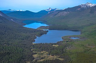
Bowron Lake Provincial Park is a wilderness provincial park located in east-central British Columbia, Canada, near the border with Alberta. It is 117 km (73 mi) east of the city of Quesnel. Other nearby towns include Wells and the historic destination of Barkerville. Once a popular hunting and fishing destination, today the park is protected and known for its abundant wildlife, rugged glaciated mountains, and freshwater lakes.
Chilcotin, meaning "people of the red ochre river" may refer to:
The Chilcotin region of British Columbia is usually known simply as "the Chilcotin", and also in speech commonly as "the Chilcotin Country" or simply Chilcotin. It is a plateau and mountain region in British Columbia on the inland lee of the Coast Mountains on the west side of the Fraser River. Chilcotin is also the name of the river draining that region. In the language of the Tsilhqot'in people, their name and the name of the river means "those of the red ochre river". The proper name of the Chilcotin Country, or Tsilhqotʼin territory, in their language is Tŝilhqotʼin Nen.

British Columbia is the westernmost province of Canada, bordered by the Pacific Ocean. With an area of 944,735 km2 (364,764 sq mi) it is Canada's third-largest province. The province is almost four times the size of the United Kingdom and larger than every United States state except Alaska. It is bounded on the northwest by the U.S. state of Alaska, directly north by Yukon and the Northwest Territories, on the east by Alberta, and on the south by the U.S. states of Washington, Idaho, and Montana. Formerly part of the British Empire, the southern border of British Columbia was established by the 1846 Oregon Treaty. The province is dominated by mountain ranges, among them the Canadian Rockies but dominantly the Coast Mountains, Cassiar Mountains, and the Columbia Mountains. Most of the population is concentrated on the Pacific coast, notably in the area of Vancouver, located on the southwestern tip of the mainland, which is known as the Lower Mainland. It is the most mountainous province of Canada.

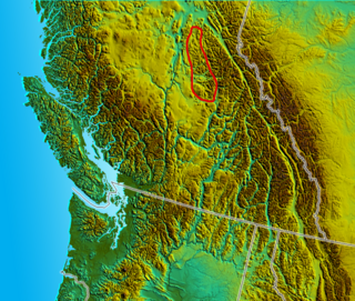
The Cariboo Mountains are the northernmost subrange of the Columbia Mountains, which run down into the Spokane area of the United States and include the Selkirks, Monashees and Purcells. The Cariboo Mountains are entirely within the province of British Columbia, Canada. The range is 7,700 square kilometres (3,000 sq mi) in area and about 245 km in length (southeast–northwest) and about 90 km at its widest (southwest–northeast).

The Cariboo Plateau is a volcanic plateau in south-central British Columbia, Canada. It is part of the Fraser Plateau that itself is a northward extension of the North American Plateau. The southern limit of the plateau is the Bonaparte River although some definitions include the Bonaparte Plateau between that river and the Thompson, but it properly is a subdivision of the Thompson Plateau. The portion of the Fraser Plateau west of the Fraser River is properly known as the Chilcotin Plateau but is often mistakenly considered to be part of the Cariboo Plateau, which is east of the Fraser.
Cariboo was one of the twelve original electoral districts created when British Columbia became a Canadian province in 1871. Roughly corresponding to the old colonial electoral administrative district of the same name, it was a three-member riding until the 1894 election, when it was reduced through reapportionment and became a two-member riding until the 1916 election, after which it has been a single-member riding. It produced many notable Members of the Legislative Assembly (MLAs), including George Anthony Boomer Walkem, third and fifth holder of the office of Premier of British Columbia and who was one of the first representatives elected from the riding; John Robson, ninth Premier of British Columbia; and Robert Bonner, a powerful minister in the W.A.C. Bennett cabinet, and later CEO of MacMillan Bloedel and BC Hydro.
Kokanee is a word from the Okanagan language referring to land-locked lake populations of sockeye salmon. It may also refer to:

The Omineca Mountains, also known as "the Ominecas", are a group of remote mountain ranges in the Boreal Cordillera of north-central British Columbia, Canada. They are bounded by the Finlay River on the north, the Rocky Mountain Trench on the east, the Nation Lakes on the south, and the upper reaches of the Omineca River on the west. They form a section of the Continental Divide, that, in this region, separates water drainage between the Arctic and Pacific Oceans. The lower course of the Omineca River flows through the heart of the range. To the south of the Ominecas is the Nechako Plateau, to the west the Skeena Mountains and Hazelton Mountains, to the north the Spatsizi Plateau and the Stikine Ranges, while east across the Rocky Mountain Trench are the Muskwa Ranges.

The British Columbia Interior, popularly referred to as the BC Interior or simply the Interior, is a geographic region of the Canadian province of British Columbia. While the exact boundaries are variously defined, the British Columbia Interior is generally defined to include the 14 regional districts that do not have coastline along the Pacific Ocean or Salish Sea, and are not part of the Lower Mainland. Other boundaries may exclude parts of or even entire regional districts, or expand the definition to include the regional districts of Fraser Valley, Squamish–Lillooet, and Kitimat–Stikine.

The Quesnel Highland is a geographic area in the Central Interior of the Canadian province of British Columbia. As defined by BC government geographer in Landforms of British Columbia, an account and analysis of British Columbia geography that is often cited as authoritative, the Highland is a complex of upland hill and plateau areas forming and defined as being the buffer between the Cariboo Plateau and the Cariboo Mountains, as a sort of highland foothills along the eastern edge of the Interior Plateau running southeast from a certain point southeast of the city of Prince George to the Mahood Lake area at the southeast corner of the Cariboo. Beyond Mahood Lake lies another separately classified area dubbed by Holland the Shuswap Highland which spans similar terrain across the North Thompson and Shuswap Lake-Adams River drainage basins, forming a similar upland-area buffer between the Thompson Plateau and the Monashee Mountains. A third area, the Okanagan Highland, extends from the southern end of the Shuswap Highland in the area of Vernon and Enderby in the northern Okanagan region into Washington State, and also abuts the Monashee Mountains.
Caribou Mountain or Mount Caribou may refer to:
Caribou River may refer to several places:


