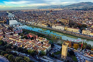
The Arno is a river in the Tuscany region of Italy. It is the most important river of central Italy after the Tiber.
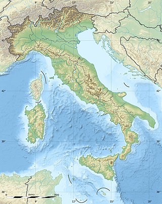
The geography of Italy includes the description of all the physical geographical elements of Italy. Italy, whose territory largely coincides with the homonymous geographical region, is located in southern Europe and comprises the long, boot-shaped Italian Peninsula crossed by the Apennines, the southern side of Alps, the large plain of the Po Valley and some islands including Sicily and Sardinia. Italy is part of the Northern Hemisphere. Two of the Pelagie Islands are located on the African continent.

Bibbiena is a town and comune in the province of Arezzo, Tuscany (Italy), the largest town in the valley of Casentino. It is located 60 kilometres (37 mi) from Florence, 30 kilometres (19 mi) from Arezzo, 60 kilometres (37 mi) from Siena, and 20 kilometres (12 mi) from the Sanctuary of La Verna. There are approximately 11,833 inhabitants

La Verna is a locality on Mount Penna, an isolated mountain of 1,283 metres (4,209 ft) situated in the centre of the Tuscan Apennines, rising above the valley of the Casentino, central Italy. The place is known especially for its association with Saint Francis of Assisi and for the Sanctuary of La Verna, which grew up in his honour. Administratively it falls within the Tuscan province of Arezzo and the comune of Chiusi della Verna, Italy.
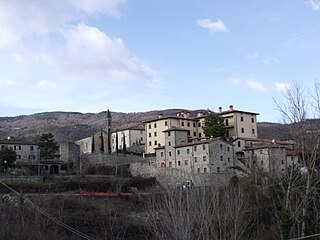
Castel Focognano is comune in the province of Arezzo, Tuscany, central Italy.
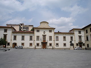
Pontassieve is a comune (municipality) in the Metropolitan City of Florence in the Italian region Tuscany, located about 14 kilometres (9 mi) east of Florence, nearby Fiesole, at the confluence of the Arno and Sieve rivers.

Reggello is a comune (municipality) in the Metropolitan City of Florence in the Italian region of Tuscany, located about 35 kilometres southeast of Florence, between the north-western side of Pratomagno and the Upper Valdarno.

Poppi is a comune (municipality) in the Province of Arezzo in the Italian region Tuscany, located about 40 km east of Florence and about 30 km northwest of Arezzo.

Stia is a frazione of the comune of Pratovecchio Stia in the Province of Arezzo in the Italian region Tuscany, located about 40 kilometres (25 mi) east of Florence and about 40 kilometres (25 mi) northwest of Arezzo. It was an independent commune until it was merged to Pratovecchio in 2014.
Vallombrosa is a toponym which indicates both a forest and a frazione, located within this forest, in the territory of the Commune of Reggello, in the Metropolitan City of Florence, in the Italian region of Tuscany.

The Parco Nazionale delle Foreste Casentinesi, Monte Falterona, Campigna is a national park in Italy. Created in 1993, it covers an area of about 368 square kilometres (142 sq mi), on the two sides of the Apennine watershed between Romagna and Tuscany, and is divided between the provinces of Forlì Cesena, Arezzo and Florence.
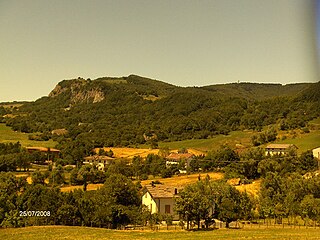
Mount Fumaiolo is a mountain of the northern Apennines range of Italy located in the southernmost corner of the Emilia-Romagna region, c. 70 km from the town of Cesena. It is at the border Emilia-Romagna and Tuscany. With an elevation of 1,407 metres (4,616 ft), Mount Fumaiolo overlooks the villages of Balze di Verghereto, Bagno di Romagna and Verghereto, in Romagna, and thanks to its extensive fir and beech forests, it is a well-appreciated tourist area of natural interest. It is most famous for being the source of the Tiber, as well as the river Savio.

The Pratomagno is a mountain range, which has the Arno River on both sides: to the west is the upper Valdarno and to the east is the Casentino. It lies north-west of the city of Arezzo, in Tuscany, Italy.
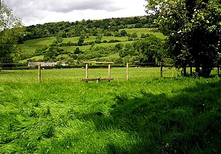
Llanwenarth is a small village and parish in the Usk Valley of Monmouthshire, south-east Wales, United Kingdom. It is in the community of Llanfoist Fawr and covered by the electoral ward of Llanwenarth Ultra.

The Valdarno is the valley of the river Arno. This name does apply to the entire river basin. Usage of the term generally excludes Casentino and the valleys formed by major tributaries.
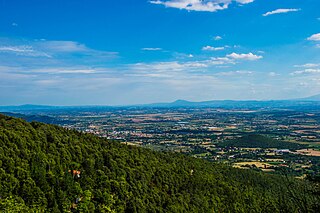
The Val di Chiana, Valdichiana, or Chiana Valley, formerly Clanis Valley, is a tectonic valley of central Italy, whose valley floor consists of important alluvial residues filled up since the 11th century, lying on the territories of the provinces of Arezzo and Siena in Tuscany and the provinces of Perugia and Terni in Umbria.
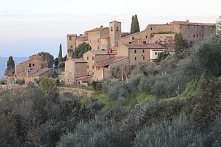
Rapale is a village located in south-western Arezzo within the municipality of Bucine in Tuscany, Italy.

The Valdarno is an Italian breed of black dual-purpose chicken. It originates in, and is named for, the lower part of the Valdarno, the valley of the Arno river, in Tuscany in central Italy. It became virtually extinct in the twentieth century, but the population is recovering. It is a quite different breed from the Valdarnese, which originates in the upper Valdarno, and is white.

The Valdarnese, also referred to as Valdarnese Bianca, Valdarno Bianca or Pollo del Valdarno, is a breed of large white chicken from the upper Valdarno, the valley of the Arno river, in Tuscany, central Italy. It became virtually extinct in the 20th century, but the population is recovering. It is a different breed from the Valdarno chicken, which originates in the lower part of the Valdarno, and is black.
Valtiberina is a valley crossed by the upper course of the Tiber, unfolding between Tuscany, Umbria and Romagna, parallel to the Casentino.


