The province of Ascoli Piceno is a province in the Marche region of Italy. Its capital is the city of Ascoli Piceno, and the province is bordered by the Adriatic Sea to the east, the province of Fermo to the north, and it faces the regions of Umbria and Abruzzo to the south. The province contains 33 comuni. The population of the province is mostly located in coastal areas and in the city of San Benedetto del Tronto, which has a population of 47,075; the province has a total population of 201,462 as of 2023.

The province of Fermo is a province in the Marche region of Italy. It was established in 2004 and became operational in 2009. Its administrative centre and provincial capital is the city of Fermo. Other major cities include Porto Sant'Elpidio, Porto San Giorgio, Sant'Elpidio a Mare, and Montegranaro. As of 2017, the province has a population of 174,358 inhabitants and spans an area of 862.77 square kilometres (333.12 sq mi). It contains 40 comuni.

The Agri is a river in the Basilicata region of southern Italy. In ancient times it was known as Aciris. The source of the river is in the Lucan Apennines north of Monte Volturino and west of Calvello in the province of Potenza. It is near the source of the Basento. The river flows south near Paterno before curving southeast. It flows near Tramutola, Viggiano, and Grumento Nova before entering a lake. After exiting the lake, the river flows eastward near Armento, Missanello, Aliano, and Sant'Arcangelo. A right tributary, the Racanello, enters the river in this area. The river forms the border between the province of Potenza and the province of Matera for part of this area of the river. It flows into a small lake before entering the province of Matera. The river flows for a short distance before entering Lago di Gannano. After exiting the lake, the river flows southeast near Tursi, Montalbano Jonico, and Scanzano Jonico before flowing into the Gulf of Taranto near Policoro.

The Tordino is a river flowing in the province of Teramo, in the Abruzzo region of central Italy. In Roman times it may have been known as "Batinus".

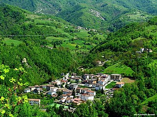
Valle Castellana is a village and comune in the Province of Teramo, in the Abruzzo region of central Italy. It is a member of the Italian community of surrounding mountain villages, Monti della Laga. It is located in the natural park known as the Gran Sasso e Monti della Laga National Park.

The Gran Sasso and Monti della Laga National Park is a natural park in central Italy. Established in 1991, it covers an area of 2,014 square kilometres (778 sq mi), mostly within the provinces of Teramo, L'Aquila, and Pescara in Abruzzo, with small areas in the provinces of Rieti in Lazio and Ascoli Piceno in Marche. The terrain is predominantly mountainous with alpine plains.

The Montone is a river in the historical region of Romagna, which is in the present-day region of Emilia-Romagna in northern Italy. It is the northernmost river on the east-facing slopes of the Apennines to flow directly into the Adriatic Sea rather than entering the Po. Its Latin name was Utis or Vitis.

The Cesano is a river in the Marche region of Italy. Its source is near Monte Catria on the border between the province of Perugia and the province of Pesaro e Urbino. The river flows northeast through Pesaro e Urbino before forming the border between Pesaro e Urbino and the province of Ancona for a short distance. It continues flowing northeast through Pesaro e Urbino and flows past Pergola before becoming the border with Ancona again near San Lorenzo in Campo. The river flows northeast near Mondavio, Corinaldo and Monte Porzio before the province of Ancona extends westward beyond the bank of the river for a short distance near Mondolfo. Finally, the river flows into the Adriatic Sea north of Senigallia and south of Marotta and Fano.

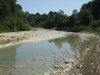
The Tronto is a 115-kilometre (71 mi) long Italian river that arises at Monti della Laga and ends in the Adriatic Sea at Porto d'Ascoli, San Benedetto del Tronto. It traverses the Lazio, Marche, and Abruzzo regions of Italy.

The Vomano is a 76 km river, which is in the Abruzzo region of Italy. Its source is near Monte San Franco in Gran Sasso d'Italia and Lago di Campotosto in the province of L'Aquila. The river crosses the border into the province of Teramo and flows northeast near Montorio al Vomano and Basciano. The Fucino flows into the Vomano south of Crognaleto and the Mavone flows into the Vomano near Basciano. It enters the Adriatic Sea near Roseto degli Abruzzi.

Cecita Lake is a man made lake in the province of Cosenza, Calabria, southern Italy.
Montagna dei Fiori is a mountain group in the Abruzzo, central Italy, forming the Monti Gemelli massif, together with the Montagna di Campli. It is located nearby the boundary between the province of Teramo and the Marche region; due to its proximity to Ascoli Piceno, it is also known as Montagna d'Ascoli.
Monte Porche is a mountain that rises to 2,233 meters in the Ascoli Piceno province of the Marche, Italy. It is part of the Sibillini Mountains in Italy.
Monte dei Frati is a mountain in the Italian province of Arezzo near the border with Pesaro e Urbino and Perugia.

The Fino is a river in eastern central Italy. Its source is near Monte Camicia in the province of Teramo in the Abruzzo region of Italy. The river flows northeast and then curves east before flowing past Bisenti. It continues flowing eastward and crosses into the province of Pescara near Elice. The river flows southeast until it joins the Tavo river and the two rivers become the Saline river.

The Salinello is a river in Italy. It is located in the province of Teramo in the Abruzzo region of southern Italy. The source of the river is in the Monti della Laga range southwest of Montagna dei Fiori. The river flows eastward and curves northeast near Civitella del Tronto. The river then curves southeast near Sant'Egidio alla Vibrata and the border with the province of Ascoli Piceno. Finally, the river flows east near Sant'Omero and enters the Adriatic Sea near Giulianova and Tortoreto Lido.
The Biscubio is a river in the Umbria and Marche regions of Italy. Its source is in the province of Perugia near the border with the province of Pesaro e Urbino in the Appennino Umbro-Marchigiano mountains. The river flows northeast into Pesaro e Urbino south of Mercatello sul Metauro. It then flows east through the mountains near Apecchio and the exclave called Monte Ruperto belonging to Città di Castello until it joins the Candigliano near Piobbico.

The Burano is a river in the Umbria and Marche regions of Italy. Its source is in the province of Perugia in the Appennino Umbro-Marchigiano mountains. The river crosses the border into the province of Pesaro e Urbino and flows north near Monte Catria, Cantiano, Monte Nerone, and Cagli before entering the Candigliano at Acqualagna.

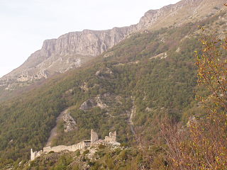
Castel Manfrino is a ruined Middle Ages castle located in Sella di Castel Manfrino, near the hamlet of Macchia da Sole, within the municipality of Valle Castellana in the province of Teramo, inside the Gran Sasso e Monti della Laga National Park.


