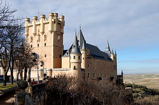
Badajoz is the capital of the Province of Badajoz in the autonomous community of Extremadura, Spain. It is situated close to the Portuguese border, on the left bank of the river Guadiana. The population in 2011 was 151,565.
Torremenga is a municipality located in the province of Cáceres, in the autonomous community of Extremadura, Spain. It had a population of 603 inhabitants in 12 km. There are some Roman and Prehistoric remains and some typical porches with granite pillars. There is a Visigothic castle and a 17th-century church.
Montánchez is a municipality located in the province of Cáceres, Extremadura, Spain. It is situated at 39°13′N6°09′W, some 702 metres above sea level. The municipality has an approximate population of just over 2,000..
Almoharín is a municipality located in the province of Cáceres, Extremadura, Spain. According to the 2005 census (INE), the municipality has a population of 2050 inhabitants. The village is primarily concerned with agriculture with many inhabitants having fincas of olives and figs. Almoharin is known as the 'Fig Capital of the World' on account of these figs; black and smooth-textured. Both dried figs and chocolate figs are exported worldwide. The village also boasts a cheese-making workshop where you can make your own cheese - after milking the sheep. There is an accompanying exhibition of the history of sheep and cheese-making in the area.
Casar de Cáceres is a town and municipality in the province of Cáceres, in the autonomous community of Extremadura. With 4532 inhabitants in 2017, it is the second most populous municipality in the Tajo-Salor Mancomunidad. In the municipality there are two population centers: Casar de Cáceres and La Perala. The capital of the municipality is located about 10 kilometers from the capital of Caceres, in the middle of Vía de la Plata.
Casas de Miravete is a municipality located in the province of Cáceres, Extremadura, Spain. According to the 2006 census (INE), the municipality has a population of 172 inhabitants.
Castañar de Ibor is a municipality located in the province of Cáceres, Extremadura, Spain. According to the 2005 census (INE), the municipality has a population of 1182 inhabitants.
Conquista de la Sierra is a municipality located in the province of Cáceres, Extremadura, Spain. According to the 2006 census (INE), the municipality has a population of 220 inhabitants.
Fresnedoso de Ibor is a municipality located in the province of Cáceres, Extremadura, Spain. According to the 2006 census (INE), the municipality has a population of 338 inhabitants.
Garvín de la Jara is a municipality located in the province of Cáceres, Extremadura, Spain. According to the 2006 census (INE), the municipality has a population of 109 inhabitants.
Oliva de Plasencia is a municipality located in the province of Cáceres, Extremadura, Spain. According to the 2005 census (INE), the municipality has a population of 252 inhabitants.
Robledillo de Trujillo is a municipality located in the province of Cáceres, Extremadura, Spain. According to the 2006 census (INE), the municipality has a population of 454 inhabitants.

Saucedilla is a municipality located in the province of Cáceres, Extremadura, Spain. According to the 2010 census (INE), it has a population of 859 inhabitants. It belongs to the Campo Arañuelo County, the capital of which is Navalmoral de la Mata.

Talayuela is a municipality located in the province of Cáceres, Extremadura, (Spain). Talayuela's name comes from "atalayuela", related to the Spanish word "Atalaya", which means "watch tower".
Zarza la Mayor is a municipality located in the province of Cáceres, Extremadura, Spain. According to the 2006 census (INE), the municipality has a population of 1488 inhabitants. This is the most occidental municipality in "Las Vegas de Alagón" region, being the only municipality in that region bordering with Portugal. It is located 4 km in a straight line to Salvaterra do Extremo. The EX-117 road from Moraleja to Alcantara pass through Zarza la Mayor.
Las Herencias is a municipality located in the province of Toledo, Castile-La Mancha, Spain. According to the 2006 census (INE), the municipality has a population of 759 inhabitants.. It adjoins the municipalities of Talavera de la Reina in the north, La Pueblanueva and San Bartolomé de las Abiertas at the east, Alcaudete de la Jara and Jara Belvís the south, and Calera y Chozas to the west, all of Toledo.

Abertura is a municipality in the province of Cáceres and autonomous community of Extremadura, Spain. The municipality covers an area of 62.71 square kilometres (24.21 sq mi) and as of 2011 it had a population of 447 people.

Cathedral of Coria or Catedral de Asunción de Nuestra Señora is a Roman Catholic church located in the town of Coria, Region of Extremadura, Spain.

Campo Arañuelo is a comarca in Cáceres, Extremadura, Spain. It contains the municipalities of Almaraz, Belvís de Monroy, Berrocalejo, Bohonal de Ibor, Casas de Miravete, Casatejada, El Gordo, Higuera de Albalat, Majadas, Mesas de Ibor, Millanes, Navalmoral de la Mata, Peraleda de la Mata, Romangordo, Rosalejo, Saucedilla, Serrejón, Talayuela, Tiétar, Toril, Valdecañas de Tajo, Valdehúncar.


