Division No. 1, Subdivision A is an unorganized subdivision on the Avalon Peninsula in Newfoundland and Labrador, Canada. It is in Division No. 1, and lies between Trinity Bay and Placentia Bay.

Burin-Placentia West is a provincial electoral district for the House of Assembly of Newfoundland and Labrador, Canada. The district was known as Placentia West prior to 1975. As of 2011 there were 7,673 eligible voters living within the district.

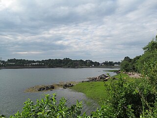
Smith Pool is a small body of water located between Salem Neck, Winter Island, and Cat Cove in Salem, Massachusetts, United States. It used to be the city's reservoir, and was later a public swimming area. It is easily accessible from Winter Island Road on Winter Island. The area is currently maintained by Salem State University, and the old dam still separates it from Cat Cove.
Cat Cove is a cove in the northwestern portion of Salem Harbor in Salem, Massachusetts. The cove is located between Winter Island and Salem Neck. There is a powerplant located on the coast of Salem Neck bordering the southwestern edge of Cat Cove.

The Burin Peninsula is a peninsula located on the south coast of the island of Newfoundland in the province of Newfoundland and Labrador.
Fortune Bay is a fairly large natural bay located in the Gulf of St. Lawrence on the south coast of Newfoundland, Canada. The Bay is bounded by Point Crewe on the Burin Peninsula and Pass Island at the entrance to Hermitage Bay to the northwest for a distance of 56 kilometers. The bay extends in a northeast direction for 105 kilometers ending at Terrenceville.
Dawson's Cove is a small settlement, about 2 km away from a small outport community Hermitage. Located on the southern shore of Newfoundland, Dawson's Cove is in Connaigre Bay — a finger-like projection of Newfoundland's Fortune Bay.
The Bay du Nord River is located on the south coast of the Island of Newfoundland in the Canadian province of Newfoundland and Labrador. Much of the drainage basin is contained within the Middle Ridge Wildlife Reserve and the Bay du Nord Wilderness Reserve of central Newfoundland.
Miles Cove is a town in the Canadian province of Newfoundland and Labrador. The town had a population of 104 in 2014, down from 140 in the Canada 2006 Census.
St. Jacques-Coomb's Cove is a town in the Canadian province of Newfoundland and Labrador. The town had a population of 669 in the Canada 2006 Census. It is located on the south coast of the island of Newfoundland on the north side of Fortune Bay, on the southern tip of the Connaigre Peninsula in what is now known as the Coast of Bays Region. The town consists of six communities, St. Jacques, English Hr. West, Mose Ambrose, Boxey, Coomb's Cove and Wreck Cove, nestled within the inlets along the coast. They all had their beginnings in the fisheries and the fisheries have always been the mainstay of employment in the communities. In recent years aquaculture was introduced in the area, providing employment for its residents.
English Harbour West is a village located on the south west shore of Fortune Bay. It is noted for its bank fishing and inshore fishing. The Way Office was established in 1866 on April 1. The first Way Master was Albert Stirling. In 1891 it became a Post Office town and William Evans was the first Postmaster. It is now a part of the Town of St. Jacques-Coomb's Cove.

Wreck Cove is a settlement in Newfoundland and Labrador. It is part of the Town of St. Jacques – Coomb's Cove.
Whale Cove is a settlement in Newfoundland and Labrador.
Furby's Cove is a settlement in Newfoundland and Labrador.
Butter Cove is a small community in Trinity Bay, Newfoundland and Labrador.
The community is between Little Heart's Ease and Gooseberry Cove.
Bull Cove is a settlement in Newfoundland and Labrador.
Frenchman's Cove Provincial Park, is a provincial park located on the west side of the Burin Peninsula in Newfoundland and Labrador.
Division No. 1, Subdivision C is an unorganized subdivision on the Avalon Peninsula in Newfoundland and Labrador, Canada. It is in Division 1 and contains the unincorporated communities of Cape St. Mary's, Cuslett, Gooseberry Cove, Great Barasway, Lears Cove, Patrick's Cove-Angels Cove, Ship Cove and Stoney House.

Division No. 1, Subdivision G is an unorganized subdivision on the Avalon Peninsula in Newfoundland and Labrador, Canada. It is in Division 1 and contains the unincorporated communities of Baccalieu Island, Besom Cove, Bradley's Cove, Burnt Point, Caplin Cove, Daniel's Cove, Grates Cove, Gull Island, Job's Cove, Kingston, Long Beach, Lower Island Cove, Low Point, Northern Bay, Ochre Pit Cove, Red Head Cove, Riverhead, Smooth Cove and Western Bay.
Division No. 1, Subdivision U is an unorganized subdivision on the Avalon Peninsula in Newfoundland and Labrador, Canada, in Division 1. It contains the unincorporated communities of Admiral's Cove, Bauline East, Bauline South, Burnt Cove, Devils Kitchen, Flat Rock, St. Michaels and Seal Cove.


