Gallery
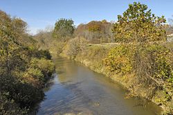
Catfish Creek is a creek in Elgin County in southwestern Ontario which empties into the north shore of Lake Erie. Catfish Creek begins in the northwest area of Aylmer and flows in a generally southern direction before flowing into Lake Erie at Port Bruce. It is a significant creek in that it flows through an area of Carolinian forest. Worthy of note is the area just northwest of Port Bruce called the Catfish Creek Slope and Floodplain Forest. "Encompassing 233 hectares, this unique Area of Natural and Scientific Interest contains some of the most endangered habitat in Canada. It lies in the heart of the Carolinian Zone of Southern Ontario and provides mature, deciduous forest cover that is able to support plant and animal life normally found much further south. All of this Carolinian Canada site is privately owned." [1]

Aylmer is a town in Elgin County in southern Ontario, Canada, just north of Lake Erie, on Catfish Creek. It is 20 kilometres (12 mi) south of Highway 401, and is almost equidistant between the United States cities of Detroit and Buffalo.

The Rouge River is a river in Markham, Pickering, Richmond Hill and Toronto in the Greater Toronto Area of Ontario, Canada. The river flows from the Oak Ridges Moraine to Lake Ontario at the eastern border of Toronto, and is the location of Rouge Park, the only national park in Canada within a municipality. At its southern end, the Rouge River is the boundary between Toronto and southwestern Pickering in the Regional Municipality of Durham.

The Grand River, formerly known as the River Ouse, is a large river in Ontario, Canada. It lies along the western fringe of the Greater Golden Horseshoe region of Ontario which overlaps the eastern portion of southwestern Ontario, sometimes referred to as Midwestern Ontario, along the length of this river. From its source near Wareham, Ontario, it flows south through Grand Valley, Fergus, Elora, Waterloo, Kitchener, Cambridge, Paris, Brantford, Ohsweken, Six Nations of the Grand River, Caledonia, and Cayuga before emptying into the north shore of Lake Erie south of Dunnville at Port Maitland. One of the scenic and spectacular features of the river is the falls and Gorge at Elora.

The Saugeen River is located in southern Ontario, Canada. The river begins in the Osprey Wetland Conservation Lands and flows generally north-west about 160 kilometres (99 mi) before exiting into Lake Huron. The river is navigable for some distance, and was once an important barge route. Today the river is best known for its fishing and as a canoe route.

Port Stanley is a community in the Municipality of Central Elgin, Elgin County in Ontario, Canada. It is located on the north shore of Lake Erie at the mouth of Kettle Creek. In 2016, it had a population of 2,148.
Kettle Creek is a creek in Elgin County in southwestern Ontario, Canada that empties into Lake Erie at Port Stanley. It drains an area of 520 square kilometres (200 sq mi). Dodd Creek is the major tributary.
The Lynn River is a fresh water river located in Norfolk County in Southwestern Ontario, Canada. It empties into Lake Erie at Port Dover.
The Carolinian forest refers to a life zone in eastern North America characterized primarily by the predominance of deciduous (broad-leaf) forest. The term "Carolinian", which is most commonly used in Canada, refers to the deciduous forests which span across much of the eastern United States from the North Carolina northward into southern Ontario, Canada. These deciduous forests in the United States and southern Ontario share many similar characteristics and species hence their association. Today the term is often used to refer to the Canadian portion of the deciduous forest region while the portion in the United States is often referred to as the "Eastern deciduous forest".
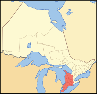
Southwestern Ontario is a secondary region of Southern Ontario in the Canadian province of Ontario. It occupies most of the Ontario Peninsula bounded by Lake Huron, including Georgian Bay, to the north and northwest; the St. Clair River, Lake St. Clair, and Detroit River, to the west; and Lake Erie to the south. To the east, on land, Southwestern Ontario is bounded by Central Ontario and the Golden Horseshoe. The region had a population of 2,796,367 in 2021. It is sometimes further divided into "Midwestern Ontario" covering the eastern half of the area and the heart of Southwestern Ontario encompassing the western half of the region.

Delhi refers to both a former township and unincorporated community located off of the junction of Ontario Highways 59 and 3. Delhi is known as the "Heart of Tobacco Country." Prior to 1880, this community was known for its lumber industry. One of the Communities in Norfolk County, Ontario, Delhi, had a population of 4,240 at the time of the 2016 Census.
The Uxbridge Forest Kames is a 644-hectare (1,591-acre) provincially significant Earth Science Area of Natural and Scientific Interest in Ontario, Canada. The land is owned and managed by the Toronto and Region Conservation Authority.
Port Talbot was the name of a community located west of Port Stanley, about one hour's drive south from London, Ontario, Canada, where Talbot Creek flows into Lake Erie. The village was the original commercial nucleus for the settlement which developed on 5,000 acres (20 km2) of land granted to Thomas Talbot in 1800 by the Crown along the northwestern shore of Lake Erie. The settlement was one of the most prosperous of its time in Upper Canada, noted for its good roads, with Talbot keeping out land speculators and securing hard-working settlers. Talbot's authoritarian control of the settlers led to conflicts with the Executive Council of Upper Canada and a reduction in his powers.

Norfolk County in the Canadian province of Ontario consists of a long list of communities. Its four designated population centres are Simcoe, Port Dover, Delhi, and Waterford.
There are three creeks named Catfish Creek in Ontario, Canada:
King's Highway 73, commonly referred to as Highway 73, was a provincially maintained highway in the Canadian province of Ontario. The route began in Port Bruce and progressed north through Aylmer, encountering Highway 401 immediately before terminating east of Dorchester. The route was established in mid-1937, remaining unchanged for nearly six decades before being transferred to Elgin County and Middlesex County in 1997 and 1998. Today the route is known as Elgin County Road 73 and Middlesex County Road 73.

The Mixedwood Plains Ecozone is the Canadian ecozone with the most southern extent, covering all of southwestern Ontario, and parts of central and northeastern Ontario and southern Quebec along the Saint Lawrence River. It was originally dominated by temperate deciduous forest growing mostly on limestone covered by glacial till. It is the smallest ecozone in Canada, but it includes the country's most productive industrial and commercial region, and is home to nearly half of Canada's population, including its two largest cities, Toronto, Ontario and Montreal, Quebec. Hence, little of the original forest cover remains, making protection of the remaining forests a high conservation priority. This ecozone includes two regions described by J.S. Rowe in his classic Forest Regions of Canada: the entire Deciduous Forest Region, and the southern portions of the Great Lakes-St. Lawrence Forest Region. In the province of Ontario, the Ontario Ministry of Natural Resources maps this area as Site Regions 6E and 7E.

Big Otter Creek is a waterway that empties into Lake Erie at Port Burwell, Ontario. It is 42 kilometres (26 mi) long, and the area of its drainage basin is 712 square kilometres (275 sq mi). The creek's headwaters are north of the Horseshoe Moraine, and its mouth is just west of the Long Point Conservation Area. Scenic bluffs line the valley as it passes through the moraine.
Big Creek is a watercourse in Norfolk County, Ontario. It is approximately 60 kilometres (37 mi) long. It empties into Lake Erie, at Port Rowan, at Long Point. Its watershed covers 730 square kilometres (280 sq mi), alternately 750 square kilometres (290 sq mi).
Venison Creek is the largest tributary to Big Creek, in the Long Point Region Conservation Area, on the north shore of Lake Erie, in Ontario, Canada.
The Long Point Region Conservation Area is an agency of the province of Ontario, Canada, formed to preserve the volume of flow, and purity, of the watercourses that flow into Lake Erie, near Long Point.
42°39′19″N81°00′28″W / 42.6554°N 81.0079°W
| | This Southwestern Ontario geographical article is a stub. You can help Wikipedia by expanding it. |
| | This article related to a river in Ontario, Canada is a stub. You can help Wikipedia by expanding it. |