The Arctic Archipelago, also known as the Canadian Arctic Archipelago, is a group of islands north of the Canadian mainland.

Aragua State is located in the north-central region of Venezuela. It has plains and jungles and Caribbean beaches. The most popular are Cata and Choroni. It has Venezuela's first national park which is called Henri Pittier.
Biruaca is a city in Apure State in Venezuela. It is part of the greater urban area of San Fernando de Apure, the center of which is just 7km away. Biruaca is the shire town of Biruaca Municipality.

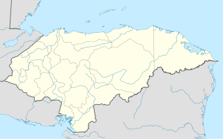
Morocelí is a municipality in the Honduran department of El Paraíso.

The Meta River is a major left tributary of the Orinoco River in eastern Colombia and southern Venezuela, South America. The Meta originates in the Eastern Ranges of the Andes and flows through the Meta Department, Colombia as the confluence of the Humea, Guatiquía and Guayuriba rivers. It flows east-northeastward across the Llanos Orientales of Colombia following the direction of the Meta Fault. The Meta forms the northern boundary of Vichada Department, first with Casanare Department, then with Arauca Department, and finally with Venezuela, down to Puerto Carreño where it flows into the Orinoco.

Guárico River is a river in Venezuela.

Nisga'a Memorial Lava Bed Provincial Park is a provincial park in the Nass River valley in northwestern British Columbia, Canada, about 80 kilometres north of Terrace, and near the Nisga'a Villages of Gitlakdamix and Gitwinksihlkw.
Los Villares de Soria is a municipality located in the province of Soria, Castile and León, Spain. According to the 2004 census (INE), the municipality has a population of 117 inhabitants.
Salvador de Zapardiel is a municipality located in the province of Valladolid, Castile and León, Spain. According to the 2004 census (INE), the municipality has a population of 188 inhabitants.

Ahlmann Glacier is the southernmost of two glaciers on the east side of Hemimont Plateau flowing east into Seligman Inlet on Bowman Coast, Graham Land in Antarctica. The glacier was photographed from the air in 1940 by the United States Antarctic Service, and was charted in 1947 by the Falkland Islands Dependencies Survey, who named it for Professor Hans Wilhelmsson Ahlmann, a Swedish glaciologist and geographer.
The Whatshan River is a tributary of the Columbia River in the Canadian province of British Columbia. The river's drainage basin is approximately 390 square kilometres (150 sq mi) in area.
This is a list of the extreme points and extreme elevations in Scotland.
The Findlay Group is a group of islands in the Canadian Arctic Archipelago in Qikiqtaaluk Region, Nunavut. This Arctic Ocean group consists of Lougheed Island, Stupart Island, Edmund Walker Island, Grosvenor Island and Patterson Island.
Wenamu River is a river in South America. It forms a portion of the international boundary between Venezuela and Guyana. It is part of the Essequibo River basin.

Portuguesa River is a river of Venezuela. It is part of the Orinoco River basin, and is a tributary of the Apure River.
The Autana River is a blackwater river of Venezuela, a tributary of the Sipapo River in the middle Orinoco River basin.

Glenwood is a neighbourhood in the city of Winnipeg, Manitoba, Canada. It is located in the northern section of the district of St. Vital, and is bounded by Carrière Avenue on the north, the Seine River on the east, Fermor Avenue on the south, and the Red River and St. Anne's Road on the west. As of the 2006 census, Glenwood had a population of 3,650.
German submarine U-867 was a Type IXC/40 U-boat of Nazi Germany's Kriegsmarine built for service during the Second World War.

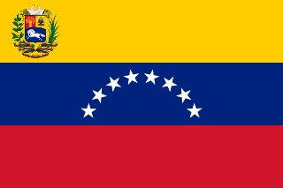
The Third Republic of Venezuela is the name commonly used to refer to the reestablished Republic of Venezuela declared by Simón Bolívar in the year 1817, during the Venezuelan War of Independence. The beginning of the Third Republic of Venezuela is attributed to the period after the Guyana Campaign, during which the republicans restored democratic institutions in Angostura. The Republic ended after the Congress of Angostura of 1819 decreed the union of Venezuela with New Granada, to form the republic of Gran Colombia.

Cuyagua is a town located on the coast of Aragua state, Venezuela. Among its rivers are Pozo de Arena and Pozo San Pedro. It has a beach that has a heavy swell where it is practiced surf and bodyboard.


